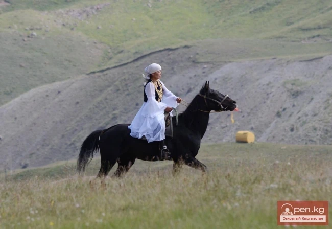
Mountains and glaciers

{title}
Mountain ranges
{title}
Mountain peaks
{title}
Mountain passes
{title}
Glaciers
{title}
Caves
{title}
Gorges
Chunkurchak Gorge
Gorges

Chunkurchak Gorge

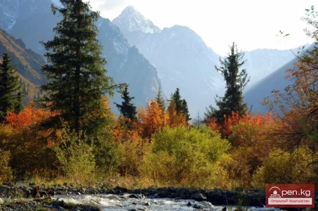
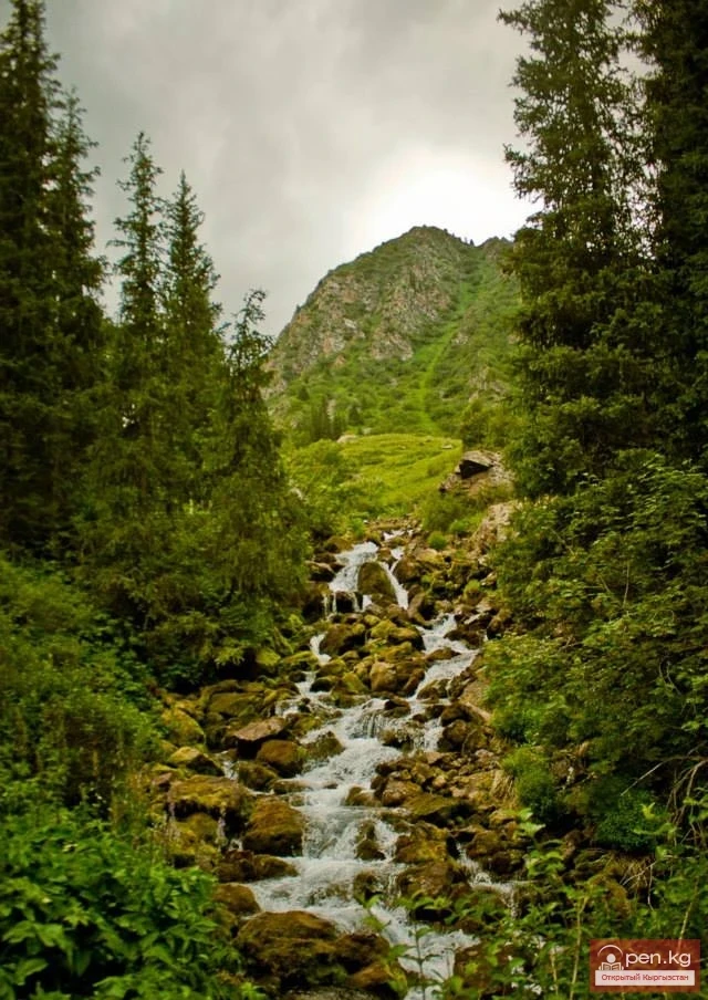
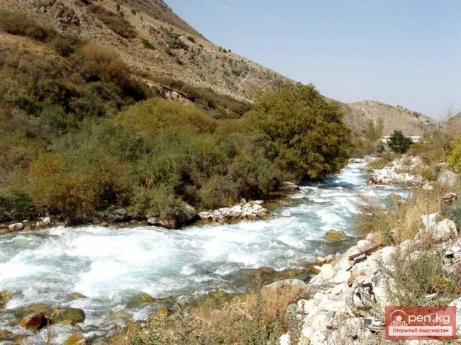
Chunkurchak Gorge – one of the smallest, yet most beautiful gorges in Kyrgyzstan. Located 45 km from Bishkek and 20 km east of the village of Tash Dobo (formerly Vorontsovka), the picturesque tiny Chunkurchak Gorge lies at the headwaters of the Alamedin River. The Chunkurchak National Biosphere Reserve is located in the gorge. It was created specifically to protect rare species of tulips. In spring, it transforms into a small Holland. Indeed, this is where the Royal Tulip grows, which can

18.08.2018, 17:50
National Nature Park "Karakol"
Gorges / National parks and reserves

National Nature Park "Karakol"

Karakol National Nature Park The park was established in accordance with the Resolution of the Government of the Kyrgyz Republic dated April 15, 1997, No. 225 “On the Organization of the National Nature Park ‘Karakol’ in the Ak-Suu District of the Issyk-Kul Region” for the purpose of preserving the unique natural complexes of the Karakol Gorge over a total area of 38,256 hectares. Forested lands comprise 7,688 hectares, with forest cover amounting to 4,767 hectares, including forest

17.08.2018, 06:44
Kegety Gorge and Köl-Tor Lake
Gorges

Kegety Gorge and Köl-Tor Lake

Another one of the most beautiful gorges in Kyrgyzstan, Kegety Gorge is located on the northern side of the Kyrgyz Ridge, 90 kilometers from the city of Bishkek. Its picturesque nature makes it very interesting and attractive for tourists. A turbulent river with the same name flows through Kegety Gorge, which has many tributaries. The largest of them is the right tributary Köl-Tor, which forms a very beautiful independent gorge, at the headwaters of which there is a lake with turquoise water.

20.09.2015, 15:29
Lake Alakol and Alakol Pass
Lakes / Mountain passes

Lake Alakol and Alakol Pass

Geographical Reference: Ala-Kul (Ala-Kyol, Alakul, Alaköl) is a closed lake in the Terkey-Alatau region, in the Central Tien Shan, Kyrgyzstan. It means "Mottled Lake" in Kyrgyz. It is located in the upper reaches of the Kurgaktor River, a right tributary of Karakol, at an altitude of 3532 meters. It has a glacial origin: the glacier, after retreating, still occupies the upper part of the valley. There are no islands in the lake.

18.04.2015, 08:08
Glaciers of Kyrgyzstan
Glaciers

Glaciers of Kyrgyzstan

The territory of Kyrgyzstan is predominantly mountainous, with peaks almost everywhere reaching the climatic line, and in most mountain ranges, the ridge zone is covered with temporary glaciation. An important place in the natural resources of Kyrgyzstan is occupied by the potential resources of glaciers, as a source of the purest fresh water and one of the main sources of river feeding. The total water reserves stored in glaciers are estimated at 650 km³. By these indicators, Kyrgyzstan can

22.10.2014, 19:29
"Ala-Archa Zone"
Natural ecological complexes / Gorges

"Ala-Archa Zone"

Ala-Archa Zone is located 30 km south of Bishkek in the central part of the Kyrgyz Ala-Too range in a picturesque gorge of the same name, which is over 35 km long. This gorge is the largest of all the gorges in the Kyrgyz range. On its territory lies the Ala-Archa National Park.

09.05.2014, 22:28
"Issyk-Ata Zone"
Natural ecological complexes / Gorges

"Issyk-Ata Zone"

Issyk-Ata Zone is located 80 km from Bishkek and includes two gorges — Issyk-Ata and Tuyuk Issyk-Ata with tributaries. This zone is distinguished not only by its favorable climatic conditions but also by its magnificent balneological resources. Based on more than fifty thermal springs, the famous Issyk-Ata resort operates in the middle part of the gorge of the same name. The springs have been known since ancient times, as evidenced by the image of the healing Buddha carved on Asal.

08.05.2014, 22:45
Modern Glaciation in the Chuy Valley
Glaciers

Modern Glaciation in the Chuy Valley

Kyrgyz Ridge - the most glaciated area in the northern part of our republic. However, despite this and its proximity to the capital of the republic, it remained unexplored for a long time. Essentially, one of the first researchers of the glaciation of this ridge, who calculated the area of glaciers, was H.L. Korzhenyevsky (1930; 1932). However, a significant contribution to the study of the glaciers of the Kyrgyz Ridge was made by the Leningrad geographer E.V. Maximov (1964, 1972).

26.04.2014, 21:39
The Cave of Kan-i-Gut
Caves

The Cave of Kan-i-Gut

Kan-i-Gut Cave is located on the southern slope of the Djaman-Chul range, approximately 18 km west of the village of Samarkandyk in the Shadymir area. The local name is Zauk-Kur. It was formed by fissure-like separations of layers and active manifestations of ore karst processes. There are almost no dripstone formations. The cavity consists of numerous grottoes, deep pits (up to 40 m), chimneys, narrow interwoven passages, and corridors. Based on random archaeological finds, scientists

16.02.2014, 17:43
Ak-Suu - Karavshin (Asian Patagonia)
Mountains and glaciers

Ak-Suu - Karavshin (Asian Patagonia)

The contrasts of nature in the mountain ranges of Matchi and Karavshin are astonishing, offering grand opportunities for the development of mountain tourism and climbing. The striking peaks, with their smooth edges converging at five-thousand-meter heights into sharp pinnacles, resemble giant crystals adorning the wide ridge of the watersheds of Ak-Suu and Karavshin.

16.02.2014, 17:08
Abshir-Sai
Gorges / Waterfalls

Abshir-Sai

Abshir-Sai (Waterfall Gorge) is located in the mountain valley of the river of the same name, flowing from the northern slopes of the Kichik-Alai mountain range. The distance from the city of Osh to Abshir-Sai is 70 km. The mountainous part of the valley begins with rocky, distinctive gates formed by layers of limestone, standing out against the backdrop of picturesque slopes.

16.02.2014, 16:16
Caves of the Osh Mountains
Caves

Caves of the Osh Mountains

In the interfluve of the Aravan and Ak-Buura rivers lies the unusual land of Chil-Ustun, where karst remnants, arranged in three rows, strikingly contrast with the green backdrop of the floodplains of the foothill valleys, which flow into the oasis of the Fergana Valley beyond the western border. From a geological, or more precisely, geomorphological perspective, the stone islands are remnants of a once large mountain massif. They are composed of sedimentary rocks from the Paleozoic era, which

16.02.2014, 16:02
Achyktash and Korumdy
Mountains and glaciers

Achyktash and Korumdy

The mountain nodes Achik-Tash and Korumdy are the main and most popular areas for high-altitude mountaineering. Achik-Tash is located in the central highest part of the Zaalai (or Chon-Alaï) ridge. The mountain complex consists of powerful glaciers and peaks: Dzerzhinsky (6716 m), Kyzyl-Aga (6663 m), Estonia (6202 m). The highest and most popular point of the Achik-Tash mountain node is Lenin Peak, which is 7134 m high. From the edelweiss glade located in the Achik-Tash area, which serves as

16.02.2014, 15:38
Suleiman Mountain (Throne of King Solomon)
Mountains and glaciers

Suleiman Mountain (Throne of King Solomon)

Suleiman Mountain (Throne of King Solomon) is located in the center of the city of Osh. The height of this mountain at its highest points reaches 100-150 meters, its length is one and a half kilometers, its width including the alluvial fan is 120 meters, and the absolute elevation is 1106 meters above sea level.

05.02.2014, 23:07
Gava-sai Gorge
Gorges

Gava-sai Gorge

Gava-Sai Gorge is a right tributary of the Kara-Unkur River, located 20 kilometers northwest of the district center Bazar-Korgon. In its middle part, about five kilometers long, lies the village of Uzbek-Gava. Surrounded by picturesque nature, it has been home to Uzbeks since ancient times. Not far from the upper boundary of the village, in the forest, there is an experimental site of the national institute of nut growing. From it, a magnificent walnut forest stretches in all directions, where

05.02.2014, 17:17
Kokshaal-Too and Peak Dankov
Mountains and glaciers

Kokshaal-Too and Peak Dankov

Remoteness, wildness, and mystery are the concepts that characterize and give an idea of this region of the Tian Shan. Before the collapse of the USSR, these areas were closed off. Only border guards and, with rare exceptions, shepherds occasionally ventured here. Almost the entire territory of the region is occupied by hard-to-reach ridges: Kokshaal-Tuu Barkaldy, Karla-Tuu. The prevailing absolute heights of the ridges range from 3400 to 5600 meters. The highest point, Dankov Peak (5982

05.02.2014, 16:24
Caves of the Kok-Kiya River
Caves

Caves of the Kok-Kiya River

Kok-Kiya River (Green Slope) - the easternmost right tributary of Ak-Sai, flows down from the northwestern slope of the Kokshaala-Too ridge. In its middle course, the river runs through an impressive canyon, the walls of which show openings of caves and grottos. One of these openings, on the left side of the lower part of the canyon, leads to the Sports Cave, discovered by speleologists of Kyrgyzstan in 1973.

04.02.2014, 22:17
Canyons of Konorchek
Gorges

Canyons of Konorchek

Canyons of Konorchek occupy the eastern part of the Kyrgyz Ala-Too, covering a vast territory. Dry, devoid of any vegetation, red canyons, colored by the oxidation of mineral particles, appear as a collection of fantastic semi-ruined castles, ancient temples, modern skyscrapers, columns, and spires. The unusual shapes of these natural structures have given rise to equally strange names: Castle Rock - an impressive mass with a flat top 300 meters high, crowned with jagged towers; Bobsleigh

03.02.2014, 22:02
Boom Canyon
Gorges

Boom Canyon

Boom Canyon is located 112 km from the city of Bishkek and serves as a unique natural gateway leading to Lake Issyk-Kul, Central and Inner Tien Shan.

03.02.2014, 22:00
Natural Complex of Shamsi
Natural ecological complexes / Gorges

Natural Complex of Shamsi

The Shamsi Natural Complex is located 85 km east of Bishkek and includes the territory of a valley of the same name with tributaries flowing from the northern slopes of the Kyrgyz Ala-Too. The largest tributaries are located in the eponymous gorges: Tura-Kayin - left lower tributary; Tuyuk - left middle tributary; Kel-Tor - right lower tributary; Karagayly-bulak - right middle tributary.

03.02.2014, 21:12
Caves of Kyrgyzstan
Caves

Caves of Kyrgyzstan

Caves of Kyrgyzstan Caves are rightly called the cradle of humanity. Primitive people took shelter in them from the wind and cold, and from predatory beasts. Later, artificial caves created by humans appeared. There are very few artificial caves in Kyrgyzstan. The most notable are the salt mines of Chon-Tuz in the Kochkor district and the tunnel under the Tuy-Ashu pass on the Bishkek-Osh road. Natural caves are formed as a result of karst processes in water-soluble rocks (limestones, gypsum,

28.01.2014, 21:43
Mountains and Glaciers of Kyrgyzstan
Mountains and glaciers

Mountains and Glaciers of Kyrgyzstan

Mountains and Glaciers The abundance of landscape resources or interesting geological features often plays an important role in defining the international tourism image of the respective country. Tourists may travel thousands of kilometers just to see such famous natural wonders of the world as the Himalayas, the Great Barrier Reef, the Grand Canyon, Mount Fuji, etc. The main natural attractions of Kyrgyzstan include: Lake Issyk-Kul, Sary-Chelek, Son-Kul, the mountains of the Tien Shan and

28.01.2014, 21:41