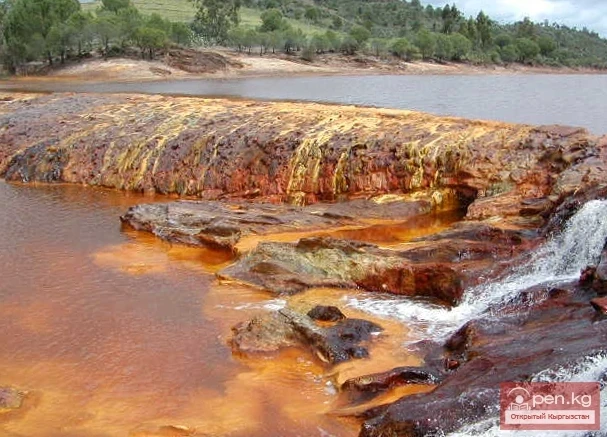
“Chatyr-Kul” translates from Kyrgyz as “Heavenly Lake.” The high-altitude lake Chatyr-Kul is located in the Inner Tian Shan. The height of the lake above sea level is 3530.2 meters. The area of the water surface is 170.6 km². The length of the lake is 23 km, width is 11 km, and the average volume of water is 8.5 km³. It is the highest of the large lakes in Tian Shan, occupying the lowest part of a tectonic depression.
Kulung - "foal" The Kulung and Kulung Minor lakes are a group of lakes, enchanting with their beauty and located in the Osh region of the Republic of Kyrgyzstan, in the western part of the Fergana Range, within the territory of the Kulunatin State Nature Reserve, established in 2004 with a total area of 24 thousand hectares, aimed at preserving the biodiversity of juniper-coniferous forests, at an altitude of 2856 m. The distance between the lakes, connected by the waters of the
Jidalyk - "breast berry" Jidalyk (Zhiydeli) is a famous lake in Kadamjay. It is a landmark of the city and is located at the foot of a mountain, which is the source of water in the lake. The lake itself serves as a source of drinking and healing water, as well as a recreational area. The place where the water flows out is called Katur-Bulak. The name Jidalyk comes from the word "zhiyde," which translates from Kyrgyz as "breast berry." Around Lake Jidalyk, many
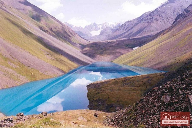
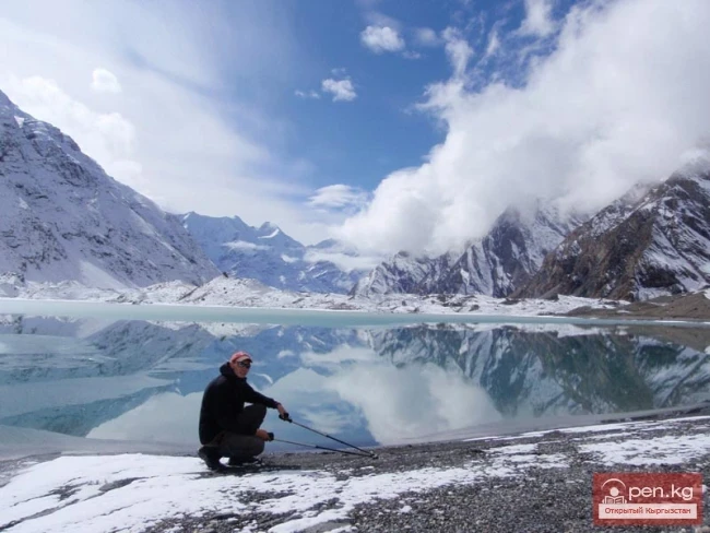
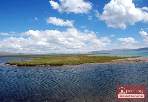
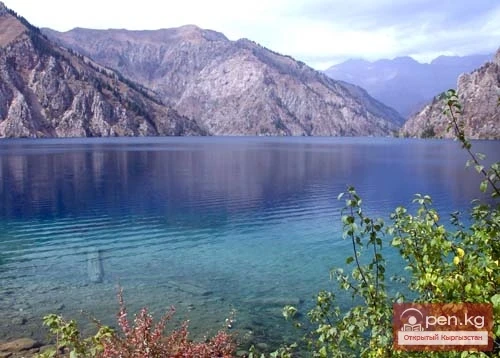
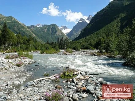
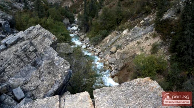
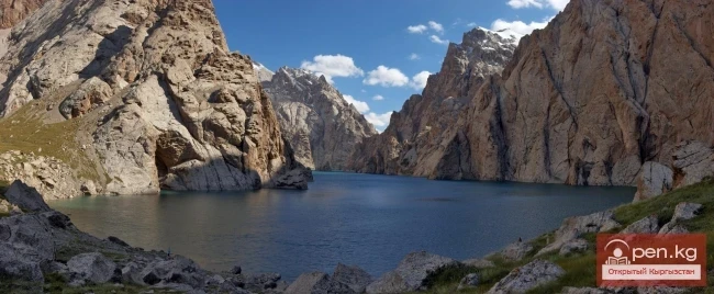
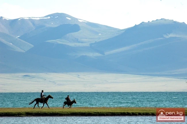
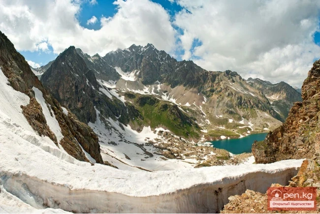
Moon Lake On the northern slope of the Turkestan Range lies Lake Ai-Köl, which translates to "moon lake." The area of the lake is 0.82 sq. km. It is located at an altitude of about 3000 m, surrounded by sheer cliffs and boulders, making access to the lake quite challenging. The shores of the lake are steep cliffs that cannot be approached, so it can only be glimpsed through small passes in the foothills. One of these passes offers a place to rest or camp for the night.
Jasyl-Kel - "Emerald Lake". "Jasyl-Kol Lake - 'a diamond in a mountain setting' - is considered one of the most beautiful high-altitude lakes in the mountain systems of the Zailiysky and Kungoy Alatau! This lake is located in the western part of the Chelekokemin ridge, at the point where two large mountain ranges, Zailiysky Alatau and Kungoy Alatau, converge. An incredibly beautiful body of water that continuously changes its color throughout the day. The waters of the
The Salt Lake, also known as the Dead Lake, is located in the territory of the Kunchyghysh rural district of the Ton district. It is 12 kilometers from the central highway. This season, it is visited by an average of 300-500 people per day. According to the staff of the tourist complex, the number of people wishing to visit the Dead Lake has decreased compared to previous years. Tourists began to visit the Salt Lake in 2000. Prior to this, academician Usen Mamyrов of the National Academy of
Lake Kapka-Tash (local residents call it Kol-bashi, which translates to "Source, beginning (head) of the lake"). Indeed, a river flows out of this lake, feeding into the next large lake and filling it.
Lake Kara-Suu is located in the Toktogul district. It is a dam-type lake, and its level depends on the time of year. Lake Kara-Suu is situated in the area of the Taktalyk ridge, at an altitude of about 2000 m above sea level. The dimensions of the lake are 6.5 by 2 km, with an average depth of about 90 m. The shores of Kara-Suu are home to Tien Shan spruce, barberry, rowan, and other plants. The enchanting azure hue of the lake changes depending on the time of day, and one can gaze at it
Geographical Reference: Ala-Kul (Ala-Kyol, Alakul, Alaköl) is a closed lake in the Terkey-Alatau region, in the Central Tien Shan, Kyrgyzstan. It means "Mottled Lake" in Kyrgyz. It is located in the upper reaches of the Kurgaktor River, a right tributary of Karakol, at an altitude of 3532 meters. It has a glacial origin: the glacier, after retreating, still occupies the upper part of the valley. There are no islands in the lake.
Before your eyes stretches the unrestrained blue of the water, which sharply contrasts with the gray-brown rocks, the whiteness of the snow on the peaks, and the boundless blue of the sky. This could be said about many glacial lakes. But Lake Merzbacher is remarkable not only for its beauty — it literally represents a world of icebergs. Here and there rise the whimsical outlines of towers, castles, ice mountains, and ice islands of various shapes. Some floating icebergs reach the height of a
Geographical Information: Song-Kul (possible variants of Russian spelling: СОНКЁЛЬ, Сонг-Кёль, Сон-Куль) is a large high-altitude lake, nestled in a basin between the internal ridges of the Tien Shan, located between the ranges of Song-Kul-Tau and Moldota-Tau, at an altitude of 3,016 meters above sea level in the northwestern part of the Naryn region (Kyrgyzstan). It is a potential site for ecological tourism. Surrounding the lake are pristine pastures and a protected area. The nearest major
Geographical Information: An astonishingly beautiful corner of nature in southern Kyrgyzstan at an altitude of 1940 meters above sea level. The lake is located in the area of relict walnut-fruit forests and is part of the natural complex of biosphere resorts.
No matter how interesting the composition and properties of water manifestations may be, it is clear that it is not these properties themselves that interest the curious reader, but rather how they will affect, first and foremost, those who will use a particular water.
Waters without 'specific' components are distinguished only from a balneological point of view as waters that do not contain any of the components considered for therapeutic purposes in conditioning quantities, except for the total salt content, for which the lower limit of concentration is set at 2 g/l.
Among thermomineral waters, waters of this type occupy a special place; as a rule, being therapeutic, they are most widely used in industry from underground waters. It is from these waters that we obtain all industrial bromine and about 3/4 of iodine. Iodobromine waters are used for treatment both externally and internally; in the latter case, their mineralization should not exceed 10-15 g/l, and if dilution with fresh water is needed, the concentration of bromine when diluted should not fall
Medicinal iron mineral waters are those that contain at least 20 mg/l of dissolved iron. There are not many such waters in our country, but it was precisely at the iron-rich Marcial waters (located 50 km from Petrozavodsk) that the first resort in Russia was established in 1719 by a decree of Peter I. They are named Marcial in honor of Mars, the ancient Roman god of war, as it was believed at that time that consuming iron mineral water made a person strong.
Rishtan Deposit is located 15 km south of the city of Rishtan in Uzbekistan and 20 km east of the river Sokh. The mineral springs are associated with the limestones of the Alai and Turkestan strata, which lie in the core of the local anticlinal fold. The water has a mineralization of 3-6 g/l, a chloride-sulfate calcium-sodium composition, and contains 50-110 mg/l of total hydrogen sulfide. The flow rate of the Rishtan springs exceeds 4 l/s, which is sufficient to provide water for a medical
While the identification of most mineral waters requires various water analyses, and radon waters even need a specially designed device — an emanometer, the presence of hydrogen sulfide waters can be recognized by the characteristic smell of this gas from a considerable distance from the spring or the flowing sulfide water from a well. Hydrogen sulfide waters are among the most valuable in balneology — they are what gives the fame to Greater Sochi as a world health resort, having been
Of all the gases found on Earth, radon is the rarest and most expensive, although it is difficult to take a sample of soil air or groundwater in which it is not detected, even in small amounts. Radon is a gas, a product of the radioactive decay of radium, with a half-life of 3.86 days, meaning it cannot accumulate since it decays relatively quickly. This feature has earned it the status of the most dangerous among radioactive poisons.
The origin of thermal waters is a topic of debate among specialists, no less than that of carbonic waters. At the same time, we will set aside cases like Yangang-Tau and, probably, Tashkumyr — here we have burning material, heat being released, and strict contours of the oxidation zone (after all, combustion is a relatively rapid oxidation) in a confined space, although even here, to be honest, there is no complete consensus among professionals. For the explanation of most other cases of
Tashkumyr Thermal Springs are located on the eastern outskirts of the city of Tashkumyr, on the cliff of the right bank of the Naryn River at the latitude of the "Severny" mine, a few meters above the river at an absolute elevation of just over 600 m. Here, for a hundred meters, one can observe about half a dozen jets of warm and hot water (in June 1978, geologist S. G. Shulgin recorded a temperature of 45°C in one of the springs). Its composition is consistently sodium sulfate with
Sary-Jaz Springs are located 3.5 km south of the village of Sary-Jaz at the foot of a nearly hundred-meter cliff on the left bank of the river of the same name at an absolute height of about 2400 m.
Pchansky Spring is well known to the residents of the western part of the Ak-Tal district and geologists in Kyrgyzstan. Its fame among the local population is due to the elevated water temperature (20°C) and high flow rate (about 15 l/s), as well as the memorable dome-shaped orifice with a diameter of 0.5 m; for geologists, it is notable as the only spring with anomalous temperature and water composition from the largest Talas-Fergana fault in the region, which defines the geological boundary
Kokomerensky Thermal Springs are located 14 km upstream from the confluence of the Kokomerena River with the Jumgal River, on the right bank at the base of the embankment of the road that runs here, which has incidentally shifted the location of the springs' emergence; the absolute elevation of the springs is close to 1650 m.
Airtash Warm Waters were brought to the surface by wells drilled by the Makmal Geological Exploration Party in 1974 for purposes far removed from the search for underground water.
Thermal Springs of Chon-Kyzylsuu are located 20 km southeast of the village of Pokrovka in the southeastern part of the Issyk-Kul region at an absolute altitude of 2400 m on the right bank of the Chon-Kyzylsuu River, below the confluence with its right tributary, the Jilisu stream.
Thermal waters of Ugut are located on the left bank of the Naryn River, 110 km west of the city of Naryn, 3.5 km downstream from the confluence of the Ala-Buga River at an absolute elevation of 1500 m.
Gulchinsky Spring is located 5 km southwest of the village of Gulcha on the left bank of the valley of the Jilisu stream at an absolute elevation of about 1900 m. The water is of the sulfate-bicarbonate magnesium-sodium-calcium type with a mineralization of just under 0.5 g/l, which is not unique and does not hold great value. The spring's discharge is close to 1.5 l/s — there are thousands of springs with such discharge in Kyrgyzstan. Finally, the water of Gulchinsky Spring contains just
Altyn-Arashan Spring is located 22 km southeast of the city of Karakol in the valley of the Arashan River. In this area, several groups of springs with anomalously high water temperatures are known, but only the middle group, located on the right bank of the Arashan River 200 m below the mouth of its right tributary, the Anarty River, at absolute elevations just over 2400 m, is used more or less regularly. A local balneotherapy center has been organized here, utilizing two small bathing pools
The Alamedin Deposit is located 28 km south of Bishkek city in the middle reaches of the Alamedin River at absolute elevations slightly below 1800 m. Like many other thermal water springs, it has been known for a long time and was used by the ancient population of the Chui Valley, as evidenced by archaeological finds in its vicinity.
Issyk-Ata Deposit is located 78 km southeast of Bishkek in the middle part of the picturesque valley of the same name river at absolute elevations of about 1750-1800 m. Good roads lead from Tokmak and Kant through the village of Yurievka to the Issyk-Ata resort, providing all-weather and year-round access for the settlements of the Chui Valley to this resort.
Dzhergalan Thermal Water Deposit was discovered accidentally during the drilling of a parametric well by the "Kyrgyzneft" management in the early 1960s in the valley of the Dzhergalan River, 200 meters upstream from the bridge over it on the Tyup-Karakol highway. The absolute elevation of the area here is 1630 m, which is about twenty meters higher than the level of Lake Issyk-Kul.
Jalal-Abad Deposit is located on the left bank of the Kugar River valley on the southeastern outskirts of the city of Jalal-Abad, the second largest industrial and cultural center in the south of the republic. The mineral springs of Hazret-Ayub-Paygambara (the name of the village that existed before the war on the slope to the north of the modern resort) have been known to the local population for a long time, in times that can be called archaeological, as their traces are usually established
The Aksu Deposit is located in Eastern Prissykul, 15 km southeast of the town of Krakal, in the river mouth area of the Ak-Suu River — a right tributary of the Arashan River, at absolute elevations of about 1750 m. The first descriptions of the deposit were made in the mid-20th century by the famous geographer P. P. Semenov-Tyan-Shansky, although local residents were undoubtedly aware of it long before that.
The question of the origin of carbonated waters is one of the most controversial in hydrogeology and is pivotal in the problem of mineral water formation.
Carbonated water in the Chaek well. For now, this is the only well of its kind in the republic that has revealed water with increased CO2 content in a place where there were no serious grounds for such an expectation.
Mineral Springs of Shilbeli contain the least mineralized naturally carbonated water in Kyrgyzstan. They are located in the basin of the Karakuldja River, 80 km directly east of the city of Uzgen, on the right bank of the Shilbeli stream valley, which is a left tributary of the middle course of the Surtaš River. The absolute elevation of the area where the Shilbeli springs are located is close to 3200 m. There are two groups of springs at a distance of 350 m from each other; in terms of carbon
Kacharaltur Area is located on the same left bank of the Yassy River as Kara-Shoro, but 200 meters downstream. At the base of the slope and along the riverbed, there are about half a dozen springs of mineral water and gas emissions. In the most concentrated flows, the water has a mineralization of about 6 g/L, with carbon dioxide content up to 1.88 g/L, otherwise closely resembling the indicators of Kara-Shoro. The flow rate of mineral water here is close to 0.5 L/s.
Kara-Shoro Deposit includes 3 areas of carbonated mineral water distribution — namely Kara-Shoro itself, Kacharaltur, and Konurtebe, and is remarkable primarily for two indicators: it features carbonated water with the highest salt content in Kyrgyzstan (over 40 g/l) and has the most diverse types of mineral waters among those found in the republic; furthermore, the water from this deposit contains the highest concentrations of microelements such as iron, zinc, and barium. Among all the
Source Arkarsur is the most frequently visited outlet of carbonated waters by wild animals. Not to mention that the marked feature is clearly expressed in the name of the spring (arkar — a direct reference to argali, while "shur" can be easily recognized as a somewhat distorted Turkic "shor" — salt).
The carbonated water of Kara-Kiche is the most sulfate-rich among the carbonated mineral waters of the republic and closely resembles the composition of the most popular sulfate narzan in the country, Kislovodsk narzan, in terms of macrocomponent ratios.
Uselik Carbonated Springs are the highest located outlets of carbonated mineral waters in Kyrgyzstan — they emerge at an absolute height of over 3600 m in the same area as the Chatyr-Kul deposit, but 15 km east of the lake, in the Torugart-Tau mountains. A distinctive feature of the geological structure of this area is the presence of young (Cenozoic) magmatic rocks (basalts), which may be related to the existence of the local mineral waters to some extent.
The Chatyr-Kul Deposit has the largest resources of carbonated water in Kyrgyzstan: they are estimated at 50 l/s, which theoretically allows each resident of our country to receive 12 bottles of mineral water per year.
Beshbelchir-Arashan Deposit has the warmest water among all manifestations of carbonated mineral waters in Kyrgyzstan. It is located at the foot of the southern slope of the Atbashy Range, 70 km southeast of the city of Naryn, in the valley of the Arachan River at an absolute height of about 3300 m. Although this area is widely known for its permafrost, which is sometimes exaggeratedly referred to as "eternal" frost, the temperature of the carbonated water here at the surface is
The Aksu mineral water deposit is the most intensively exploited deposit of therapeutic table carbonated water in the republic. It is located 30 km south of the village of Belovodskoye in the Moscow district, in the valley of the Jartash River — a right tributary of the upper Aksu River. The absolute elevation at the mineral water outcrop sites is close to 2300 m. A good road accessible to all types of transport leads to the deposit, which was previously manifested by two groups (lower and
Currently, there are 28 known deposits and occurrences of carbonated waters in Kyrgyzstan, containing free carbon dioxide in amounts of 500 mg/l or more. Most of them are located in the Fergana Range: in the basin of the Yassy River — areas of Arkarshur, Baibiche, Jol-Chavay, Kara-Shoro, Kacharalatour, Konurtebe, Kokdjar, Kolubek, Tuyde, Chitty, Chon-Chavay; in the basin of the Tar River — areas of Kulun, Suek, Terek, Tuz-Ashu; in the basin of the Arpa River — Karakol (eastern) and
The Arashans of Kyrgyzstan have been known to the local population for their healing properties since ancient times. This is evidenced by numerous stone monuments at the sites of thermal springs, as well as various legends associated with the names of mineral water deposits.
The components and indicators that provide grounds for assessing water as mineral can include the degree of mineralization, the composition and ratio of dissolved substances in the water, gas content, pH reaction, and radioactivity.