A specific form of natural conditions is represented by the internal adverse dangerous natural phenomena (ADNP) or natural disasters inherent to certain localities. In specialized literature, the concept of a natural disaster is interpreted as a dangerous natural phenomenon that causes an emergency situation.
The concept of an emergency situation is associated with such concepts as danger and risk (quantitative assessment of danger).
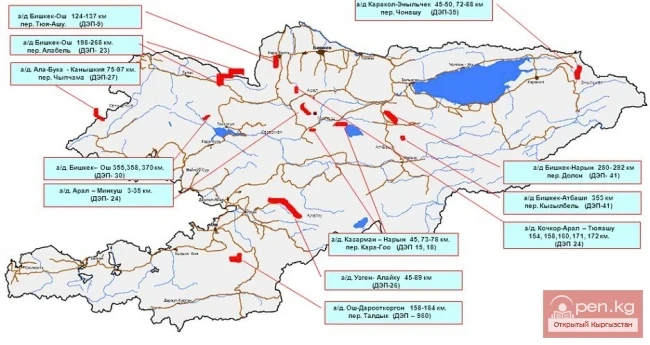
In Kyrgyzstan, according to specialists, there are more than 75 varieties of dangerous processes and phenomena of natural, technogenic, ecological, biological, and social nature. However, monitoring and forecasting cover no more than 10 types of disasters that occur most frequently and pose a significant threat to humans.
By genesis, all the main known types of ADNP in the Chui Valley are divided into hydrometeorological and geological-geomorphological. Some of them occur in the form of sudden and short-lived events (earthquakes, landslides, avalanches, collapses, mudflows, etc.), causing significant material losses and loss of life. Others, such as floods and erosion, develop over a long time, rarely leading to human casualties, but can cause colossal material damage.
The treachery of natural phenomena has been known to humanity for millennia. Traces of past destructions, descriptions, legends, paintings, and much more remind us of the catastrophes that have occurred in the world as a result of natural phenomena.
Earthquakes are the most significant geological phenomenon in terms of their consequences. Every year, according to specialists, about 10,000 people die from them worldwide, and the material damage, based on incomplete data, reaches 400 million dollars.
Earthquakes are caused by seismic waves and elastic vibrations of the Earth's crust. The destructive power of earthquakes is characterized in conditional intensity points. In the Chui Valley, a 12-point intensity scale is adopted to describe the forces of earthquakes.
The destructive effect of an earthquake is determined by the energy and depth of its focus or hypocenter, the amplitude and period of seismic wave oscillations, and the distance from the epicenter, where seismic energy is absorbed. The radial projection of the hypocenter on the surface of the Earth is called the epicenter of the earthquake - this is the area where the greatest destruction occurs.
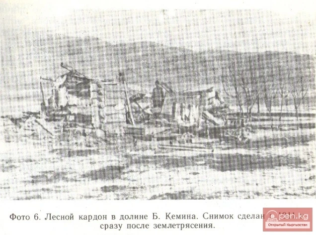
An earthquake represents a complex disaster due to its numerous direct and secondary manifestations on the Earth's surface. The main disasters caused by earthquakes are associated with enormous physical damage, casualties, as well as fear of this disaster, which leads to the destruction of housing, fires, and accidents. For example, the Suusamyr earthquake of 1992, according to the Ministry of Emergency Situations and Civil Defense specialists, caused enormous damage to the Chui Valley, approximately 1.5 billion rubles.
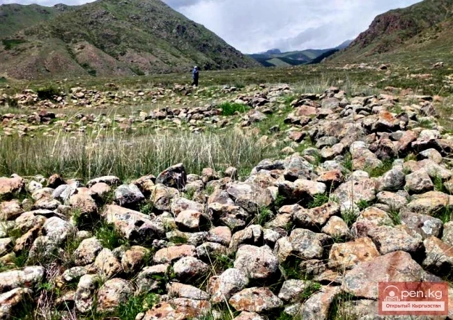
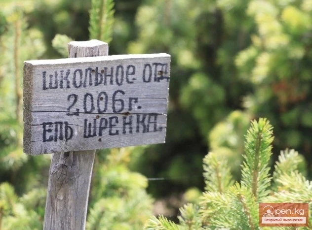
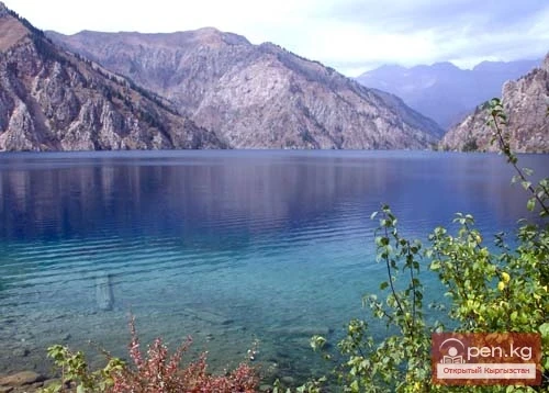
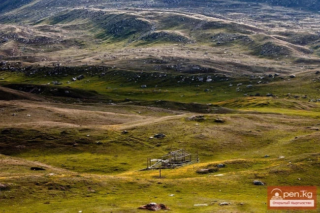
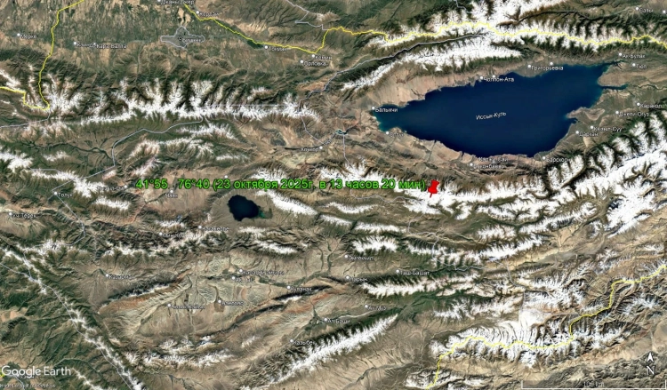
Within the Chui Valley (and adjacent areas), significant catastrophic earthquakes are known, such as the Belyvodskoye earthquake in 1865, the Vernensky earthquake in 1887, and the Kemin earthquake in 1911. The most powerful devastating earthquake, a 10-point Suusamyr earthquake, occurred on August 19, 1992. It claimed many lives and reminded us once again of the danger. The main shock of the earthquake was felt by people throughout Kyrgyzstan with a force of 4.5 points and higher, depending on the distance to the epicenter. The zone of maximum tremors covered the northern part of the Suusamyr Ridge, partly the Ketmen-Tyobon and Talas valleys. According to residents, at the moment of the earthquake, "waves" ran across the ground, as if the surface of the soil became bumpy and then straightened out. In the epicentral zone, cracks appeared on the surface of the ground, and massive collapses and landslides were noted in the mountains. It became clear that one of the strongest earthquakes of the year had occurred, which is the largest in the Tian Shan since the post-war period.
As a result of a comprehensive analysis of geological and seismic data (working program for the protection of buildings and structures "Saktoo," Bishkek, 1992) and seismic zoning of the territory of Kyrgyzstan, conducted in 1977 and 1995, seismogenic zones were identified. All the strongest earthquakes are associated with the Northern Tien Shan zone, as it is located along edge faults at depths ranging from 20-40 to 60 km, with the speed of recent movements along them reaching 5-7 mm per year.
To preserve the lives of people living in seismically hazardous areas, to ensure the stability and resistance of buildings against the destructive impact of earthquakes, norms and rules are being created and applied in practice, providing for various measures aimed at increasing their seismic resistance.