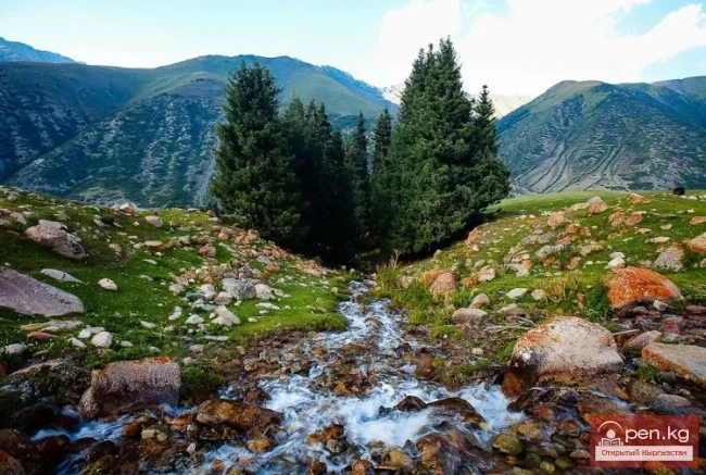
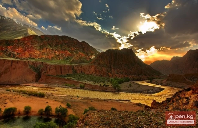
About Kyrgyzstan

{title}
State structure
{title}
National symbols
{title}
Government
{title}
Armed forces
{title}
National currency
{title}
Banknotes
{title}
Circulation coins
{title}
Collectible coins
{title}
Political organization
{title}
Domestic policy
{title}
Foreign policy
{title}
History
{title}
Kyrgyz in antiquity
{title}
Kyrgyz in the VI-XII centuries
{title}
Kyrgyz in the XIII—first half of XVIII century
{title}
The struggle for the independence of the Kyrgyz
{title}
Kyrgyzstan as part of Russia
{title}
Kyrgyzstan during the Soviet period
{title}
Kyrgyzstan — a sovereign state
{title}
Historical records
{title}
Kurmanjan Datka
{title}
Chagatai Ulus. Haidu State. Moghulistan
{title}
History and archeology of the ancient Tien Shan
{title}
Peoples movements of Central Asia in the XIX century
{title}
Kyrgyzstan during the Great Patriotic War
{title}
Kyrgyzstan in the 1920s
{title}
1937 in Kyrgyzstan
{title}
Shabdan Baatyr
{title}
Territory, geography and administrative division
{title}
Chuy Region
{title}
Attractions of Chuy Region
{title}
Issyk-Kul Region
{title}
Sights of Issyk-Kul
{title}
Naryn Region
{title}
Attractions of Naryn Region
{title}
Talas Region
{title}
Attractions of Talas Region
{title}
Osh Region
{title}
Attractions of Osh Region
{title}
Batken Region
{title}
Attractions of Batken Region
{title}
Jalal-Abad Region
{title}
Attractions of Jalal-Abad Region
{title}
Cities
{title}
Bishkek
{title}
Streets of Bishkek
{title}
Pishpek - Frunze - Bishkek
{title}
History of the capital of Kyrgyzstan in documents
{title}
Osh
{title}
Osh - 3000
{title}
Naryn
{title}
Jalal-Abad
{title}
Batken
{title}
Talas
{title}
Karakol
{title}
Tokmok
{title}
Cholpon-Ata
{title}
Uzgen
{title}
Kochkor
{title}
Kemin
{title}
Balykchy
{title}
Kyzyl-Kiya
{title}
Mailuu-Suu
{title}
Sulukta
{title}
Tash-Kumyr
{title}
Toktogul
{title}
Kara-Kul
{title}
Kara-Balta
{title}
Kara-Balta - Black Ax
{title}
Kant
{title}
Villages
{title}
Population
{title}
Language
{title}
Diaspora
{title}
Nature
{title}
Climate
{title}
Natural ecological complexes
{title}
Water resources
{title}
Rivers
{title}
Lakes
{title}
Secrets of Issyk-Kul Lake
{title}
Reservoirs
{title}
Waterfalls
{title}
Mineral waters
{title}
Flora
{title}
Fauna of Kyrgyzstan
{title}
Mammals of Kyrgyzstan
{title}
Birds of Kyrgyzstan
{title}
Fish of Kyrgyzstan
{title}
Amphibians and reptiles of Kyrgyzstan
{title}
Insects of Kyrgyzstan
{title}
Mountains and glaciers
{title}
Mountain ranges
{title}
Mountain peaks
{title}
Mountain passes
{title}
Glaciers
{title}
Caves
{title}
Gorges
{title}
National parks and reserves
{title}
Pastures and valleys
{title}
Soil and minerals
{title}
Red Book
{title}
Fungi and higher plants
{title}
Animals
{title}
Arthropods
{title}
Fish
{title}
Amphibians and reptiles
{title}
Birds
{title}
Mammals
{title}
Economy of Kyrgyzstan
{title}
Entrepreneurship
{title}
Agriculture
{title}
Finance
{title}
Construction
{title}
Industry
{title}
Transport and communications
{title}
Socio-economic resources
{title}
Tourism industry
{title}
Healthcare
{title}
Education
{title}
Sports
{title}
Science
{title}
Environmental science
{title}
Mass media
{title}
Art
{title}
Dances
{title}
Ballet
{title}
Decorative and applied arts
{title}
Musical instruments
{title}
Architecture
{title}
Painting
{title}
Music
{title}
Theater
{title}
Cinema
{title}
Sculpture
{title}
Circus
{title}
Literature
{title}
Photography
{title}
Culture
{title}
Epigraphy
{title}
Folklore
{title}
Kyrgyz heroic epic "Manas"
{title}
The epic "Manas" in prose
{title}
Poetic retelling of the epic "Manas"
{title}
"Semetey" - poetic story
{title}
"Semetey" in prose
{title}
Religion
{title}
Ethnography
{title}
National games
{title}
Customs
{title}
Myths and legends
{title}
Kyrgyz fairy tales
{title}
Kyrgyz cuisine
{title}
Meat and offal dishes
{title}
Soups of Kyrgyzstan
{title}
Main dishes of Kyrgyzstan
{title}
Sweet dishes of Kyrgyzstan
{title}
Drinks of Kyrgyzstan
{title}
Salads and appetizers
{title}
Flour products
{title}
Miscellaneous information about Kyrgyzstan
{title}
Historical and holiday dates of Kyrgyzstan
{title}
Famous personalities of Kyrgyzstan
{title}
Women of Kyrgyzstan
{title}
Historical figures
{title}
Heroes of Kyrgyzstan
{title}
Hero of the Kyrgyz Republic
{title}
Heroes internationalists
{title}
Heroes of Kyrgyzstan in World War II
{title}
Kyrgyzstanis — Full cavaliers of the Order of Glory
{title}
Writers of Kyrgyzstan
{title}
Inventors of Kyrgyzstan
{title}
Scientists of Kyrgyzstan
{title}
Architects of Kyrgyzstan
{title}
Artists of Kyrgyzstan
{title}
Musicians of Kyrgyzstan
{title}
Cinematographers of Soviet Kyrgyzstan
{title}
Actors of Kyrgyzstan
High-altitude Natural and Ecological Complex of Inylchek
Natural ecological complexes

High-altitude Natural and Ecological Complex of Inylchek

Muzdag Mountains, Khan Tengri Peak, and Victory Peak. The Muzdag mountain range (ice mountains) is located in the Central Tien Shan and occupies its highest area. For extreme tourism enthusiasts, this region, also known as the "Arctic," offers a wide variety of challenges. In the summer, a corporate climbing camp operates here, organized by various tour operators.

05.02.2014, 15:42
Kekemeren River
Rivers

Kekemeren River

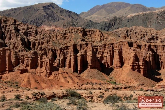
Kekemeren River is one of the most amazing and beautiful rivers in Kyrgyzstan. The Kekemeren is formed by the confluence of the impressive rivers Suusamyr and Eastern Karakol. The beauty of the Kekemeren lies in its mighty energy, unusual greenish color, multicolored steep banks, striking bends, rapids, and floodplain forests. For 199 km, up to its confluence with the Naryn, stretches the realm of the "Green River" (as some tourists call the Kekemeren). Along the riverbank, there is

05.02.2014, 15:30
The Valleys of Alamedin and Issyk-Ata
Pastures and valleys

The Valleys of Alamedin and Issyk-Ata

Ala-Medin. The Ala-Medin Valley is located 25 km from Bishkek. The valley opens up through the so-called "Wolf Gates," beyond which it unfolds. The surrounding steep cliffs resemble the ruins of ancient fortresses. The gorge, which climbs steeply upward, widens at its sources, forming the picturesque Salik Valley. The areas covered with a variety of alpine meadow grasses are adorned with beautifully arranged rocks and adjacent cliffs. Here, in the upper part of the left bank of the

05.02.2014, 15:21
Ala-Archa National Park
National parks and reserves

Ala-Archa National Park

In the ridges of the Kyrgyz Ala-Too, there are 480 glaciers. The largest of them are located in the central part of the ridge between the upper reaches of the Ala-Archa and Alamedin rivers. This is the so-called Ak-Sai mountain knot. The highest points of the ridge are located on its crest: Semenov Tien-Shan Peak (4874 m), Corona Peak (4860 m), Free Korea Peak (4640 m), Teke-Tor Peak (4441 m), and Ak-Tuu Peak (4620 m). The path to the Ak-Sai peaks lies through the picturesque Ala-Archa gorge,

05.02.2014, 15:08
Osh Region
Osh Region

Osh Region

The Osh Region was established on November 21, 1939, replacing the former district. After numerous reorganizations, the current territory of the Osh Region occupies the southern part of the country and borders the Batken Region to the west, the Jalal-Abad Region to the north, the Naryn Region to the northeast, China to the east, Tajikistan to the south, and Uzbekistan to the northwest. The region includes 7 districts: Aksy, Aravan, Kara-Kulja, Kara-Suu, Nookat, Uzgen, and Chon-Alai, as well as

04.02.2014, 22:45
Ak-Talaa
Pastures and valleys

Ak-Talaa

Ak-Talaa includes the valleys of the Ala-Buka, Arpa, and Terek rivers, as well as the southern slopes of the Moldo-Too ridge within the middle reaches of the Naryn River.

04.02.2014, 22:24
Caves of the Kok-Kiya River
Caves

Caves of the Kok-Kiya River

Kok-Kiya River (Green Slope) - the easternmost right tributary of Ak-Sai, flows down from the northwestern slope of the Kokshaala-Too ridge. In its middle course, the river runs through an impressive canyon, the walls of which show openings of caves and grottos. One of these openings, on the left side of the lower part of the canyon, leads to the Sports Cave, discovered by speleologists of Kyrgyzstan in 1973.

04.02.2014, 22:17
Small Naryn
Natural ecological complexes

Small Naryn

Small Naryn encompasses the valley of the river of the same name, located between the ridges of Jetim-Bel, Kapkatash, Karadjorgo, Jetim-Too, Uch-Emchek, and Terskey Ala-Too. Approximately 25 km from its mouth, Small Naryn flows into the Naryn; the valley of the river, transforming into the southern slopes of the Kapkatash ridge, makes a sharp turn at a right angle and continues to stretch almost 100 km to the east. On the right bank of the river, in the area of the bend and on the northern

04.02.2014, 22:12
Upper Naryn
Natural ecological complexes

Upper Naryn

Upper Naryn includes the upper part of the Naryn River basin from the vicinity of the town of Naryn to the headwaters of its two main tributaries - Taragay and Kara-Say, which originate in the ridge's crest area of Ak-Shiyrak. The territory of the complex lies within the administrative boundaries of the Issyk-Kul and Naryn regions.

04.02.2014, 22:08
Naryn Region
Naryn Region

Naryn Region

The Naryn Region is located in the southeast of Kyrgyzstan and was first established on November 21, 1939, under the name "Tian Shan Region." On December 30, 1962, the region was dissolved, and its districts came under republican jurisdiction. The Naryn Region was re-established on December 11, 1970. On October 5, 1988, it was merged with the Issyk-Kul Region, and on December 14, 1990, it was renamed back to Naryn Region. The region borders the Issyk-Kul Region to the east, the Chui

04.02.2014, 21:55
Issyk-Kul Region
Issyk-Kul Region

Issyk-Kul Region

The Issyk-Kul Region is located in the eastern part of Kyrgyzstan. It was established on November 21, 1939, and after several reorganizations, it was officially confirmed in its current form on December 14, 1990. To the north and northeast, the region borders Kazakhstan; to the east and southeast, it borders China; to the west and southwest, it borders the Naryn Region; and to the northwest, it borders the Chui Region. The area of the region is 43.1 thousand square kilometers (21.6% of the

04.02.2014, 16:03
Religion in Kyrgyzstan
Religion

Religion in Kyrgyzstan

Pilgrimage is the oldest form of travel, known for over a millennium. Up to 80% of tourist attractions are religious sites; for example, in Paris, religious sites make up 44%. The motivations for pilgrimage travel stem from a spiritual desire to visit religious centers and holy places. This motivation arises either from religious prescriptions, such as the requirement for every Muslim to perform Hajj to Mecca, or from an individual's religious aspirations and beliefs.

04.02.2014, 11:32
Ecosystems and Protected Areas of Kyrgyzstan
Nature

Ecosystems and Protected Areas of Kyrgyzstan

Protected Natural Areas of the Kyrgyz Republic “We, the people, will lose part of our essence if we allow the last corners of the wild nature to disappear from the face of the earth, if we pollute the last clean air and poison the last clean rivers and pave our highways through the last refuge of silence.” This saying belongs to Wallace Stegner - an American writer. Today, 500 million people travel around the world each year for pleasure, and the wonders of wild nature are a favorite

04.02.2014, 11:15
Industrial Steps of the Republic of Kyrgyzstan
Kyrgyzstan during the Soviet period

Industrial Steps of the Republic of Kyrgyzstan

Industry in Kyrgyzstan The leading sector of the national economy of the Kyrgyz SSR became industry. It accounts for more than half of the gross product, includes over 130 industries producing about 4,000 types of products. Today, it produces in half a day as much industrial output as was produced in the entire year of 1924. The volume of industrial production in the republic increased more than 700 times over the 60 years of the existence of the USSR.

03.02.2014, 23:33
Communist Party, Komsomol, Trade Union of Soviet Kyrgyzstan
Kyrgyzstan during the Soviet period

Communist Party, Komsomol, Trade Union of Soviet Kyrgyzstan

Development of Soviet Kyrgyzstan On October 14, 1924, the second session of the All-Russian Central Executive Committee (VTSIK) approved the resolution of the Central Executive Committee (CEC) of the Turkestan ASSR on the establishment of the Kara-Kyrgyz Autonomous Region, which was incorporated into the RSFSR. On May 25, 1925, by the resolution of the VTSIK, the Kara-Kyrgyz region was renamed the Kyrgyz Autonomous Region, on February 1, 1926, it was transformed into the Kyrgyz ASSR, and on

03.02.2014, 23:11
Canyons of Konorchek
Gorges

Canyons of Konorchek

Canyons of Konorchek occupy the eastern part of the Kyrgyz Ala-Too, covering a vast territory. Dry, devoid of any vegetation, red canyons, colored by the oxidation of mineral particles, appear as a collection of fantastic semi-ruined castles, ancient temples, modern skyscrapers, columns, and spires. The unusual shapes of these natural structures have given rise to equally strange names: Castle Rock - an impressive mass with a flat top 300 meters high, crowned with jagged towers; Bobsleigh

03.02.2014, 22:02
Boom Canyon
Gorges

Boom Canyon

Boom Canyon is located 112 km from the city of Bishkek and serves as a unique natural gateway leading to Lake Issyk-Kul, Central and Inner Tien Shan.

03.02.2014, 22:00
Natural Complex of Shamsi
Natural ecological complexes / Gorges

Natural Complex of Shamsi

The Shamsi Natural Complex is located 85 km east of Bishkek and includes the territory of a valley of the same name with tributaries flowing from the northern slopes of the Kyrgyz Ala-Too. The largest tributaries are located in the eponymous gorges: Tura-Kayin - left lower tributary; Tuyuk - left middle tributary; Kel-Tor - right lower tributary; Karagayly-bulak - right middle tributary.

03.02.2014, 21:12
Chuy Region
Chuy Region

Chuy Region

The Chuy Region was established on December 14, 1990. Until 1939, various administrative-territorial formations (districts, cantons, volosts) were created on the current territory of the region. From 1939 to 1959, it was the Frunze Region, and from 1939, it included districts of republican subordination. The Chuy Region occupies the northern part of Kyrgyzstan. To the north and west, the region borders Kazakhstan; to the southwest, it borders the Talas Region; to the south, it borders the

03.02.2014, 20:45
What is the Red Book?
Nature

What is the Red Book?

All rare and endangered species of animals and plants in the territory of Kyrgyzstan are protected by the state. According to the resolution of the Government of the Kyrgyz Republic, all rare and endangered species of animals and plants are included in the Red Book of the Kyrgyz Republic. The red color is a signal of alarm, understood by people all over the world. That is why this book was named, as it contains facts about the status of those species of animals and plants that are threatened

03.02.2014, 20:12
Suusamyr Valley
Pastures and valleys

Suusamyr Valley

The length of the valley is 155 km. It is bordered on the north by the Kyrgyz Ala-Too, on the south and southwest by the Suusamyr-Tuu ridge, and on the south and southeast by the Jumgal-Tuu ridge. The vast expanses of Suusamyr stretch from the Ala-Bel pass in the west to the beginning of the Kekemeren River in the east.

03.02.2014, 18:45
The title "Сырты Тянь-Шаня" translates to "The Ridges of the Tian Shan."
Pastures and valleys

The title "Сырты Тянь-Шаня" translates to "The Ridges of the Tian Shan."

Syrty - the magnificent pastures of Kyrgyzstan In the valleys of the Arabel-Su and Kumtor rivers, which form the Taragay river, there are landscapes of rare beauty known as syrty. Syrty stretch for many tens of kilometers, filling vast spaces between the ridges of Ak-Shiyrak, Sary-Djaz, and Terskey Ala-Too. Syrty is a cold semi-desert plain formed at elevations in the Tian Shan from 3000 to 3600 meters, characterized by gentle hills, small lakes and marshes, and scattered stones of various

02.02.2014, 21:28
The Kyrgyz Path to Gaining a Name
About Kyrgyzstan

The Kyrgyz Path to Gaining a Name

In 2002, at the Hyatt hotel in the capital, during the presentation of the book “The Kyrgyz Path to Gaining a Name”, introduced by the advisor to the President of the Kyrgyz Republic on tourism, Max Habershtro, the President of the country, Askar Akayev, spoke. The speech was vivid and thus memorable. I would like to return to this speech and present it as a preface:

28.01.2014, 22:53
From the History of Geographic Research in Kyrgyzstan
History / Historical records

From the History of Geographic Research in Kyrgyzstan

Researchers of Central Asia Throughout the centuries of studying the Tian Shan, it has been "assaulted" by travelers and scientists from more than 40 countries of the Old and New Worlds. It has been "besieged" from all four corners of the horizon. In ancient times, these were representatives of the Greco-Roman world and the Ancient East; in the Middle Ages — Arabs; and from the 18th century until the October Revolution — Russians, Germans, English, French, and others. The

28.01.2014, 22:32
Ancient Architecture of Kyrgyzstan
History / Historical records

Ancient Architecture of Kyrgyzstan

Masterpieces and Mysteries of Ancient Kyrgyz Architecture Among the outstanding architectural works of Kyrgyzstan from the 11th to 12th centuries is the Burana Tower—an 11th-century minaret. The tower is located in the Chui Valley near the city of Tokmak. Over the centuries, the purpose of the tower has been forgotten by the people. Some believe it was a watchtower, while others adhere to the legend that it is part of a castle where a powerful khan sheltered his beloved daughter. What does

28.01.2014, 22:27
Archaeological Finds in the Territory of Kyrgyzstan
History / Historical records

Archaeological Finds in the Territory of Kyrgyzstan

Archaeological Finds of Kyrgyzstan In the summer of 1960, parts of the skeleton of a large mammal, the Trogontherium, were found in the valley of the Jergalan River. Judging by the size of the skeletal remains, the height of this animal reached 5 meters. Trogontheria inhabited this area about 300,000 years ago. The history of Kyrgyzstan is extremely complex, as its territory lay on the path of invasions by many conquerors and powerful migrations that influenced the composition of the

28.01.2014, 22:23
The Plant World of Kyrgyzstan
Nature

The Plant World of Kyrgyzstan

Flora of the Republic of Kyrgyzstan The totality of all plant species is called flora. The totality of all instances of plants covering a certain territory is called vegetation. The diversity of the flora of Kyrgyzstan is explained by its geographical location and serves as a crossroads of floras from different natural and climatic zones. The plant world of Kyrgyzstan includes over 3,500 species. Among them are many fodder, medicinal, tanning, essential oil, and rubber-producing plants that

28.01.2014, 22:05
Wildlife of Kyrgyzstan
Nature

Wildlife of Kyrgyzstan

Wildlife of the Republic of Kyrgyzstan People around the world are increasingly interested in unique or rich flora and fauna, which is forming a significant and constantly growing segment of the tourism industry. Currently, thousands of tourists travel to distant places such as the Galapagos Islands, the Serengeti Reserve in Africa, the Great Barrier Reef, the jungles of Costa Rica, etc., to see and photograph rare plants and trees, butterflies or other insects, as well as endangered animals.

28.01.2014, 22:03
Natural Resources of Kyrgyzstan
Soil and minerals

Natural Resources of Kyrgyzstan

Mineral Resources of the Republic of Kyrgyzstan The subsoil of Kyrgyzstan is truly a gigantic "treasury" of valuable mineral resources. In the figurative expression of scientists, here "nature has hidden the entire periodic table of Mendeleev underground." By 1982, more than 5,000 deposits and manifestations of various types of minerals had been discovered and accounted for in the republic. Did you know that silver and gold, as well as ores of tin, copper, lead, mercury,

28.01.2014, 22:01
Water Resources of Kyrgyzstan
Nature

Water Resources of Kyrgyzstan

Kyrgyzstan: A Country of Heavenly Lakes Kyrgyzstan can confidently be called a country of heavenly lakes, as there are about 2,000 of them in the republic. The water surface of the lakes covers almost 7,000 square kilometers. Here you can find giant lakes, whose water volume can rival that of some seas, as well as tiny lakes that are so small they are not even marked on topographic maps. Kyrgyzstan has 1,923 lakes with a total mirror area of 6,836 square kilometers. The lake area of the

28.01.2014, 21:59
The Climate of Kyrgyzstan
Climate

The Climate of Kyrgyzstan

Nature of Kyrgyzstan The best elixir of health is nature. Walks through picturesque forested gorges and relaxation by the shores of a beautiful lake are the best ways to restore and maintain health. Humans have always sought to study the impact of various climatic factors on the body and to use their beneficial effects to strengthen it. The mechanism of action of climatic factors is based on the reflex-humoral principle, where climatic factors, by acting on receptors, reflexively influence the

28.01.2014, 21:55
Caves of Kyrgyzstan
Caves

Caves of Kyrgyzstan

Caves of Kyrgyzstan Caves are rightly called the cradle of humanity. Primitive people took shelter in them from the wind and cold, and from predatory beasts. Later, artificial caves created by humans appeared. There are very few artificial caves in Kyrgyzstan. The most notable are the salt mines of Chon-Tuz in the Kochkor district and the tunnel under the Tuy-Ashu pass on the Bishkek-Osh road. Natural caves are formed as a result of karst processes in water-soluble rocks (limestones, gypsum,

28.01.2014, 21:43
Mountains and Glaciers of Kyrgyzstan
Mountains and glaciers

Mountains and Glaciers of Kyrgyzstan

Mountains and Glaciers The abundance of landscape resources or interesting geological features often plays an important role in defining the international tourism image of the respective country. Tourists may travel thousands of kilometers just to see such famous natural wonders of the world as the Himalayas, the Great Barrier Reef, the Grand Canyon, Mount Fuji, etc. The main natural attractions of Kyrgyzstan include: Lake Issyk-Kul, Sary-Chelek, Son-Kul, the mountains of the Tien Shan and

28.01.2014, 21:41
Population of Kyrgyzstan as of January 1, 2013
Population

Population of Kyrgyzstan as of January 1, 2013

Population of Kyrgyzstan Thanks to the fundamental changes that occurred in Kyrgyzstan after the October Revolution, the mortality rate in the republic has decreased almost sixfold compared to pre-revolutionary times, which, combined with a high birth rate, has led to a significant natural population growth. As of January 1, 2013, the natural increase in Kyrgyzstan was 20.0 people per 1,000 residents.

28.01.2014, 21:39
Territory, Geography, and Administrative Division of Kyrgyzstan
Territory, geography and administrative division

Territory, Geography, and Administrative Division of Kyrgyzstan

Territory, Geography, and Administrative Division of the Kyrgyz Republic The Kyrgyz Republic occupies the northeastern part of Central Asia. It is located in a desert zone at an altitude ranging from 500 to 7500 meters. It is separated from the seas by vast distances, surrounded by extensive deserts. To the north, west, and southeast of the republic are the sandy "seas" of Kara-Kum, Muyun-Kum, Pribalhashia, and Western China. Kyrgyzstan is a country of high mountains and sunny

28.01.2014, 21:38
About Kyrgyzstan
About Kyrgyzstan

About Kyrgyzstan

In the northeast of Central Asia, the powerful ridges of the Tian Shan stretch for hundreds of kilometers, one of the greatest mountain systems on the planet. Here, landscapes of eternal snows coexist with the scorching deserts of Asia, flat plains give way to sharp snowy peaks. In the valleys, the Central Asian sun transforms into clusters of grapes, the ruby flesh of pomegranates, quince, and figs, and fragrant melons.

28.01.2014, 21:36