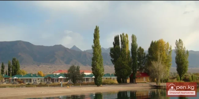
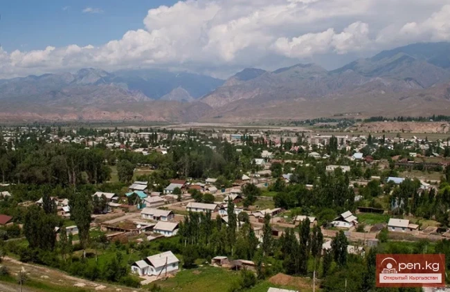
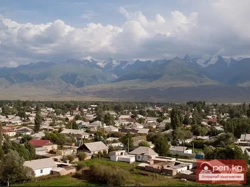
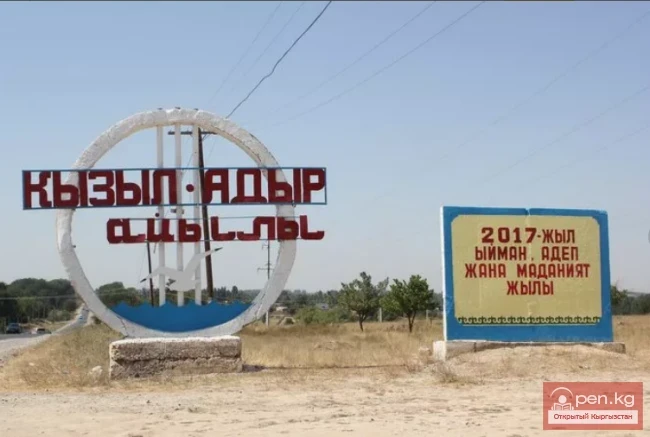
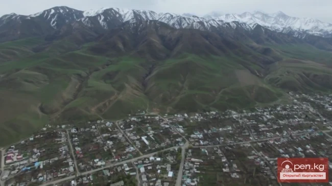
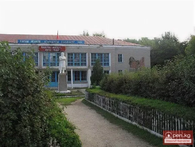
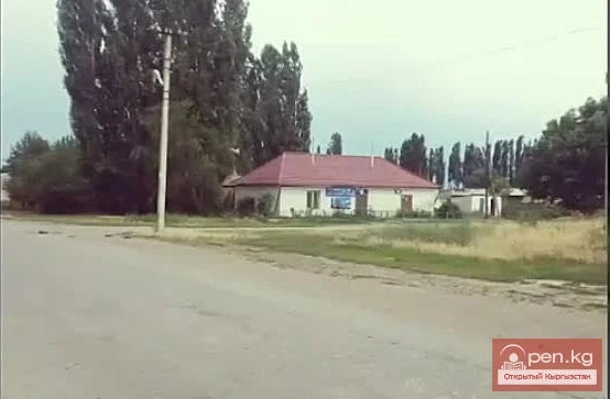
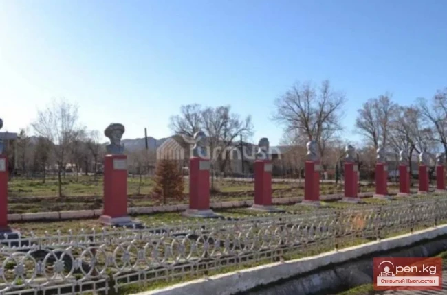
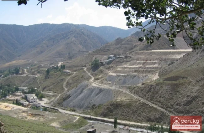
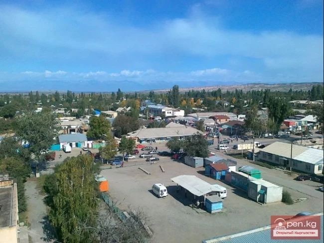
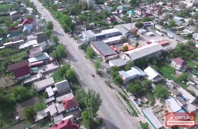
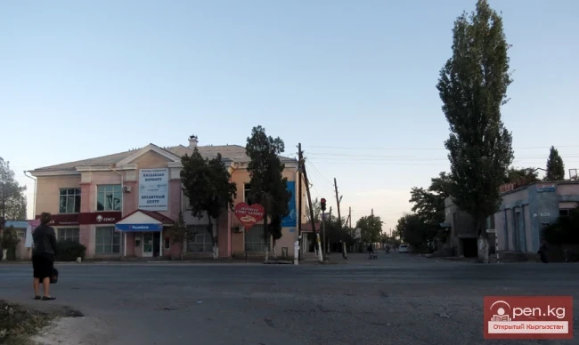
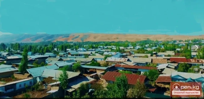
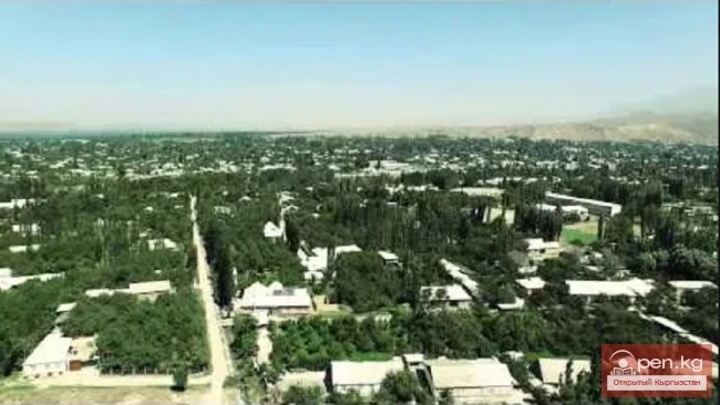
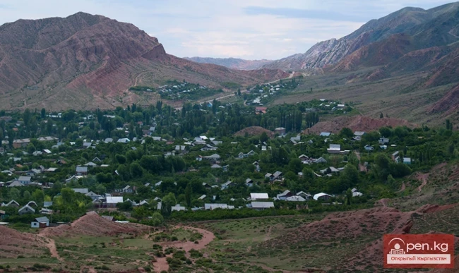
Tash-Debe - a flower on a stone hill In 2019, it marks 120 years since the founding of the first Kyrgyz settlement in the Chui Valley — the village of Tash-Debe, located 18 kilometers from the city of Pishpek. In those distant times, the Kyrgyz built houses in this area for the first time, modeled after Russian structures, with gabled roofs made of reeds and small windows. The settlement stretched in a straight line, lined with poplars. “Tash-Debe” means “stone hill, elevation.” According to
Toru-Ayghyr with a Rich Past The village of Toru-Ayghyr, with a population of 2,616, is located on the northeastern shore of Lake Issyk-Kul, 20 kilometers from the village of Balakchy. During the Soviet era, the village was part of the Semirechye region. Previously, the village was called Sikul, named after the ancient legend of the faithful horse Toru-Ayghyr. The surroundings of Toru-Ayghyr are rich in various historical and natural monuments. These include ancient petroglyphs, rock
Ak-Terek — a village in the Jeti-Oguz District of the Issyk-Kul Region of Kyrgyzstan. It is the administrative center of the Jarlygach rural district. The population is 3,586 people. The village of Ak-Terek is located on the shores of Lake Issyk-Kul and is part of the resort area. A regional highway runs through its territory. Administratively, the village is the center of the Jarlygach rural district, within which the ruins of an ancient settlement have been preserved. In ancient times, its
Sosnovka Sosnovka village is located in the Jayil district of the Chui region in the northern part of the Kyrgyz Republic. During the Soviet era, the district was named Kalininsky, but after the republic gained sovereignty in 1991, it was renamed Jayil in honor of Jayil-biya, who, according to Kyrgyz genealogical legends, lived in these areas in the late 18th to early 19th century and was the leader of a large ethnic union of northern Kyrgyz – the Solto tribe. Sosnovka village is situated 20
Aravan — a village, the administrative center of the Aravan District in the Osh Region of Kyrgyzstan. Central Asia, 5 kilometers from the Uzbek border. It is located in the southernmost part of the Fergana Valley, stretching along the Aravay-Say River. Situated on the Great Silk Road.
Massy – a village, the center of the Nooken district. It is located 60 kilometers northwest of the regional center Jalal-Abad along the M41 highway, which connects Bishkek and the city of Osh. Massy stretches in the eastern part of the Fergana Valley, on one of the rivers that descends from the Babash-Ata ridge. Here, the river flows onto the plain, and almost all of its water is diverted through irrigation canals. The village lies at the foot of the southern slopes of the ridge.
Safed-Bulan – it has recently been returned to its historical name According to legends, the last place that Alexander the Great managed to reach is the sacred mountain Archa-Mazar. To confirm this information, local residents show an ancient granite slab on which "Alexandria Eschata" is inscribed in Greek, which translates as "the last Alexandria." At the foot of the mountain lies the ancient village of Safed-Bulan ("White Bulan"). This name has been preserved
Katran is a village in the Leilek District of the Batken Region of Kyrgyzstan. In 2009, its population was 5,095 people. There are legends that the bushes of katran, which grow abundantly here, have saved local residents during times of famine. The village was named in honor of this plant. The village is located at the beginning of the Kuzu-Baglan River, over which a bridge was built by the Ministry of Transport in 2017. The opening ceremony was attended by the Minister of Transport,
The village of Samarkandek is located in the Batken district of the same-named region of Kyrgyzstan According to legends, the village of Samarkandek got its name from a woman named Samara, who escaped from hunger by gathering apricots. This village is home to just under 13,000 Kyrgyzstani residents. Literally a hundred meters away is the territory of another state, the village of Chorku, which is an enclave of Vorukh in the Republic of Tajikistan. The process of demarcation and delimitation of
Bakai-Ata (until 2001 — Leninpol) A village, the administrative center of the Bakai-Ata District in the Talas Region, located in the northwest of Kyrgyzstan, 35 kilometers from Talas. It is the administrative center of the Leninpol rural district. Population. In 1999, the population of the village was 6,552 people (3,299 men and 3,253 women). According to the 2010 census, the village had a population of 6,834 (3,491 men and 3,343 women). Currently, there are 7,008 residents. The village is
Boo-Terek (until 2001 — Klyuchevka) is a village in the Bakai-Ata District of the Talas Region of Kyrgyzstan It is the administrative center of the Boo-Terek rural district. Population
Resilient Residents of Kopuro-Bazar Kopuro-Bazar village is located in the Talas region, on the southern slope of the Kyrgyz Ridge. It is quite easy to find – the village is situated along the Bishkek–Talas highway. The village is relatively prosperous, with a population of 5,483 people. The main sources of income for the local residents are livestock farming and agricultural activities focused on exporting environmentally friendly products to Kazakhstan.
Kok-Oy is a village in the Talas District of the Talas Region of Kyrgyzstan. It is the administrative center of the Kok-Oy rural district. Until 2001, it was called Ivan-Alexeyevka. On February 5, 2001, the Ivan-Alexeyev rural council was renamed to Kok-Oy, and the village of Ivan-Alexeyevka was also renamed to Kok-Oy. Until 2007, it served as the administrative center of the Talas District. Elevation above sea level: 1203 meters
Manas Village in Talas Manas village has been the administrative center of the Talas district in the Talas region of Kyrgyzstan since 2007. It is the administrative center of the Omuraliev rural district. It is located in the northern part of the republic. In the past, the settlement was known as Ak-Sai, but the toponym was changed to its current name in 2006. Administratively, the village serves as the district center, where one of the buildings houses the administrative apparatus. The
Chayek – Agricultural Settlement The village of Chayek is the center of the Jumgal district in the Naryn region of Kyrgyzstan. The settlement is located in the central part of Kyrgyzstan and is situated on the Jumgal River. It occupies a narrow mountain valley surrounded by picturesque steep ridges of the Inner Tien Shan. The road leading from the Tuy Ashuu pass to Kochkor runs through here. Chayek is approximately equidistant from the capital city of Bishkek and the regional center of Naryn –
Krasnaya Rechka — a village with a rich past Krasnaya Rechka is a village in the Krasnorechensky rural district of the Issyk-Ata district in the Chuy region of Kyrgyzstan and is essentially the only populated point within its boundaries. It is located on the Bishkek—Tokmak highway, 8 km east of the city of Kant. The village is traversed by a road that serves as a transport artery connecting Bishkek and Tokmak. Population - 7,328 people. It was founded in 1907 by settlers from the central and
Bosteri – a popular resort village Bosteri is a village in the Issyk-Kul District of the Issyk-Kul Region of Kyrgyzstan. It is located on the shores of Lake Issyk-Kul, 8 km east of the district center, the city of Cholpon-Ata, and 255 km from Bishkek on the northern shore of Issyk-Kul. The village is situated near the highway connecting Cholpon-Ata with Karakol. Bosteri is a popular resort village, home to a large number of hotels, guesthouses, sanatoriums, and private homes available for
Village Pokrovka is the administrative center of the Manas District in the Talas Region of Kyrgyzstan. It is located in the northeastern part of the Talas Region. Previously, the settlement was named Kyzyl-Suu and belonged to the Jety-Oguz District. Since then, its status and territorial affiliation have changed after a series of transformations. To the north and west, the district shares borders with the Jambyl Region of Kazakhstan, while its southern borders are with the Kara-Buura and
Bayetovo – a high-altitude village in Central Kyrgyzstan, surrounded by the ridges and massifs of Naryn-Tau (a part of the Tian Shan system). Elevation above sea level: 2023 m. The settlement is located in a small oasis valley, on one of the tributaries of the Naryn River. The proximity to the main river of the region sometimes brings a lot of trouble to the local residents: quite strong and destructive floods occur. Bayetovo is the center of the Ak-Tal district, located 120 kilometers from
KazarMan – a village in central Kyrgyzstan, the administrative center of the Toguz-Toro district. It is located in a small valley along the banks of the Naryn River, at the junction of the Fergana Range and the Moldo-Too mountains, at an altitude of 1310 meters above sea level, near the famous gold mining site of Makmal. The village is connected to the district's populated areas by roads, although it is cut off from civilization during the winter months due to heavy snowfall. There is an
Kochkor - the charm of local fauna and the colorful traditions Kochkor village is located in the northern part of the Naryn region. It stretches across a vast valley at the confluence of the Eastern Karakol and Kara-Kudzhur rivers into the Chu River. The valley is surrounded by the mountains of the Inner Tien Shan. Additionally, Kochkor is the center of the eponymous district and a transport hub for the region. The village is where the roads converge, leading to Balykchy, Naryn, and the
National Ethnic Complex "Bokonbaeva Village" Bokonbaeva is a picturesque village on the southern shore of Lake Issyk-Kul, which serves as a center for ecological tourism in Kyrgyzstan. The village is located at an altitude of 1800 m above sea level, approximately 160 km from Karakol and 280 km from Bishkek. It is the administrative center of the Ton District in the Issyk-Kul region of the Republic of Kyrgyzstan, with a population of 10,405 people. The valley where the village is
At-Bashi - translated from Kyrgyz as "Horse's Head" At-Bashi (Kyrg. Ат-Башы) is a rural settlement (kyshtak[ky]), as well as the administrative center of the eponymous district in the Naryn region of the Kyrgyz Republic. The village is located at the northern foothills of the At-Bashi ridge in a vast basin formed by the confluence of the Kara-Koyun and At-Bashi rivers, at an altitude of 2060 m above sea level. The village lies along the Balykchy – Naryn – Torugart Pass
Kyzyl-Adyr means "red foothills" Kyzyl-Adyr is a village in the Talas region, the administrative center of the Kara-Buurin rural district. It is located on the southern shore of the Kirov Reservoir, which was created on the Talas River for agricultural needs. In the area, the river valley widens, forming a broad fertile valley. The regional center is located 60 kilometers to the east. Bishkek is 350 km away. Neighboring settlements include It-Agar, Kara-Kul, Taraz, and Toktogul.
Ala-Buka Village Ala-Buka Village is the administrative center in the west of Kyrgyzstan, located in the southern foothills of the Chatkal Range. It is situated on a small mountain plain in the valley of the Ala-Buka River (a tributary of Kasan-Say, part of the Syr Darya basin), at an altitude of about 1180 m above sea level. The village is located 6 kilometers north of the Uzbek border and 750 kilometers from Bishkek, the capital of the country. The population of Ala-Buka Village is about
Ak-Suu Village, formerly Teploklyuchenka Ak-Suu Village is located in the eastern part of the Issyk-Kul region, within the territory of the Teploklyuchensky rural district, approximately 9 kilometers from Karakol. In the granite gorge of Ak-Suu, with a bottom width of 30-40 meters and slopes rising about 300 meters, flows the river of the same name, Ak-Suu. Not far from Jilandy — the Issyk-Kul Nature Reserve of the Teploklyuchen district — another river, Arashan, flows into Ak-Suu. The
Kara-Kulja Village is the center of the eponymous district Karakulja (archaic: Kara-Kulja; at the source — Karakol) is a river flowing through the Osh region of Kyrgyzstan. The length of the river is 104 km. It collects its waters from the southwestern slope of the Fergana Range. Karakulja is the right tributary of the Karadarja River. The Kuldzhinsky district is located in the river basin. It was established in 1936 under the name Soviet District. It was abolished in 1962, restored in 1969,
Sokuluk – a large rural settlement It is the administrative center of the Sokuluk District. This is the largest settlement in the district, even surpassing the nearby city of Shopokov, which is located to the east of Sokuluk. Currently, the boundaries between them are quite conditional. Further east, 20 kilometers away, lies Bishkek. The Bishkek – Tashkent highway and the Bishkek – Lugovaya railway pass through the village. The village is named after the Sokuluk River, which stretches along
The village of Kanysh-Kiya is the center of the Chatkal district. The settlement is located in a remote and hard-to-reach region on the Chatkal River. The northern bank of the river is bordered by the slopes of the Chandalash Ridge, while the southern bank is bordered by the Chatkal Ridge, and Kanysh-Kiya lies in the Chatkal Valley, stretching for several kilometers along the river. The district shares its borders with the Talas region of Kyrgyzstan and the Tashkent region of Uzbekistan. An
Kyzyl-Suu - "Red Water" The village of Kyzyl-Suu is located in the territory of the Jeti-Oguz district and serves as its administrative center. In the past, the settlement was called Pokrovka and was founded by Russian settlers. A regional highway runs through its territory. Geographically, it occupies an area situated between the Jeti-Oguz resort and a mountain gorge. The distance from its outskirts to the shores of Lake Issyk-Kul is no more than 10 kilometers. It is believed that
Lebedinovka Village The village is part of the Alamudun District and serves as its administrative center. An important regional highway runs through the territory of the settlement, connecting Bishkek and Balakchy. In the recent past, the majority of its residents were Chechens. Over time, significant changes in the ethnic composition occurred, beginning in 1991 with the collapse of the Soviet Union. In terms of population, the village is classified as a large settlement, similar to
Belovodskoye Village is located in the west of the Chui Valley It is situated approximately 42 kilometers from Bishkek. It got its name from the Ak-Suu River, which translates to "White Water." Belovodskoye, one of the largest resettlement villages in the Chui Valley, was established in the spring of 1868. The history of Belovodskoye is filled with tragic and heroic pages. In terms of its historical past and its mention in historiography, it has no analogs among rural settlements in
Gulcha – a village, the administrative center of the Aksy District. This is a comfortable, remarkably beautiful, and small settlement in Kyrgyzstan. The village is located in the center of the Osh region, at the northern end of the Alai Ridge. The settlement occupies the wide Gulcha Valley, formed by three mountain streams that merge here into the Koshrab River. The village lies 150 kilometers from the city of Osh along the M41 highway, known as the Pamir Highway – the main transport corridor
The village and district center of Suzak is located at the foot of a low mountain range on the Kök-Art River. It lies in the eastern part of the Fergana Valley, 7 kilometers from the Uzbek border. Nearby, to the northeast, is the regional center – Jalal-Abad. The two settlements are separated by just 2 kilometers and the national highway M41, which runs from Bishkek to Osh. As in most settlements near the border with Uzbekistan, Uzbeks make up the majority here, accounting for over 90% of the
Uch-Korgon – a large village (kishlak) in the northeast of the Batken region. The word "korgon" translates from Turkic as fortress (not to be confused with burial mounds). The settlement stretches in close proximity to the Uzbek border, in the very south of the Fergana Valley. To the south of Uch-Korgon rise the mountain ranges of the Alai Ridge. The Isfayram River flows through the village. Uch-Korgon is located along the Southern Kyrgyz Highway (Kadamjai – Osh), and the nearest
Kosh-Kol Settlement – Immerse Yourself in the Seaside Relaxation of Issyk-Kul Located 210 km from Bishkek and just 30 km from Cholpon-Ata, the village of Kosh-Kol offers a calm and measured way of life. Kosh-Kol, also known as Kosh-Kel, Kosh-Kol, or Koshkol, is a small settlement situated 5 km west of the larger village of Tamchy. There are not many recreation centers and private houses here, making relaxation in this part of the Issyk-Kul coast more tranquil. The main part of the settlement
BAZARKORGON AND BAZARKORGON DISTRICT Bazarkorgon (Kyrgyz: Базар-Коргон) is a village in the Jalal-Abad region of Kyrgyzstan, the administrative center of the Bazarkorgon district and at the same time the center of the Bazarkorgon rural district. The village is located 673 km from Bishkek, on the strategic M41 highway connecting the capital of the country with the city of Osh, 35 km from the regional center to the northwest of the city of Jalal-Abad at an altitude of 1200 meters. It borders the
Tyup – a village and the center of the eponymous district in the Issyk-Kul region. It is located at the extreme eastern tip of Issyk-Kul, at the mouth of the Tyup River (the second largest tributary of the lake), which meanders significantly here, forming old riverbeds and marshy areas. Tyup lies 27 kilometers from Karakol, which is connected by a road. To the north of the village stretches a protected area – one of the sections of the Issyk-Kul Nature Reserve. Tyup was founded by Russian
Kadzhi-Sai - a leap from a closed zone to a tourist destination Kadzhi-Sai is today a quiet, almost forgotten village in the Ton district of the Issyk-Kul region. Located on the southern shore of Issyk-Kul along the Balakchy-Karakol highway, the village is 270 km from Bishkek and 120 km from Karakol. The history of the settlement begins in 1947 when uranium deposits were discovered near Kadzhi-Sai at a depth of 600 meters. This fact was crucial for the policy of the Soviet Union, which at that
This was once the name of the village of Gulistan, located fifteen kilometers from the village of Ala-Buka — the center of the Ala-Buka district in the Osh region. In the IX-X centuries, an urban settlement emerged here, which became a developed medieval city in the XI-XII centuries. Today, there are not many ancient structures to see, but the mausoleum of Shah-Fazil, built at the turn of the eleventh and twelfth centuries, has been preserved. Built on a rock, this mausoleum is unique in its