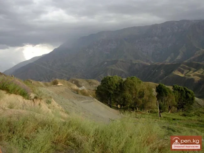
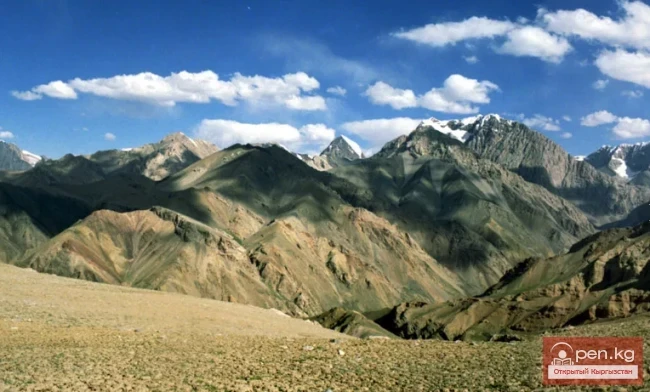
Chatkal Ridge
Mountain ranges

Chatkal Ridge

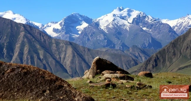
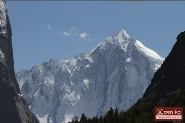
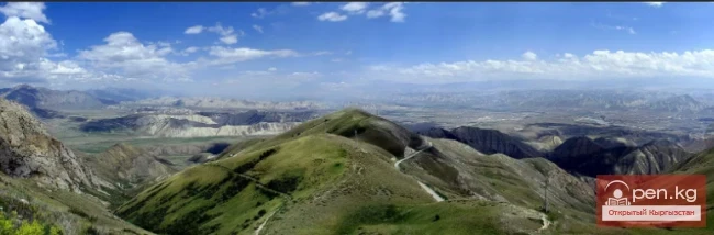
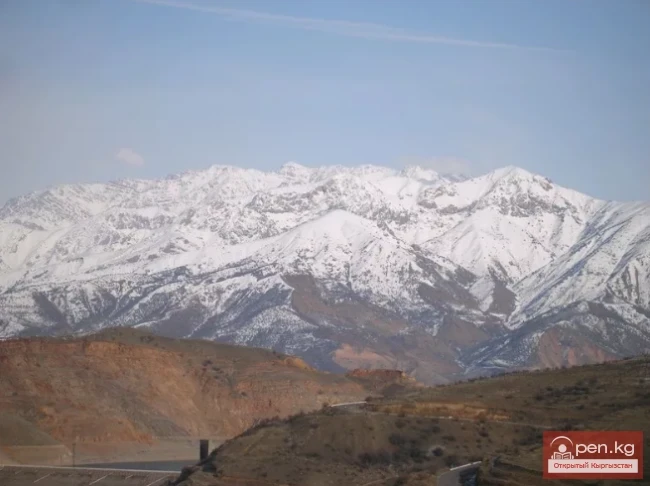
Chatkal Ridge of the Central Tien Shan The mountain range in the Western Tien Shan, which limits the Fergana Valley from the northwest, is about 225 km long, 30 km wide, and has an average height (above sea level) of 3800 m. The highest peak, Chatkal (Aflatun), reaches 4503 m. It is located in the Tashkent region of Uzbekistan and the Jalal-Abad region of Kyrgyzstan. The main peaks of this ridge are slightly above 3000 meters, among which stand out Big Chimgan, Kyzylnura, Babaytag, Karakush,

21.11.2018, 21:34
The title "Хребет Джангарт" translates to "Dzhangart Ridge" in English.
Mountain ranges

The title "Хребет Джангарт" translates to "Dzhangart Ridge" in English.

Dzhangart Ridge The Dzhangart mountain ridge is located south of the Kainy Ridge on the border with the People's Republic of China. Administratively, it belongs to the Aksuysky district of the Issyk-Kul region. The small Dzhangart ridge is separated from the Kokshaaltau Ridge by the Dzhangart River and glacier. Ascents are possible both on the Dzhangart ridge, where heights reach up to 4600 meters above sea level, and in the Kokshaaltau Ridge, where heights are 5340 meters above sea

19.11.2018, 17:52
Meridional Ridge
Mountain ranges

Meridional Ridge

Meridional Ridge The main nodal uplift of the Central Tien Shan on the border of Kyrgyzstan and China is the Meridional Ridge, approximately 90 km long and with an average height of over 6000 m. The northern continuation of the ridge is the Kakshaal-Too. The highest peaks include Peak Friendship (up to 6800 m), in the Akatau range - Peak High (up to 6964 m), and Peak Military Topographers (up to 6873 m), as well as Bezimenniy (6814 m) and Marble Wall (6140 m), located at the intersection of

18.11.2018, 19:42
Fergana Range
Mountain ranges

Fergana Range

Fergana Ridge A mountain range in the Tien Shan that stretches from southeast to northwest, separating the cold high-altitude plateaus of central Tien Shan from the scorching plains of the Fergana Valley. The length of the ridge is 225 km. Its width is 62 km. The average height (above sea level) is 3620 m. The highest peak, Kara-Kuldja (Uch-Seyit), reaches 4940 m. In the southeastern part, there are about 400 glaciers with a total area of about 195 km². The area in the southern part of the

17.11.2018, 20:03
Turkestan Range
Mountain ranges

Turkestan Range

Turkestan Range A high mountain range oriented in a latitudinal direction, approximately 340 km long and up to 30 km wide, belonging to the Gissar-Alai mountain system. The average height (above sea level) is 4430 m. The highest peaks are Skalistyy (5621 m) and Pyramid Peak (5509 m). Through the Matcha mountain knot, the range connects with the Alai Range to the east and stretches to the Samarkand Plain to the west. The northern slope is long and gentle, with juniper forests and sparse

17.11.2018, 15:21
Terskey Alatoo Ridge
Mountain ranges

Terskey Alatoo Ridge

Terskey Alatau The Terskey Alatau Ridge is very beautiful in its variety of landscapes. In one day, you can see the beauty of red sandstone cliffs, wild forests, and snowy peaks, widely spread over the greatest lake, Issyk-Kul. Each gorge is unique and unparalleled in its execution. The Terskey Alatau Ridge ("colorful mountains turned away from the sun") is located latitudinally and frames the basin of Lake Issyk-Kul from the south. The length of the ridge is about 375 km, and in the

16.11.2018, 02:27
Talas Ridge
Mountain ranges

Talas Ridge

Talassky Ala-Too A mountain range located in the Western Tien Shan system. Most of it is situated in Kyrgyzstan, with a part in southern Kazakhstan. This range separates the Talas Valley from other ranges and valleys of the Western Tien Shan and the western part of the so-called Inner Tien Shan. The length of Talassky Ala-Too is about 270 km, with a width of 40 km. The average height (above sea level) is 3930 m, with the highest peak being 4488 m – Mount Manas. The Talas basin is bounded to

16.11.2018, 02:13
The Ridges of Sonkyoiltau and Susamyrtau
Mountain ranges

The Ridges of Sonkyoiltau and Susamyrtau

Son-Kul-Tau A mountain range in the Tian Shan, in the southeastern part of Kyrgyzstan. It arches around the northern edge of the Son-Kul lake basin. The length of the ridge is about 60 km, with a maximum height of 3856 m. It is primarily composed of limestone. Alpine meadows are located on the northern slope and in the summit area of the ridge, while subalpine meadow-steppes and steppes are found on the southern side. Susamyr-Tau A mountain range in Kyrgyzstan, part of the Inner Tian Shan

15.11.2018, 19:41
The Saridzhaz Ridge
Mountain ranges

The Saridzhaz Ridge

Sarydjaz The mighty snow-covered barrier of the Sarydjaz mountain range rises in the Central Tian Shan, on the territory of Kyrgyzstan and partially Kazakhstan. It is located between the Sarydjaz River to the north and its left tributary, the Inylchek River, to the south. The length of the ridge is 113 km, with a width of up to 16 km. Its peaks rise above 5000 m. The average height is 4370 m, with the highest point being Semenov Peak (5816 m). The ridge is composed of metamorphic schists,

15.11.2018, 19:34
Naryn-Too Ridge
Mountain ranges

Naryn-Too Ridge

Naryn-Tau The area is hard to access and rarely visited. Due to the low glaciation and modest heights, the Naryn-Tuu ridge has only been traversed by watermen, one hiking group (Svitanko-1963), and, strangely enough, cyclists. The mountain range in the Inner Tien Shan in Kyrgyzstan forms the left bank of the valley of the Great Naryn River. To the east, it is bounded by the Karakolka River - a left tributary of the Naryn. From there, the ridge stretches westward for about 120 km to the

15.11.2018, 19:27
The Moldotau Ridge
Mountain ranges

The Moldotau Ridge

Moldotau A mountain range in the Inner Tian Shan, in the central part of Kyrgyzstan, south of Lake Son-Kul. The range stretches generally from west to east, between the valleys of the Kökömeren and Naryn rivers. The length of the ridge is about 150 km. The maximum height is 4185 m. It is mainly composed of limestone. The lower slopes are covered with mountain steppes and meadows, while higher up there are areas of spruce forests and juniper groves.

14.11.2018, 18:55
Kungey-Alatau Ridge
Mountain ranges

Kungey-Alatau Ridge

Kungey-Alatau To the south of the Zailiysky Alatau, beyond the deep longitudinal valleys of the Chilik and B. Kemin (Chon-Kemin) rivers, stretches a chain of snowy peaks of the Kungey-Alatau ridge, which borders Lake Issyk-Kul from the north (the Terkey Alatau ridge limits this basin from the south). Together with the Zailiysky Alatau, it forms the Northern Tien Shan. The ridge is elongated in a latitudinal direction (from west to east) and has a length of 275 km in a straight line.

14.11.2018, 18:28
Kuylytau Ridge
Mountain ranges

Kuylytau Ridge

Kuylytau A mountain range in the Central Tien Shan, in Kyrgyzstan. It is located between the rivers Kuyly and Uchkel (the Sarydjaz basin). The length of the ridge is about 50 km, and the maximum height is 5203 m. The ridge is composed of limestones, metamorphic schists, and granites. The Kuyly massif extends approximately 50 km in the latitudinal direction and 25 km in the meridional direction. The natural boundaries of the area are the rivers Sary-Djaz, Uch-Kel, Sarychat, Kuyly, and the Kuyly

14.11.2018, 17:35
Koksu Ridge
Mountain ranges

Koksu Ridge

Koksu Ridge Located in the Western Tien Shan, on the border of Kyrgyzstan and Uzbekistan. Its length is about 70 km, with average heights around 2000 m. It bounds the valley from the southeast, through which the Koksu River flows into the Charvak Reservoir. Here is how V.N. Popov describes the Koksu Ridge in his book: "Western Tien Shan".

13.11.2018, 20:28
Kyrgyz Ridge
Mountain ranges

Kyrgyz Ridge

Kyrgyz Mountain Ridge A mountain range that borders the Chuy Valley and the Moyunkum Desert to the south. It is located 40-60 km south of the capital of Kyrgyzstan. It is situated in the northwestern part of the Tien Shan within Kyrgyzstan and partially in Kazakhstan. The range extends 400 km from west to east - from the city of Jambyl to the Boom Gorge of the Chu River. In the northern part, it connects with the Talas Ridge, and through a watershed saddle of the Karakol West and Karakol East

13.11.2018, 20:14
The title "Хребет Какшаал-Тоо" translates to "Kakshaal-Too Ridge" in English.
Mountain ranges

The title "Хребет Какшаал-Тоо" translates to "Kakshaal-Too Ridge" in English.

Kakshaal-Tuu A mountain range in the Central Tian Shan system, on the border of Kyrgyzstan and China. The length of the range is about 582 km, width is 54 km, and the highest point is Victory Peak (7439 m). The average height (above sea level) is 4500 m. The western part of the Kakshaal-Tau range forms the southern boundary of the Inner Tian Shan. The range is composed of clay slates, sandstones, limestones, pierced by granite intrusions. Alpine relief predominates with a total glaciation area

12.11.2018, 21:14
The title translates to "Kainyda-Katta Ridge."
Mountain ranges

The title translates to "Kainyda-Katta Ridge."

Kainyda-Katta In the Central Tien Shan in Kyrgyzstan, extending west from the peak of the Red Army in the Inylchektau range, is the relatively low Kainyda-Katta ridge, which has a well-developed orography on its northern slopes and completely unbroken southern slopes. In the area of the Bulantor peak, the ridge branches into two parallel limbs. It is located in the basin of the Saryjaz River, stretching south from the Kainyda Valley. The length of the ridge is about 65 km. The maximum height

12.11.2018, 21:00
The Ridge of Inylchektau
Mountain ranges

The Ridge of Inylchektau

Inylchektau A mountain range in the Central Tien Shan in Kyrgyzstan. It is located in the basin of the left tributaries of the Sarydjaz River. The ridge stretches in a sublatitudinal direction between the Inylchek and Kaindyn valleys. This ridge branches off from Kokshaaltau 20 kilometers west of Victory Peak along the Komsomol Glacier, initially heading north but then turning west, almost parallel to the Sarydjaz Ridge. Between these ridges lies the Inylchek Valley. Almost from the very base

12.11.2018, 19:04
Zailiysky Alatau Ridge
Mountain ranges

Zailiysky Alatau Ridge

Zailiyskiy Alatau A mountain range in the northwest of the Tian Shan (on the border of Kazakhstan and Kyrgyzstan). The prevailing heights are 4000–4600 m. The highest points of the Zailiyskiy Alatau, between the Kastek Pass in the west and the Amanzhol Pass in the east, belong to the central part of the ridge - the Talgar (Chilik-Kemin) mountain knot, where the highest point of the entire system rises - Talgar Peak or Talgar Peak (4973 m). The northern slope is relatively gentle, deeply

11.11.2018, 10:37
Zhalay Range
Mountain ranges

Zhalay Range

Zaalai Ridge A ridge oriented in a latitudinal direction, separating the Pamir and the Alai Valley. The length of the ridge is 250 km, width – 40 km. The average height (above sea level) is 5460 m.

11.11.2018, 10:23
Jumgaltau Ridge
Mountain ranges

Jumgaltau Ridge

Jumgaltau A mountain range in the northern part of the Tien Shan, in Kyrgyzstan. The ridge extends in a sublatitudinal direction for more than 100 km. Width 15 km. Average height (above sea level) 3800 m. Maximum height (above sea level) – 4281 m, peak - Min Teke. To the west, it is separated from the Susamyrtau ridge by the gorge of the Kökömeren River. Jumgaltau is composed of tuffaceous sandstones, limestone-mica schists, and granites. On the slopes, there are meadows with juniper shrubs,

11.11.2018, 10:16
The title "Хребет Джетим" translates to "Djetim Ridge" in English.
Mountain ranges

The title "Хребет Джетим" translates to "Djetim Ridge" in English.

Djetim A mountain range in the Tian Shan, in Kyrgyzstan, south of the Terskey Alatau. The length of the ridge is about 120 km, with the maximum height being the peak of Moldobashi at 4931 m. The Naryn River flows along the southern foothills. The slopes are covered with steppe, meadow, and meadow-steppe vegetation. In the eastern part, there are glaciers. The Djetim Ridge is lower than its neighbors. The peaks reach a height of only 4900 m. Djetim is unpopular due to the lack of information.

10.11.2018, 15:28
The title translates to "Dzhomantau Ridge."
Mountain ranges

The title translates to "Dzhomantau Ridge."

Jamanatau A mountain range in the Tian Shan, located in Kyrgyzstan, northwest of Lake Chatyr-Kul. It is oriented in a latitudinal direction and is bordered to the west by the canyon of the Ala-Buga River (Arpa), to the north by the valley of the Ala-Buga River, to the east by the valley of the Karasu River, and to the south by the Arpa Basin. To the west, beyond the gorge of the Arpa River, it adjoins the Fergana Range. The length of the ridge is about 70 km, with the highest point being

10.11.2018, 13:30
The title "Хребет Борколдой" translates to "Borkoldoy Ridge" in English.
Mountain ranges

The title "Хребет Борколдой" translates to "Borkoldoy Ridge" in English.

Borkoldoy A mountain range in the Inner Tien Shan, in the southeastern part of Kyrgyzstan. The length of the ridge is about 100 km. The average height is 4300 m. There is significant glaciation on the northern slope. The ridge is composed of crystalline schists, marbles, and granites. The slopes are predominantly covered with semi-desert vegetation, while higher up, there are rocks and scree with sparse xerophytic vegetation. Although the area is not particularly high on average, its harsh

10.11.2018, 13:23
The Atbashi Ridge
Mountain ranges

The Atbashi Ridge

Atbash The mountain range belongs to the southern arc of the Inner Tien Shan in Kyrgyzstan. It separates the Atbashin Basin in the north from the Chatyr-Kul Basin and the Aksai Surt in the south. It is located north of Lake Chatyr-Kul, between the valleys of Ak-Sai and At-Bashi-Kara-Koyun. The length of the ridge is 140 km, and its width is 30 km. The highest parts of the Atbash Ridge are located in the middle section, while to the west and east the ridge descends to 3500 m. The central ridge

09.11.2018, 17:56
Alay Ridge
Mountain ranges

Alay Ridge

Alay Range A mountain range of the Pamir-Alai mountain system in Kyrgyzstan and partially in Tajikistan. The passes are very high and difficult. The average height of the range is 4,450 meters. It separates the Fergana and Alay valleys. The length of the granitoid-gabbro Alay Range, between the Zeravshan mountain knot in the west and 74°48" E longitude in the east, is 350 kilometers. The width is 20 km. The range is almost entirely covered with eternal snow and is rich in glaciers,

09.11.2018, 17:44
The title translates to "Ak-Shiyrak Ridge."
Mountain ranges

The title translates to "Ak-Shiyrak Ridge."

Ak-Shiyrak The Ak-Shiyrak Ridge is a watershed between the Naryn and Sary-Jaz rivers in the Tian Shan, located in the Issyk-Kul region, south of the central part of the Terskey Alatoo ridge, and represents one of the largest glaciation nodes in Central Tian Shan in Kyrgyzstan. The ridge, 28 kilometers wide, stretches 60 kilometers in length, with a large part of the area covered by glaciers. The highest point is the Jaman-Su peak, located at an altitude of 5126 meters in the eastern part of

09.11.2018, 17:35