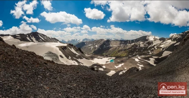
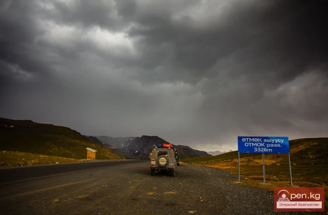
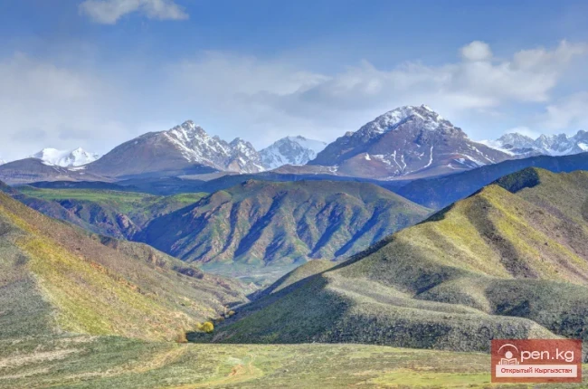
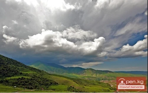
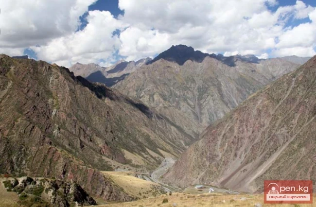
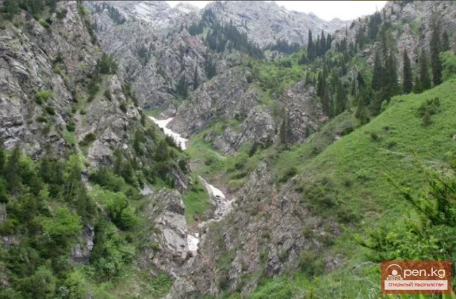
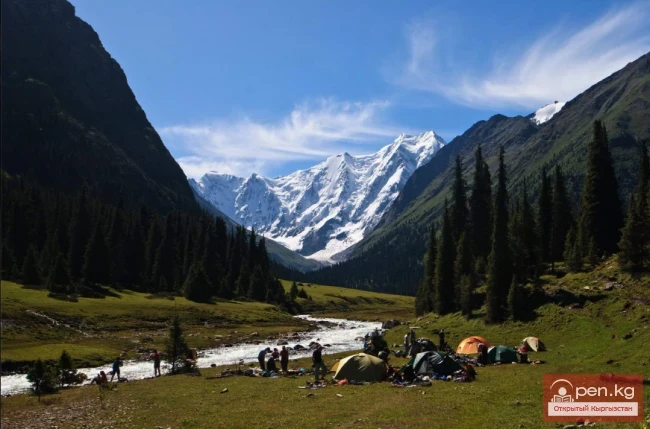
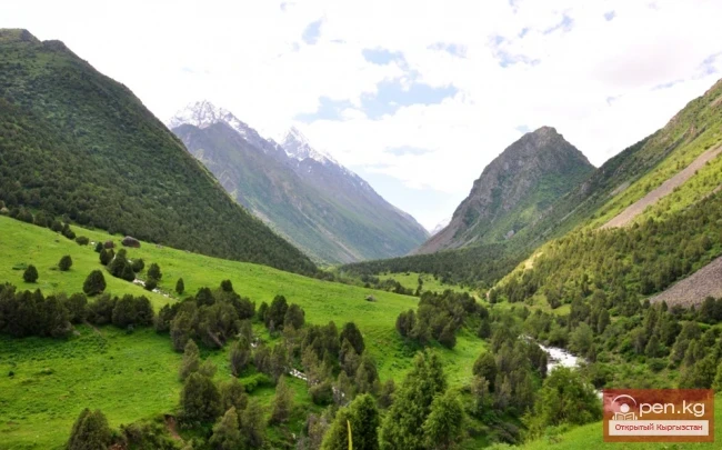
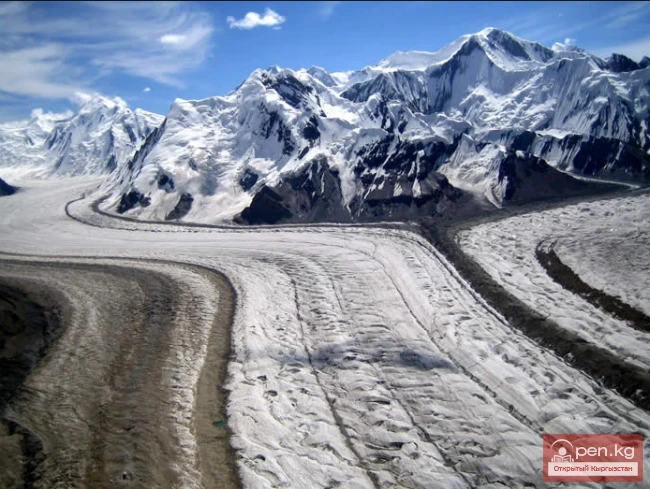
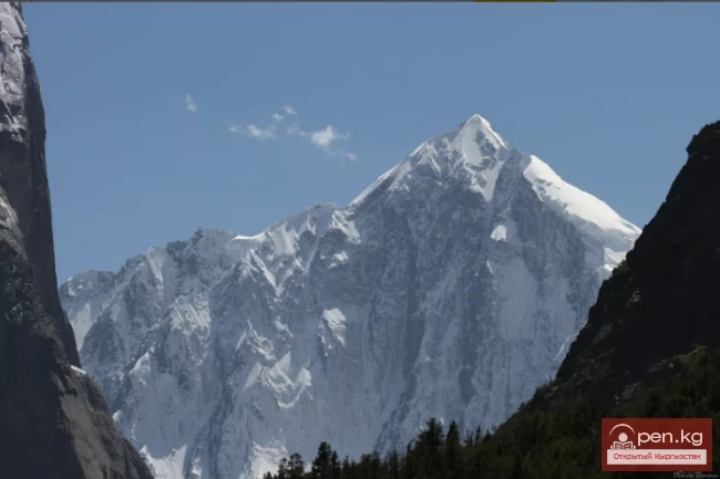
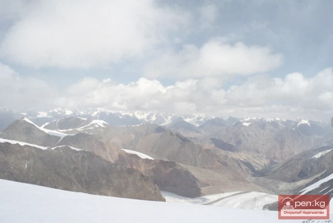
South Inylchek "Inylchek" in Old Turkic means "little prince." But the "prince" turned out to be quite large. The Inylchek glacier is divided into North and South. So, South Inylchek is the largest glacier in the Tien Shan and the second largest mountain glacier in the CIS countries after the Fedchenko glacier in the Pamirs. Its length is slightly less than that of the colossal glaciers of the Karakoram, such as Siachen, Biafo, Baltoro, and Batura. It is located
Meridional Ridge The main nodal uplift of the Central Tien Shan on the border of Kyrgyzstan and China is the Meridional Ridge, approximately 90 km long and with an average height of over 6000 m. The northern continuation of the ridge is the Kakshaal-Too. The highest peaks include Peak Friendship (up to 6800 m), in the Akatau range - Peak High (up to 6964 m), and Peak Military Topographers (up to 6873 m), as well as Bezimenniy (6814 m) and Marble Wall (6140 m), located at the intersection of
Fergana Ridge A mountain range in the Tien Shan that stretches from southeast to northwest, separating the cold high-altitude plateaus of central Tien Shan from the scorching plains of the Fergana Valley. The length of the ridge is 225 km. Its width is 62 km. The average height (above sea level) is 3620 m. The highest peak, Kara-Kuldja (Uch-Seyit), reaches 4940 m. In the southeastern part, there are about 400 glaciers with a total area of about 195 km². The area in the southern part of the
Turkestan Range A high mountain range oriented in a latitudinal direction, approximately 340 km long and up to 30 km wide, belonging to the Gissar-Alai mountain system. The average height (above sea level) is 4430 m. The highest peaks are Skalistyy (5621 m) and Pyramid Peak (5509 m). Through the Matcha mountain knot, the range connects with the Alai Range to the east and stretches to the Samarkand Plain to the west. The northern slope is long and gentle, with juniper forests and sparse
Terskey Alatau The Terskey Alatau Ridge is very beautiful in its variety of landscapes. In one day, you can see the beauty of red sandstone cliffs, wild forests, and snowy peaks, widely spread over the greatest lake, Issyk-Kul. Each gorge is unique and unparalleled in its execution. The Terskey Alatau Ridge ("colorful mountains turned away from the sun") is located latitudinally and frames the basin of Lake Issyk-Kul from the south. The length of the ridge is about 375 km, and in the
Talassky Ala-Too A mountain range located in the Western Tien Shan system. Most of it is situated in Kyrgyzstan, with a part in southern Kazakhstan. This range separates the Talas Valley from other ranges and valleys of the Western Tien Shan and the western part of the so-called Inner Tien Shan. The length of Talassky Ala-Too is about 270 km, with a width of 40 km. The average height (above sea level) is 3930 m, with the highest peak being 4488 m – Mount Manas. The Talas basin is bounded to
Son-Kul-Tau A mountain range in the Tian Shan, in the southeastern part of Kyrgyzstan. It arches around the northern edge of the Son-Kul lake basin. The length of the ridge is about 60 km, with a maximum height of 3856 m. It is primarily composed of limestone. Alpine meadows are located on the northern slope and in the summit area of the ridge, while subalpine meadow-steppes and steppes are found on the southern side. Susamyr-Tau A mountain range in Kyrgyzstan, part of the Inner Tian Shan
Sarydjaz The mighty snow-covered barrier of the Sarydjaz mountain range rises in the Central Tian Shan, on the territory of Kyrgyzstan and partially Kazakhstan. It is located between the Sarydjaz River to the north and its left tributary, the Inylchek River, to the south. The length of the ridge is 113 km, with a width of up to 16 km. Its peaks rise above 5000 m. The average height is 4370 m, with the highest point being Semenov Peak (5816 m). The ridge is composed of metamorphic schists,
Naryn-Tau The area is hard to access and rarely visited. Due to the low glaciation and modest heights, the Naryn-Tuu ridge has only been traversed by watermen, one hiking group (Svitanko-1963), and, strangely enough, cyclists. The mountain range in the Inner Tien Shan in Kyrgyzstan forms the left bank of the valley of the Great Naryn River. To the east, it is bounded by the Karakolka River - a left tributary of the Naryn. From there, the ridge stretches westward for about 120 km to the
Moldotau A mountain range in the Inner Tian Shan, in the central part of Kyrgyzstan, south of Lake Son-Kul. The range stretches generally from west to east, between the valleys of the Kökömeren and Naryn rivers. The length of the ridge is about 150 km. The maximum height is 4185 m. It is mainly composed of limestone. The lower slopes are covered with mountain steppes and meadows, while higher up there are areas of spruce forests and juniper groves.
Kungey-Alatau To the south of the Zailiysky Alatau, beyond the deep longitudinal valleys of the Chilik and B. Kemin (Chon-Kemin) rivers, stretches a chain of snowy peaks of the Kungey-Alatau ridge, which borders Lake Issyk-Kul from the north (the Terkey Alatau ridge limits this basin from the south). Together with the Zailiysky Alatau, it forms the Northern Tien Shan. The ridge is elongated in a latitudinal direction (from west to east) and has a length of 275 km in a straight line.
Kuylytau A mountain range in the Central Tien Shan, in Kyrgyzstan. It is located between the rivers Kuyly and Uchkel (the Sarydjaz basin). The length of the ridge is about 50 km, and the maximum height is 5203 m. The ridge is composed of limestones, metamorphic schists, and granites. The Kuyly massif extends approximately 50 km in the latitudinal direction and 25 km in the meridional direction. The natural boundaries of the area are the rivers Sary-Djaz, Uch-Kel, Sarychat, Kuyly, and the Kuyly
Koksu Ridge Located in the Western Tien Shan, on the border of Kyrgyzstan and Uzbekistan. Its length is about 70 km, with average heights around 2000 m. It bounds the valley from the southeast, through which the Koksu River flows into the Charvak Reservoir. Here is how V.N. Popov describes the Koksu Ridge in his book: "Western Tien Shan".
Kyrgyz Mountain Ridge A mountain range that borders the Chuy Valley and the Moyunkum Desert to the south. It is located 40-60 km south of the capital of Kyrgyzstan. It is situated in the northwestern part of the Tien Shan within Kyrgyzstan and partially in Kazakhstan. The range extends 400 km from west to east - from the city of Jambyl to the Boom Gorge of the Chu River. In the northern part, it connects with the Talas Ridge, and through a watershed saddle of the Karakol West and Karakol East
Kakshaal-Tuu A mountain range in the Central Tian Shan system, on the border of Kyrgyzstan and China. The length of the range is about 582 km, width is 54 km, and the highest point is Victory Peak (7439 m). The average height (above sea level) is 4500 m. The western part of the Kakshaal-Tau range forms the southern boundary of the Inner Tian Shan. The range is composed of clay slates, sandstones, limestones, pierced by granite intrusions. Alpine relief predominates with a total glaciation area
Kainyda-Katta In the Central Tien Shan in Kyrgyzstan, extending west from the peak of the Red Army in the Inylchektau range, is the relatively low Kainyda-Katta ridge, which has a well-developed orography on its northern slopes and completely unbroken southern slopes. In the area of the Bulantor peak, the ridge branches into two parallel limbs. It is located in the basin of the Saryjaz River, stretching south from the Kainyda Valley. The length of the ridge is about 65 km. The maximum height
Inylchektau A mountain range in the Central Tien Shan in Kyrgyzstan. It is located in the basin of the left tributaries of the Sarydjaz River. The ridge stretches in a sublatitudinal direction between the Inylchek and Kaindyn valleys. This ridge branches off from Kokshaaltau 20 kilometers west of Victory Peak along the Komsomol Glacier, initially heading north but then turning west, almost parallel to the Sarydjaz Ridge. Between these ridges lies the Inylchek Valley. Almost from the very base
Zailiyskiy Alatau A mountain range in the northwest of the Tian Shan (on the border of Kazakhstan and Kyrgyzstan). The prevailing heights are 4000–4600 m. The highest points of the Zailiyskiy Alatau, between the Kastek Pass in the west and the Amanzhol Pass in the east, belong to the central part of the ridge - the Talgar (Chilik-Kemin) mountain knot, where the highest point of the entire system rises - Talgar Peak or Talgar Peak (4973 m). The northern slope is relatively gentle, deeply
Zaalai Ridge A ridge oriented in a latitudinal direction, separating the Pamir and the Alai Valley. The length of the ridge is 250 km, width – 40 km. The average height (above sea level) is 5460 m.
Jumgaltau A mountain range in the northern part of the Tien Shan, in Kyrgyzstan. The ridge extends in a sublatitudinal direction for more than 100 km. Width 15 km. Average height (above sea level) 3800 m. Maximum height (above sea level) – 4281 m, peak - Min Teke. To the west, it is separated from the Susamyrtau ridge by the gorge of the Kökömeren River. Jumgaltau is composed of tuffaceous sandstones, limestone-mica schists, and granites. On the slopes, there are meadows with juniper shrubs,
Djetim A mountain range in the Tian Shan, in Kyrgyzstan, south of the Terskey Alatau. The length of the ridge is about 120 km, with the maximum height being the peak of Moldobashi at 4931 m. The Naryn River flows along the southern foothills. The slopes are covered with steppe, meadow, and meadow-steppe vegetation. In the eastern part, there are glaciers. The Djetim Ridge is lower than its neighbors. The peaks reach a height of only 4900 m. Djetim is unpopular due to the lack of information.
Jamanatau A mountain range in the Tian Shan, located in Kyrgyzstan, northwest of Lake Chatyr-Kul. It is oriented in a latitudinal direction and is bordered to the west by the canyon of the Ala-Buga River (Arpa), to the north by the valley of the Ala-Buga River, to the east by the valley of the Karasu River, and to the south by the Arpa Basin. To the west, beyond the gorge of the Arpa River, it adjoins the Fergana Range. The length of the ridge is about 70 km, with the highest point being
Borkoldoy A mountain range in the Inner Tien Shan, in the southeastern part of Kyrgyzstan. The length of the ridge is about 100 km. The average height is 4300 m. There is significant glaciation on the northern slope. The ridge is composed of crystalline schists, marbles, and granites. The slopes are predominantly covered with semi-desert vegetation, while higher up, there are rocks and scree with sparse xerophytic vegetation. Although the area is not particularly high on average, its harsh
Atbash The mountain range belongs to the southern arc of the Inner Tien Shan in Kyrgyzstan. It separates the Atbashin Basin in the north from the Chatyr-Kul Basin and the Aksai Surt in the south. It is located north of Lake Chatyr-Kul, between the valleys of Ak-Sai and At-Bashi-Kara-Koyun. The length of the ridge is 140 km, and its width is 30 km. The highest parts of the Atbash Ridge are located in the middle section, while to the west and east the ridge descends to 3500 m. The central ridge
Alay Range A mountain range of the Pamir-Alai mountain system in Kyrgyzstan and partially in Tajikistan. The passes are very high and difficult. The average height of the range is 4,450 meters. It separates the Fergana and Alay valleys. The length of the granitoid-gabbro Alay Range, between the Zeravshan mountain knot in the west and 74°48" E longitude in the east, is 350 kilometers. The width is 20 km. The range is almost entirely covered with eternal snow and is rich in glaciers,
Ak-Shiyrak The Ak-Shiyrak Ridge is a watershed between the Naryn and Sary-Jaz rivers in the Tian Shan, located in the Issyk-Kul region, south of the central part of the Terskey Alatoo ridge, and represents one of the largest glaciation nodes in Central Tian Shan in Kyrgyzstan. The ridge, 28 kilometers wide, stretches 60 kilometers in length, with a large part of the area covered by glaciers. The highest point is the Jaman-Su peak, located at an altitude of 5126 meters in the eastern part of
Cave Named After Academician A. E. Fersman About 20 km south of Chyl Ustun, in the Tuy-Moyun mountains, lies the deepest cave in Kyrgyzstan. It is named after Fersman and has a depth of 240 meters. Other well-known caves are also located here: Surprise (450 meters long) and Victory (1200 meters long). Their underground halls and passages are adorned with crystalline formations of various colors. Fersman (4580/-219 m). It is located approximately 2 km west of the Dangi gorge. The Aravan River
Passes in Naryn Tash-Rabat Pass (height 3968) is located in the Naryn region and stretches from Tash-Rabat to Torugart. Tash-Rabat, which translates to Stone Courtyard, is believed to have been a key point for crossing the Tian Shan, as it not only provided shelter for merchants but also served as a fortress against raiders. Trade caravans passed through Tash-Rabat on their way to the cities of the Fergana Valley. The ancient caravanserai on the cold three-kilometer pass is one of the most
Jalalabad Passes Kaldama Pass (height 3062) is located in the Jalalabad region and stretches from Kazarman to Jalal-Abad. The ascent to Kaldama Pass begins gently, and in this section, it is very beautiful: far below, a river flows in a deep canyon, and the mountain landscapes gain power right before your eyes. The pass is a transit route, used by regular vehicles traveling towards Kazarman. It is quite challenging for heavy trucks to climb this pass. Numerous sharp turns require truck drivers
Talas Passes The Otmok Pass (height 3330) is located in the Talas region and stretches from Susamyr to Talas, connecting the region with the Suusamyr Valley and the Bishkek — Osh highway. The road tests your patience, but generously rewards the eye and heart with beauty and unforgettable impressions. The alpine highlands around the upper point of the Otmok Pass are intensively used as summer pastures. The Karabuura Pass (height 3302) is located in the Talas region and stretches from Talas to
Osh Passes Taldyk Pass - a pass in the Alai Range, oriented from north to south, connects the valley of the Gyulcha River in the north with the Alai Valley in the south. The pass is located in the Osh Region, 160 kilometers south of the city of Osh, and serves as a gateway to one of the highest and most beautiful roads in the world — the Pamir Highway. The height of the pass is 3615 m. In the 1930s, a road was opened from Osh, through the Taldyk Pass, allowing access to China or to Lenin Peak.
Mountain Passes of Issyk-Kul Region San-Tash Pass (height 2195 m) is located in the Issyk-Kul region and stretches from Tyup to Jirgalen, in the eastern part of the Central Tien Shan. The road from the Issyk-Kul basin to Almaty (Alma-Ata) passes through San-Tash. In the vicinity of the pass, there are numerous burial mounds dating back to the 7th-3rd centuries BC. A grand burial complex is located southwest of the beginning of the San-Tash Pass, at the foot of Adyr. The central feature of the
Main Passes in the Chui Valley Shamsi Pass is located in the Chui region and stretches from Shamsi to Kochkor. In the upper zone of the Shamsi gorge, 60 km south of the city of Tokmak, lies the Shamsi Pass. Its height is 3570 m. It serves as a link between the Kochkor and Chui valleys. Tuu-Ashu Pass (height 3586) is located in the Chui region and stretches from Karabalta to Susamyr. Tuu-Ashu is the pass connecting the Chui valley with the southern regions of Kyrgyzstan. It is located 135 km
Roads in the Sky Irkeshtam Pass is located in the Osh region and stretches from Sary-Tash to Kashgar. The "Irkeshtam" border crossing between the Kyrgyz Republic and the People's Republic of China is located 76 kilometers east of the village of Sary-Tash at the Irkeshtam Pass, which is 2841 meters above sea level. Irkeshtam begins in the city of Osh in southern Kyrgyzstan. The road goes south along the valleys of the Taldyk and Gulcho rivers to the village of Sary-Tash (Yellow
Those who love clean, mountain air should visit the Oruu-Sai gorge. It is located just thirty-five kilometers from Bishkek. The picturesque hills covered with lush vegetation leave no one indifferent. Mountain gorges adorned with thickets of wild rose, barberry, wild raspberries, and juniper alternate with slopes of red clay. The ringing silence is filled only by the murmuring of springs with crystal clear water and the chirping of birds. In the summer, people visit these places to relax
Kara-Balta Gorge is located on the northern slope of the Kyrgyz Ala-Too. The Kara-Balta Gorge begins at the village of Sosnovka and winds for several dozen kilometers to its highest point—the Tyo-Ashuu Pass (about 3000 m). Beyond it lies Suusamyr. The Bishkek-Osh highway runs through the gorge. The road is picturesque—it first follows the Kara-Balta River, ascending to the Toо-Ashuu Pass at an altitude of about 3200 meters, and then descends into the Suusamyr Valley. The gorge is very scenic,
Mountains of Kyrgyzstan Akshiyrak A mountain range in the Tian Shan, located in Kyrgyzstan. It forms a watershed between the upper reaches of the Naryn River and the rivers of the Sary-Jaz basin. The range consists of three parallel ridges arranged in a culisiform manner, extending in a sublatitudinal direction. It is composed of metamorphic schists, limestones, and granites. The dominant landscapes are high-altitude – subnival and glacial-nival. Akshiyrak is an important center of glaciation
Picturesque Chichkan Gorge In the tourist center of Central Asia – Kyrgyzstan, there are many beautiful and amazing places. Chichkan Gorge is one of them. The gorge is located at the 240th kilometer of the Bishkek-Osh highway, which connects the two capitals of the country, just beyond the Ala-Bel Pass at an altitude of 2200 m above sea level, winding several dozen kilometers south from the pass to the Toktogul Reservoir. Here, the unique pristine nature is still preserved, untouched by man or
The Red Water Gorge - Chon-Kyzyl-Suu The picturesque Chon-Kyzyl-Suu gorge is one of the most beautiful places on the southern shore of Issyk-Kul. At the bottom of the gorge, the turbulent river Kyzyl-Suu carries its rushing waters from the glaciers of the mighty Terskey Alatoo ridge. Emerald green in its upper reaches, the river turns bright red at the point where it flows into Issyk-Kul, eroding red mountain sandstones along the way. This unusual color is what gives the river its name –
Altyn-Arashan – a Romantic Place Altyn-Arashan (translated as "Golden Spring") is a high-altitude gorge located in the eastern part of the Terskey Alatau range, near the city of Karakol. This gorge is one of the most popular tourist destinations in Kyrgyzstan, thanks to its unique nature, hot springs located right in the gorge, vast coniferous forests, and stunning views. The Altyn-Arashan Gorge is located in the upper reaches of the river Arashan of the same name, situated 10 km
The Mysterious Place - Fairy Tale Canyon. The Issyk-Kul region is famous not only for its amazing pristine nature, which can rival the "Seven Wonders of the World." In this rich territory, there are places where it is hard to believe that this is planet Earth. There is a sense of irrationality, an unknown beauty from another planet. One of these mysterious places is Fairy Tale Canyon. Fairy Tale Canyon is located on the southern shore of Lake Issyk-Kul, in the foothills of the
Grigorievskoe Gorge is one of the wonderful and picturesque natural attractions Chon Ak-Suu Gorge, or Grigorievskoe, begins to the south of the village of Grigorievka. It is 56 kilometers from the city of Cholpon-Ata to the First Lake in Grigorievskoe Gorge, and approximately 110 kilometers from the city of Balakchi to the middle of the gorge. The length of the Chon Ak-Suu River valley from the village of Grigorievka to the beginning of the ascent to the Ak-Suu Pass, which is located at an
Semyonovskoye Gorge is one of the most beautiful places in the Pre-Issyk-Kul region On the northern shore of Issyk-Kul, 40 km from the resort town of Cholpon-Ata, along the road from Bishkek north of the village of Semyonovka, lies one of the most beautiful places in the Pre-Issyk-Kul region, the Semyonovskoye Gorge. Its length is about 30 kilometers. Semyonovskoye Gorge is named in honor of one of the first explorers of these places - the Russian scientist-geographer P. P.
Juu Valley (also known as Juku, Zhukuu, Zauka) - one of the most beautiful valleys of the Terskey Alatoo. It is located south of the village of Saru, which is 10 km west of the village of Pokrovka, approximately 75 km from the city of Karakol. Juu Valley is the longest on the Terskey Alatoo ridge. The length of the valley reaches 50 km. The length of the valley is due to its unusual shape: in the lower part, the valley stretches strictly from north to south, sharply turning to the west in the
Gorge along the Sokuluk River Belogorka Gorge is located to the west of Ala-Archa Gorge in the Sokuluk District of the Chuy Region. The gorge is situated southwest of Bishkek, at a distance of 72 km. On the Sokuluk plain to the west of Bishkek lies the village of Tash-Bulak (Stone Stream). It stretches widely along the Sokuluk River, which flows through alpine meadows and forested areas, showcasing a variety of wildlife. The village is still known to locals by its Soviet name, Belogorka, which
The Famous Barskaun Gorge The majestic mountain range of Terskey Alatoo frames the southern shore of Issyk-Kul. Hidden within its slopes are numerous magnificent paradise spots with picturesque landscapes. One of them is the Barskaun Gorge, which is about 30 kilometers long. At the very beginning of the Barskaun Gorge lies the village of the same name, which was known in ancient times as Barskhan. In the past, this was the residence of a khan, and nearby were the cities of Lower and Greater
Just 37 km from the city of Karakol, lies one of the most beautiful places in Kyrgyzstan - Jeti-Oguz Gorge It is located in the floodplain of the river of the same name on the northern slope of the Terskey Alatoo range, which curves around Lake Issyk-Kul from the south. The name Jeti-Oguz (translated from Kyrgyz as "seven bulls") comes from a chain of weathered red rocks that resemble lying bulls on the ground and serve as the gorge's hallmark. A local attraction is the rock
The Alamedin Gorge is characterized by the exuberance of nature and diverse vegetation. The Alamedin Gorge is located on the northern slope, in the central, highest part of the Kyrgyz Ala-Too ridge, 30 kilometers east of the city of Bishkek. It is one of the longest gorges stretching from south to north, with a length of about 50 kilometers. Steep rocky slopes, magnificent dense juniper forests, and towering snow and ice peaks rising up to 4900 meters above sea level cannot leave nature lovers