The China Road and Bridge Corporation, which is involved in road construction, emphasized that the use of drones marks a new stage in the digitalization and intellectualization of road construction in the country.
The project is being implemented under challenging high-altitude conditions, where traditional geodetic methods require significant time and effort, as well as involve certain risks.
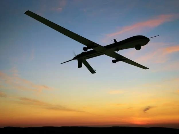
Six drones participated in the aerial photography, including both multicopters and fixed-wing aircraft. The most powerful among them is the Qinwubing A-I, equipped with an industrial H4D-50 camera and a lidar that allows for high shooting accuracy—up to several centimeters.
This drone was used for large areas, as well as for obtaining data on the terrain of the main route. The project planned 35 shooting zones and over 90 routes.
Thousands of quality aerial photographs were processed, calibrated, and modeled in a special system. As a result, specialists were able to create digital linear maps (DLG), orthomosaics (DOM), and three-dimensional terrain models.
These digital tools allow designers to conduct virtual diagnostics, identify potential risks, and optimize routes with a high degree of accuracy and efficiency. The use of drones has reduced the time required for work by approximately 70% compared to traditional approaches.