Relief of the Chuy Valley
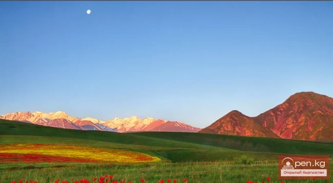
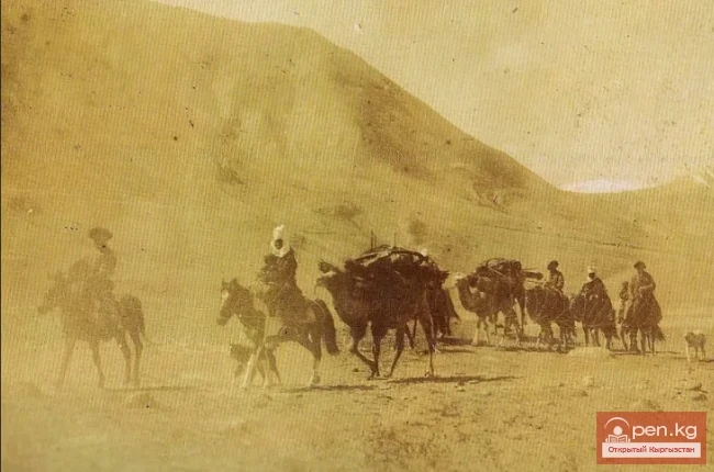
The main types and forms of relief in the region are the result of prolonged geological development of the territory, tectonics, combined with the complex composition of the lithology of rocks and the active participation of various physical-geographical processes. All of this has determined the complex diversity of the surface structure of the Chuy Valley and its mountainous framing.
On the geomorphological map included in the Atlas of the Kyrgyz SSR (1987), P.G. Grigorenko, along with other authors, identified types of relief grouped into three main genetic categories: tectonic-denudational mountainous, tectonic-denudational-accumulative foothill, and tectonic-accumulative plain.
In the Chuy Valley and its mountainous framing, the following relief complexes are clearly distinguished: mountain tectonic-denudational, foothill tectonic-denudational-accumulative, and plain tectonic-accumulative. Each complex represents a combination of types and forms of relief characterized by specific morphometric features and morphological signs, and differs in its economic significance.
The mountain complex is further divided into the following types of relief:
• Dissected glacial highlands;
• Dissected erosional mid-mountains;
• Erosional low mountains - foothill uplands.
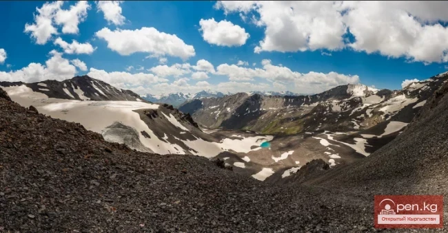
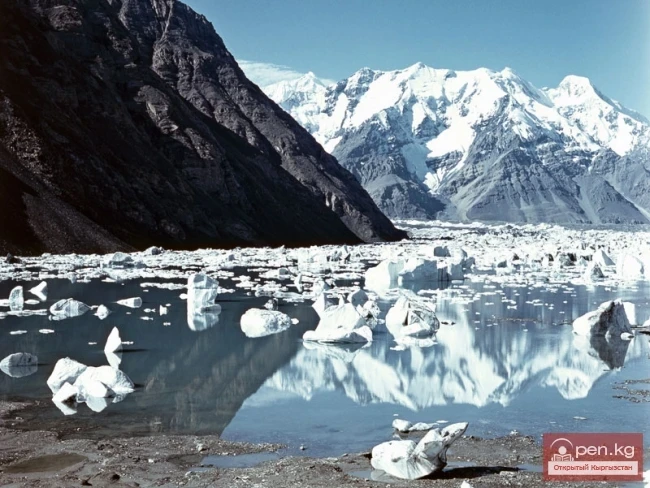
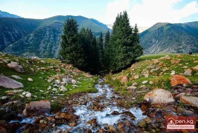
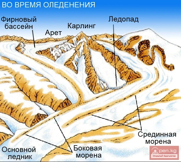
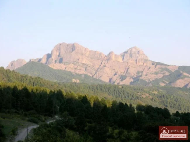
The dissected glacial highlands occupy the axial parts and lateral ridges of the Kyrgyz Ala-Too at elevations of more than 3500-4000 m. The northern slopes of the Kyrgyz Ridge are divided into three unequal parts: central, eastern, and western, based on the nature of glaciation and orography (S. Maximov, A. Osmanov, 1995).
The external contours of the relief are sharp, with steep slopes and sharp rocky peaks. Along the northern slope of the ridge, a continuous chain of cirques can be observed - huge bowl-shaped depressions formed by glaciers, measuring up to 400 m, sometimes more than 600 m in diameter. They are often multi-chambered and contain glaciers. Frequently, as the back walls of opposing slopes converge, the cirques form a saddle in the watershed ridge, or when the walls of three or four cirques converge in the middle, a rocky peak remains - Karling.
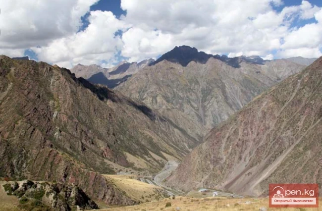
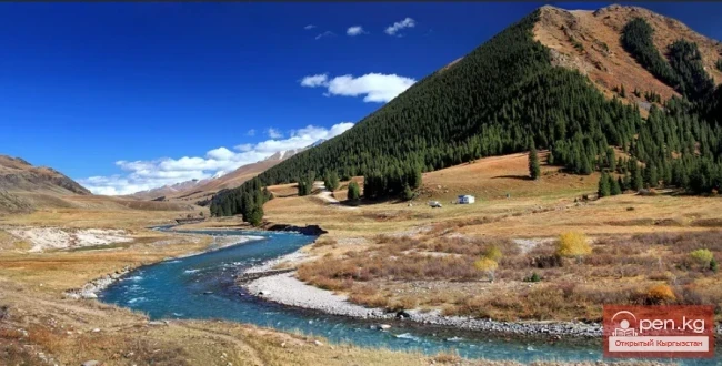
Traces of past Quaternary glaciation, in the form of cirques, trough valleys, morainic dammed lakes, and terminal moraines, are observed in several places of the Kyrgyz Ridge. For example, from the ends of modern glaciers in the upper reaches of the rivers Shamsy, Issyk-Ata, Ala-Archa, Ak-Suu, etc., trade valleys begin with steep slopes and flat bottoms. The depth of the troughs is usually 150-200 m. In their lower parts, the troughs are to some extent disrupted by post-glacial erosion. Troughs are box-shaped valleys that have partially lost their original features.
At the lower end of the troughs, there is also a pile of moraines forming significant height steps. Among the morainic formations, terminal moraines hold a special place. They usually represent irregularly bulging elevations, stones - "heads," rising several tens of meters above the valley level. Often, terminal moraines are associated with ridge-like steps.
Dammed lakes formed by terminal moraines are also found, which were described by S. Maximov and A. Osmanov (1995).
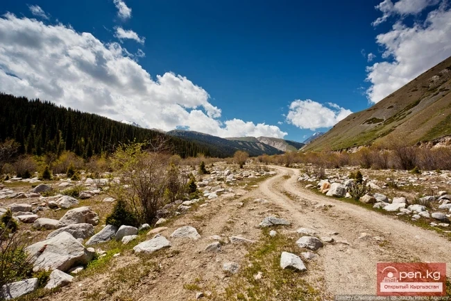
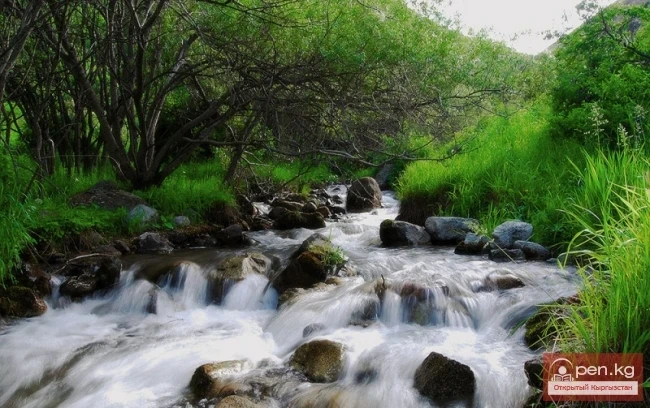
The dissected mid-mountains are widely distributed in the Kyrgyz Ala-Too and occupy altitudinal limits of 2100-3200 m. In the central and western parts of the ridge, they directly adjoin the highland relief, while in the eastern part, they are represented by more or less independent mountain masses (Oktorok, Baibichenin Soorus, Kok-Jon, Gagyzgan-Choku, etc.). The mid-mountains are characterized by more rounded, soft contours, but at the same time, they are intensely dissected by a network of grand canyons, reaching depths of up to 500-700 m or more. The areas of maximum height of the mid-mountains, represented in the central part of the ridge, are distinguished by the greatest depth of dissection.
The considered relief, depending on the nature of geological structure and relief, is divided into two subtypes:
• Mid-mountains on a loose Paleogene-Neogene foundation. Developed in the interfluves of Shamsy - Kyzyl-Suu. The relief is generally uniform, valleys are relatively wide, interfluves are hilly, dissected by shallow ravines;
• Mid-mountains on a solid Paleozoic foundation. Characterized by a greater diversity of relief forms. The relief features denudational surfaces. The valleys of rivers are canyon-shaped, their slopes are steep, often rocky.
Read also:
What types of climate are found in Kyrgyzstan?
The Climate of Mountainous Kyrgyzstan The climatic conditions of the country are determined by the...
Orography and Relief
Curl error: Operation timed out after 120001 milliseconds with 0 bytes received...
Tectonics of the Chuy Valley
The main structures of the Chui Basin and its mountainous framing were formed by Baikal and...
Nikolai Mikhailovich Sinitsin
Sinin Nikolai Mikhailovich (1909-1958), Doctor of Geological and Mineralogical Sciences, Professor...
Zailiysky Alatau Ridge
Zailiyskiy Alatau A mountain range in the northwest of the Tian Shan (on the border of Kazakhstan...
Soil of the Chui Valley
The soil-vegetation cover of the Chui Valley and its mountainous framing, as the most important...
Modern Glaciation in the Chuy Valley
Kyrgyz Ridge - the most glaciated area in the northern part of our republic. However, despite this...
Osmonov Abdyrai
Osmonov Abdyrai (1937), Candidate of Geographical Sciences (1974), Professor (2002), Laureate of...
Mountain Tourism
Mountain tourism is a journey in the mountains that involves traversing relatively difficult...
Geological Structure and Tectonics of the Chuy Valley
The Chui Valley (depression) and the Kyrgyz Ridge framing it from the south are located within the...
Lakes in the Chui Region
There are relatively few lakes in the Chui Valley and its mountainous surroundings, and all of...
Fauna and Flora of Kyrgyzstan
The plant and animal world in the territory of the republic is characterized by great diversity....
Vasily Mikhailovich Popov
Popov Vasily Mikhailovich (1901-1991), Doctor of Geological and Mineralogical Sciences (1955),...
Kyrgyz Ridge
Kyrgyz Mountain Ridge A mountain range that borders the Chuy Valley and the Moyunkum Desert to the...
Groups and Types of Arrowheads
Classification of Arrowheads A particular interest is presented by a small collection of medieval...
Zhunushbayev Abdrashit
Zhunushbaev Abdrashit (1920-1994), Doctor of Geographical Sciences (1973) Kyrgyz. Born in the...
Geoecological Requirements for Land Protection and Rational Use
It has been noted above that a significant part of the territory of the republic is subject to...
Geographical Representations of the Kyrgyz People
The close connection of the Kyrgyz as a nomadic people with their environment required them to...
Settlement of Kyrgyz Tribes in the Late 19th - Early 20th Centuries
Based on materials collected by S. M. Abramzon, R. Ya. Vinnikov, and A. Sydykov (Abramzon, 1960,...
Orography of the Chui Valley
The Chui Valley is located on the northern edge of the Kyrgyz Republic. The Kyrgyz part of the...
State Natural Park "Chon-Kemin"
State Natural Park "Chon-Kemin" is a nature conservation and scientific research...
Viktor Ivanovich Klimok
Klimok Viktor Ivanovich (1946), Doctor of Physical and Mathematical Sciences (1990) Ukrainian....
Achyktash and Korumdy
The mountain nodes Achik-Tash and Korumdy are the main and most popular areas for high-altitude...
Worldview Concepts of the Surrounding World
Most geographical names in Kyrgyzstan have local etymology. The origin of several toponyms is...
Zhumabaev Beishenbek Zhumabaevich
Zhumabaev Beishenbek Zhumabaevich (1947), Doctor of Technical Sciences (1993) Kyrgyz. Born in the...
Knauf Vladimir Iosifovich
Knauf Vladimir Iosifovich (1917-1987), Doctor of Geological and Mineralogical Sciences (1975),...
High-altitude Natural and Ecological Complex of Inylchek
Muzdag Mountains, Khan Tengri Peak, and Victory Peak. The Muzdag mountain range (ice mountains) is...
Ala-Archa National Park
In the ridges of the Kyrgyz Ala-Too, there are 480 glaciers. The largest of them are located in...
Fergana Range
Fergana Ridge A mountain range in the Tien Shan that stretches from southeast to northwest,...
Stepanov Vladimir Yakovlevich
Stepanov Vladimir Yakovlevich (1939), Doctor of Technical Sciences (1991), Professor (1995)...
Talas Ridge
Talassky Ala-Too A mountain range located in the Western Tien Shan system. Most of it is situated...
Tajibaev Kushbakali Tajibaevich
Tajibaev Kushbakali Tajibaevich Doctor of Technical Sciences. Honored Scientist of the Kyrgyz...
Glaciers of the Kyrgyz Range
Glaciers of the Kyrgyz Ala-Too The highlands of the Kyrgyz Range feature a deeply dissected alpine...
Manzhikov Batyr Tsebekovich
Manzhikov Batyr Tsebekoich (1950), Doctor of Physical and Mathematical Sciences (1997) Kyrgyz....
The Climate of Kyrgyzstan
Nature of Kyrgyzstan The best elixir of health is nature. Walks through picturesque forested...
Four Kyrgyz Types of Settlements
Kyrgyz Settlements The character of the settlement, as well as the dwellings themselves, shows...
Kara-Balta Gorge
Kara-Balta Gorge is located on the northern slope of the Kyrgyz Ala-Too. The Kara-Balta Gorge...
Glaciations in the River Basins of Kyrgyzstan
CHARACTERISTICS OF GLACIERS IN RIVER BASINS To provide a complete understanding of the glaciation...
Protected Natural Areas of Kyrgyzstan
Categories of Protected Natural Areas in Kyrgyzstan Kyrgyzstan has established 83 special...
Nikolai Leontievich Dobretsov
Dobretsov Nikolai Leontievich (1936), Doctor of Geological and Mineralogical Sciences (1970),...
In the Ak-Su Gorge, poachers who shot a mountain goat were detained. Video
On the night of October 22, poachers who illegally shot a mountain goat were apprehended in the...
Kara-Balta
Kara-Balta, which translates as "Black Axe," is one of the youngest cities in the Kyrgyz...
Otorbaev Kaip
Otorbaev Kaip (1922), Doctor of Geographical Sciences (1971), Professor, Academician of the...
Natural Regions and Occupations of the Population of Kyrgyzstan
The Population of Kyrgyzstan in the 19th - Early 20th Century Most of the country's territory...
Weapons of the Medieval Nomads of Kyrgyzstan
Sarybulak Spear The set of arrows from the Mongolian period looks significantly different. In...
Padyshatinsky State Nature Reserve
Padyshatinsky State Nature Reserve is a specially protected natural area in Kyrgyzstan. The...
Wild Anatoly Nikitovich (1937)
Dikikh Anatoliy Nikitovich (1937), Doctor of Geographical Sciences (1998). Russian. Born in...
Chuy Region
The Chuy Region was established on December 14, 1990. Until 1939, various...