Zone "Toktogul"
Natural ecological complexes

Zone "Toktogul"

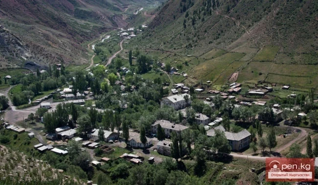
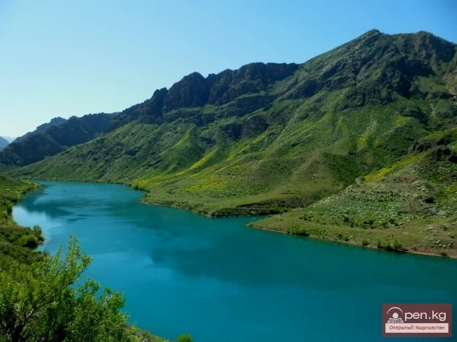
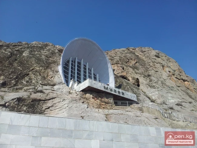
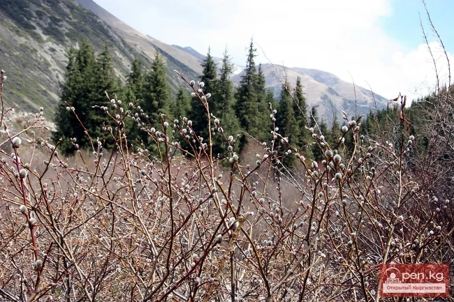
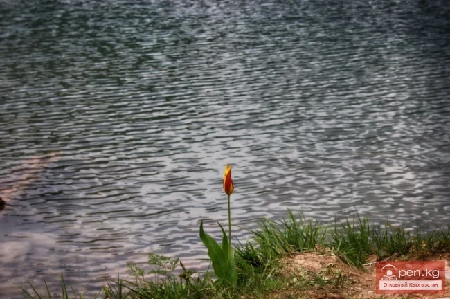
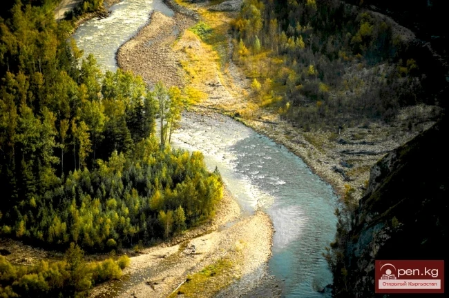
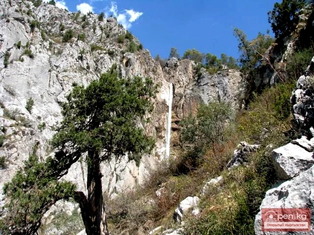
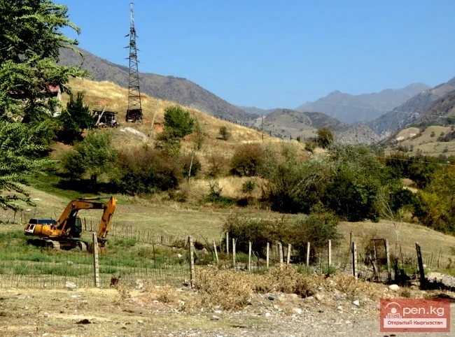
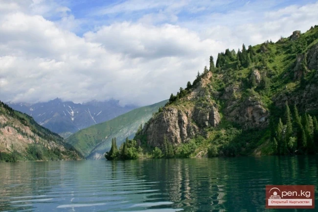
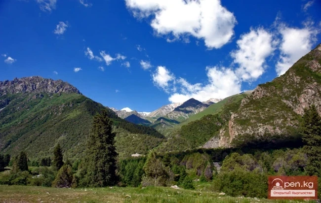
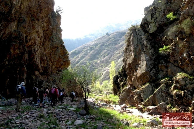
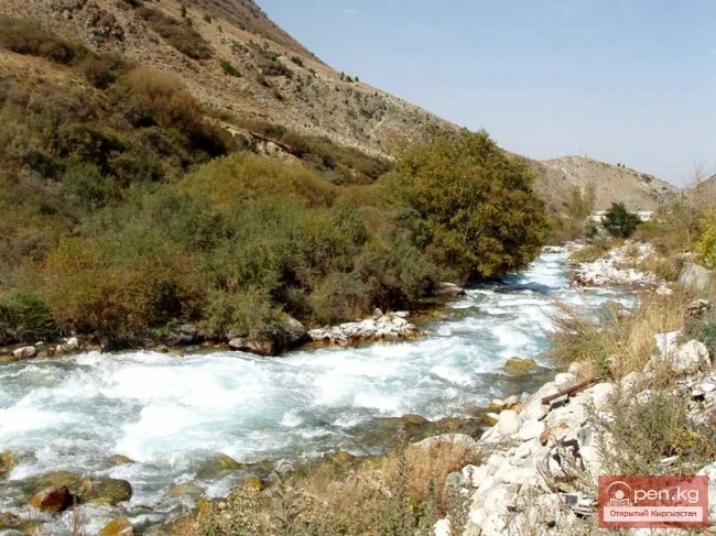
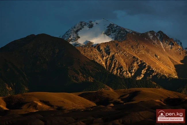
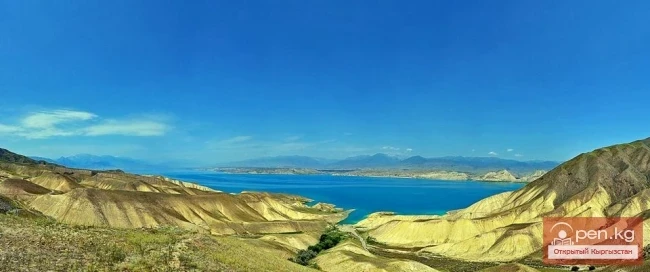
The Toktogul Zone includes the Ketmentebin intermountain basin in the lower reaches of the Naryn River, the Toktogul Reservoir, and the valley of the right tributary of the Naryn — Chychkan ("mouse"). The zone is located within the middle section of the famous Kyrgyz route Bishkek — Osh. Its center, the village of Toktogul, is located 190 km from the city of Talas. The city of Kara-Kul, located on the southern border of the zone, is 295 km away from Osh. The Ketmentebin basin is

12.07.2014, 19:09
"Manas Zone"
Natural ecological complexes

"Manas Zone"

The "Manas" zone is located 63 km from the city of Talas, south of the village of Kirovskoye on the northern slopes of the Talas Ala-Too. It includes the branched gorges of Kara-Buura, Kyurkureo-Suu, and Maidantal, through which the rivers of the same name flow. On the slopes of the lower part of the gorges, mountain steppes with patches of various shrubs are widely represented. Sometimes snakes can be encountered here. More than ten species of snakes are found in Kyrgyzstan.

12.07.2014, 17:35
Zone "Talas"
Natural ecological complexes

Zone "Talas"

The "Talas" zone is located in the central part of the Talas River valley and includes the city of Talas, its surroundings, as well as historical and cultural areas with remarkable architectural monuments, among which the mausoleum of Manas holds a special place. It is advisable to start the acquaintance with the city of Talas. This is a small city, whose growth was long hindered by the weak development of industry. It was founded in 1877 by Russian and Ukrainian settlers on the left

12.07.2014, 16:48
"Orto-Tokoy Zone"
Natural ecological complexes

"Orto-Tokoy Zone"

The Orto-Tokoy Zone encompasses the territorial foothills at the western end of the Terskey Ala-Too range, including the Kochkorka and Kara-Kudzhur valleys. The distance by road to the center of the zone — the district center of Kochkorka — is about 150 kilometers from the city of Naryn and 58 kilometers from the city of Balikchy. The Kochkorka mid-mountain valley is framed by the Kyrgyz Ala-Too range (4234 m in this zone), Terskey Ala-Too (3600 m in this zone), Kara-Dzhorgo (3933 m), and

12.07.2014, 15:58
Zone "Min-Kysh" (a thousand birds)
Natural ecological complexes

Zone "Min-Kysh" (a thousand birds)

The zone "Min-Kysh" (a thousand birds) includes the fabulously beautiful valley of the same name, which is about 40 kilometers long. The valley rises from 1400 to 3100 meters above sea level. Its maximum width is two kilometers. The valley is framed by the Kabak-Too ridge (4144 m) and the Moldo-Too ridge (4418 m). At the lower part of the zone, where the Min-Kush flows into the Kekemeren, lies the village of Ornok. A road runs from the village along the riverbed to the village of

12.07.2014, 13:39
"Suusamyr Zone"
Natural ecological complexes

"Suusamyr Zone"

The Suusamyr Zone includes the eponymous high-altitude valley stretching 155 km. To the north, it is bordered by the Kyrgyz Ala-Too (peak Alamidin 4855 m), to the south and southwest by the Suusamyr-Tuu ridge (4048 m), and to the south and southeast by the Jumgal-Tuu ridge (4121 m). The valley floor rises from 2000 to 3200 m. The Western Karakol begins as a result of the confluence of the rivers Ushu-Tor, Southern Issyk-Ata, and Iyri-Tor. The Western Karakol extends for 70 km through the

12.07.2014, 13:12
Zone "Toguz-Toroo" ("Nine Chestnuts")
Natural ecological complexes

Zone "Toguz-Toroo" ("Nine Chestnuts")

The zone "Toguz-Toroo" ("nine bays") includes the valley of the same name, the southern slopes of the Moldo-Too ridge (eastern part), and the valley of the Naryn River up to the mouth of the Kekemerena tributary. The center of the zone, the district center of Kazarman, is located 200 kilometers by road from the city of Naryn. The settlement got its name from the barracks of the cavalry unit of the Red Army that were stationed here during the fight against the Basmachi. The

12.07.2014, 12:46
Zone "Ak-Talaa"
Natural ecological complexes

Zone "Ak-Talaa"

The "Ak-Talaa" zone includes the valleys of the Ala-Buka, Arpa, and Terek rivers, as well as the southern slopes of the Moldo-Too ridge within the middle reaches of the Naryn River. The center of the zone, the district center of Bayetovo, is located approximately 120 km from the city of Naryn. Within the zone, the Naryn River collects numerous large and small tributaries, becoming turbulent and full-flowing, comparable to a mighty hero bringing warmth and light to people. Over many

12.07.2014, 12:29
Zone "Chatyr-Kel"
Natural ecological complexes

Zone "Chatyr-Kel"

The Chatyr-Kel Zone includes a significantly elevated intermountain basin with a lake of the same name, stretching from the southwest to the northeast for 70 km from the Tuz-Bel pass to the watershed of the Kek-Ayghyr River, and the western part of the Aksai Valley. The zone is located along the highway from Naryn city to Torugart village, 130-140 km from Naryn. The road bypasses the lake from the west and south and leads into the Aksai Valley. The mountain ranges framing the basin reach their

11.07.2014, 13:54
Zone "At-Bashi"
Natural ecological complexes

Zone "At-Bashi"

The At-Bashi Zone includes the Atbashi-Karakoyun Valley. The center of the zone, the village of At-Bashi, is located 50 kilometers from the city of Naryn. The valley floor rises from 2000 to 3200 meters above sea level. Its total length is 160 kilometers and about 30 kilometers wide. The valley is surrounded on all sides by mountain ridges: to the south is At-Bashi (4786 m); to the north are Naryn-Tuu (4944 m) and Baibiche-Tuu (4434 m); to the west is Djaman-Tuu (4737 m). The At-Bashi River is

11.07.2014, 13:13
Zone "Maly Naryn"
Natural ecological complexes

Zone "Maly Naryn"

The "Maly Naryn" zone encompasses the valley of the river of the same name, located between the ridges of Jetim-Bel, Kapkatap, Karadjorgo, Jetim-Too, Uch-Emchek, and Terskey Ala-Too. Approximately 25 km from the mouth, where the Maly Naryn flows into the Naryn (2253 m), the river valley makes a sharp turn at a right angle against the southern slopes of the Kapkatash ridge and stretches almost 100 km strictly to the east. On the right bank of the river in the area of the bend and on

11.07.2014, 12:43
"Pamir-Alai Zone"
Natural ecological complexes

"Pamir-Alai Zone"

The Pamir-Alai Zone encompasses a section of the Alai Valley, which stretches along the major water artery of the south of the republic, the Kyzyl-Suu River. It is bordered to the south by the northern slopes of the heavenly Zaalai (Chon-Alai) range and to the north by the southern slopes of the Alai range. From the city of Osh, the famous Pamir Highway leads to the zone, connecting the city of Osh with the village of Gulcha and the village of Sary-Tash, which then continues to the city of

10.07.2014, 20:35
Zone "Shakhimardan" (Shaimerden)
Natural ecological complexes

Zone "Shakhimardan" (Shaimerden)

The Shakhimardan Zone (Shaimerden) encompasses the basin of the Shakhimardan-Sai River. There is a road leading here from the city of Osh to the village of Frunze. The village produces the best antimony in the world. There are many springs with low-temperature mineralized water in its vicinity. The Shakhimardan-Sai River is formed by the Ak-Suu (on the left) and Kek-Suu (on the right). Below the confluence of these rivers in the valley of the Shakhimardan-Sai stand two powerful cliffs,

09.07.2014, 19:05
Zone "Isfayram-Sai"
Natural ecological complexes

Zone "Isfayram-Sai"

Zone "Isfayram-Sai". The left tributary of the Isfayram-Sai River is the Surme-Tash River, which originates from glaciers above the peak of Kara-Kaayk ("black pole"), while the right tributary is Archa-Kanysh, merging at an elevation of about 2850 m. The Isfayram-Sai gorge is very rocky. Thickets of juniper and shrubs often hang over the water. Several side gorges of small tributaries branch off from the main gorge in the upper reaches: Kel, Jashil-Kel, Sauk-Dzhailoo,

09.07.2014, 18:27
"Chil-Ustun Zone"
Natural ecological complexes

"Chil-Ustun Zone"

The Chil-Ustun Zone includes the Chil-Ustun, Chil-Mayram, and Keklik-Too mountains located around the village of Aravan, which rise sharply among the flat plains with rocky ridges along the Arawan-Say River valley. The distance from the city of Osh is about 30 km along the highway west to the village of Aravan. The territory of the zone is situated within the arid landscapes of Southern Pritfergan, occupying the hilly slopes of low ridges. In small areas that have remained in their natural

09.07.2014, 15:15
Zone "Osh"
Natural ecological complexes

Zone "Osh"

The "Osh" zone introduces tourists to the attractions of the ancient city of Osh. The city is over three thousand years old, rather than the two hundred years previously thought. It is the oldest city in our country and a contemporary of Rome. Modern Osh is the second largest city in Kyrgyzstan. It sprawls across the foothill valley on both banks of the mountain river Akbuura, at an altitude of 940—1070 m above sea level. Its layout clearly shows the ancient part and the new part,

09.07.2014, 11:28
Zone "Tar"
Natural ecological complexes

Zone "Tar"

The "Tar" zone includes the valley of the river of the same name and its tributaries. In this area, the river changes its name four times — Aлай-Куу, Ой-Тал, Tar, and then becomes Карадарья. The valley is bordered by the Fergana Ridge to the north and the Alai Ridge to the south. A road runs along the river from the city of Uzgen to the village of Kashka-Suu. The valley, with its large and turbulent Tar River, is surrounded on all sides by steep rocky slopes. For many thousands of

09.07.2014, 10:38
Zone "Yassy"
Natural ecological complexes

Zone "Yassy"

The Yassy Zone occupies the valley of the same name, located near the city of Uzgen, 80 km from Osh. The Yassy River (Jazy) flows along the valley, and there is a road leading from Uzgen to the village of October 15. The area is characterized by magnificent climatic conditions — mild temperatures throughout the year, relatively low precipitation, and gentle winds that positively affect the human body, making this zone a potential climate resort. In the Yassy Valley, as well as in other gorges

08.07.2014, 17:53
Contrasts of Southern Kyrgyzstan
Natural ecological complexes

Contrasts of Southern Kyrgyzstan

Have you ever, in a short span of time measured in hours, visited a hot valley, tasted sweet melons and watermelons; walked through mountain gorges that caress with coolness; indulged in the numerous gifts of berry bushes and nut-fruit trees; climbed to blooming alpine meadows and finally touched snow with your hand? If not, we invite you to visit the southern region of Kyrgyzstan. The natural borders of the region are the crests of powerful mountain ranges: to the north — Chatkal, to the east

08.07.2014, 17:01
Kek-Art
Natural ecological complexes

Kek-Art

The "Kek-Art" Zone encompasses the surroundings of the city of Jalal-Abad, as well as the valleys of the Kek-Art River and its tributaries from the foothills of the Fergana Range to its watershed. It is located 80 km northeast of Osh city along the highway leading to Jalal-Abad. The climate of the zone is characterized by dry and hot summers with slight temperature fluctuations.

12.05.2014, 21:29
Kyzyl-Unkyur
Natural ecological complexes

Kyzyl-Unkyur

The "Kyzyl-Unkyur" Zone is located 15 km northeast of the village of Arslanbap in the valley of the Kara-Unkyur River in the Jalal-Abad region. It is accessible via an asphalt road from the city of Osh. The zone occupies the territory of one of the most picturesque areas of these places — Kyzyl-Unkyur and also includes the ridge part of the Fergana Range.

12.05.2014, 21:13
Zone "Arslanbap" (Arslanbob)
Natural ecological complexes

Zone "Arslanbap" (Arslanbob)

Arslanbap Zone (Arslanbob) is located on the southwestern slopes of the Fergana Range in the eponymous area, stretching up to 10 kilometers and situated 180 km from the city of Osh in the Jalal-Abad region. The entire territory of the zone is intertwined with picturesque serpentine asphalt roads that run along the riverbed of the Kara-Unkur River from the city of Osh through the town of Bazar-Kurgan to the village of Arslanbap (1400 m) and further into the mountains.

12.05.2014, 21:02
Mayluu-Suu (Mayli-Sai)
Cities / Mailuu-Suu / Natural ecological complexes

Mayluu-Suu (Mayli-Sai)

The "Maili-Sai" Zone is located in close proximity to one of the major industrial centers of the Osh region in the Jalal-Abad region. The city of Maili-Sai includes the valley of the Mailuu-Suu River ("fat water"). This area is known for its oil deposits. The distance from the city of Osh to the zone is 170-180 km.

12.05.2014, 20:47
Kara-Suu
Natural ecological complexes

Kara-Suu

The "Kara-Suu" Zone is located in the eastern part of the southern slope of the Chatkal Ridge and occupies the valley of the river of the same name. In the lower reaches of the river, semi-deserts with sparse forests of pistachio and almond trees are widely represented. South of the city of Tash-Kumyr is the botanical reserve of Dzhiel-Tiibes, covering an area of 800 hectares, where a reference section of the southern semi-desert is protected. Below Tash-Kumyr is a Paleogene group of

12.05.2014, 20:36
"Sary-Chelek Zone"
Natural ecological complexes

"Sary-Chelek Zone"

Sary-Chelek Zone ("yellow bowl") territorially coincides with the basin of the Khoja-Ata River. The zone includes the territory of the Sary-Chelek State Biosphere Reserve, the village of Arkyt, which houses its office, as well as the "Sary-Chelek" tourist base of the Osh Regional Council for Tourism and Excursions. The upper part of the zone, including the southern tip of Lake Sary-Chelek, is composed of limestone and metamorphosed conglomerates and has a highly dissected

10.05.2014, 21:35
Zone "Aflatun"
Natural ecological complexes

Zone "Aflatun"

Aflatun Zone is located on the southeastern slopes of the Chatkal Ridge and occupies the basin of the Aflatun River — the largest right tributary of the Kara-Suu River in the Jalal-Abad region. The distance from the city of Osh to the zone is about 320 km along the highway leading to the village of Aflatun.

10.05.2014, 21:24
Zone "Padsha-Ata"
Natural ecological complexes

Zone "Padsha-Ata"

The "Padsha-Ata" zone includes the gorge of the same name and is located near the district center of Karavan, 350 km from the city of Osh. Along the gorge, a dirt road runs along the right bank of the river to the village of Karabashat. At the end of the road lies the mazar of the "saint" Padsha-Ata. In a stretch of about 500 meters along the riverbed, there is a dense grove of ancient birches, the trunks of which reach two circumferences in diameter.

09.05.2014, 23:10
"Ala-Archa Zone"
Natural ecological complexes / Gorges

"Ala-Archa Zone"

Ala-Archa Zone is located 30 km south of Bishkek in the central part of the Kyrgyz Ala-Too range in a picturesque gorge of the same name, which is over 35 km long. This gorge is the largest of all the gorges in the Kyrgyz range. On its territory lies the Ala-Archa National Park.

09.05.2014, 22:28
"Issyk-Ata Zone"
Natural ecological complexes / Gorges

"Issyk-Ata Zone"

Issyk-Ata Zone is located 80 km from Bishkek and includes two gorges — Issyk-Ata and Tuyuk Issyk-Ata with tributaries. This zone is distinguished not only by its favorable climatic conditions but also by its magnificent balneological resources. Based on more than fifty thermal springs, the famous Issyk-Ata resort operates in the middle part of the gorge of the same name. The springs have been known since ancient times, as evidenced by the image of the healing Buddha carved on Asal.

08.05.2014, 22:45
Zone "Kety"
Natural ecological complexes

Zone "Kety"

Kegety Zone is located 75 km from Bishkek in the gorge of the same name on the road to the village of Ivanovka and further to the Kegety gorge. The Kegety River has many tributaries, the largest of which is the right tributary Keltor, forming a very beautiful independent area. It is interesting to note that the Keltor River flows underground through the moraines and only bursts forth with a roar into the open in the forest zone. At the beginning of the gorge, the slopes are covered with

08.05.2014, 22:36
"Chon-Kemin Zone"
Natural ecological complexes

"Chon-Kemin Zone"

Chon-Kemin Zone includes the valleys of the Chon-Kemin and Kichi-Kemin rivers between the high ridges of Zailiysky and Kungey Ala-Too. It is located 150 km east of Frunze city on the road to Novorossiysk village.

08.05.2014, 22:28
Ala-Archa National Park
Natural ecological complexes

Ala-Archa National Park

The longest gorge, bearing the same name, is located just 30 km from the city. Immediately behind the Voronцовка recreation center are three gorges: Alameddin, from which a small river flows, Malinovoe, overgrown with dense raspberry bushes, and the largest one — Ala-Archa. The word "Ala" translates to "snowy," and "archa" is analogous to "juniper." Indeed, there are glaciers in the gorge that only melt during the scorching summer. The slopes of the

30.04.2014, 16:37
Kara-Shoro
Natural ecological complexes

Kara-Shoro

In the upper reaches of the Yassy River, on its right bank, there is a whole series of mineral water springs. Kara-Shoro is the most famous among them, known for its carbonated water springs. There are more than twenty of them, with pure cold water that bubbles with gas, rivaling the taste and healing qualities of the most renowned springs in Europe and Asia.

16.02.2014, 21:58
Natural and Ethnographic Complex of Kojo-Kelen
Natural ecological complexes

Natural and Ethnographic Complex of Kojo-Kelen

Kojo-Kelen - a natural and ethnographic complex that is still little known to tour operators. Each year, Kojo-Kelen becomes more famous and attracts more and more tourists. The beautiful village of Kojo-Kelen is located in a wide area of the valley of the Jiptik River, a left tributary of the Ak-Buura River. At the upper edge of the village, fantastic orange cliffs open up along the left bank of the river. At the foot of the cliffs lies the Kojo-Kelen Cave, or rather a pink grotto with a

16.02.2014, 15:51
High-altitude Natural and Ecological Complex of Inylchek
Natural ecological complexes

High-altitude Natural and Ecological Complex of Inylchek

Muzdag Mountains, Khan Tengri Peak, and Victory Peak. The Muzdag mountain range (ice mountains) is located in the Central Tien Shan and occupies its highest area. For extreme tourism enthusiasts, this region, also known as the "Arctic," offers a wide variety of challenges. In the summer, a corporate climbing camp operates here, organized by various tour operators.

05.02.2014, 15:42
Small Naryn
Natural ecological complexes

Small Naryn

Small Naryn encompasses the valley of the river of the same name, located between the ridges of Jetim-Bel, Kapkatash, Karadjorgo, Jetim-Too, Uch-Emchek, and Terskey Ala-Too. Approximately 25 km from its mouth, Small Naryn flows into the Naryn; the valley of the river, transforming into the southern slopes of the Kapkatash ridge, makes a sharp turn at a right angle and continues to stretch almost 100 km to the east. On the right bank of the river, in the area of the bend and on the northern

04.02.2014, 22:12
Upper Naryn
Natural ecological complexes

Upper Naryn

Upper Naryn includes the upper part of the Naryn River basin from the vicinity of the town of Naryn to the headwaters of its two main tributaries - Taragay and Kara-Say, which originate in the ridge's crest area of Ak-Shiyrak. The territory of the complex lies within the administrative boundaries of the Issyk-Kul and Naryn regions.

04.02.2014, 22:08
Natural Complex of Shamsi
Natural ecological complexes / Gorges

Natural Complex of Shamsi

The Shamsi Natural Complex is located 85 km east of Bishkek and includes the territory of a valley of the same name with tributaries flowing from the northern slopes of the Kyrgyz Ala-Too. The largest tributaries are located in the eponymous gorges: Tura-Kayin - left lower tributary; Tuyuk - left middle tributary; Kel-Tor - right lower tributary; Karagayly-bulak - right middle tributary.

03.02.2014, 21:12