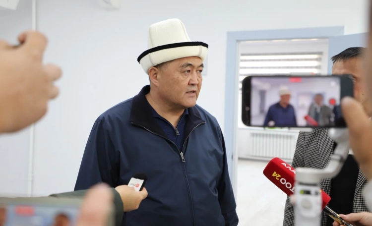
In his speech, he elaborated on the sections that were the subject of exchange with the Tajik side.
Translation of Tashiev's speech:
“The work on the delimitation and demarcation of the border between Kyrgyzstan and Tajikistan began in December 2002. During the negotiations between the governments of both countries, 45 protocols of working groups on topographic issues and 25 protocols on legal issues were signed.
The length of the state border between Kyrgyzstan and Tajikistan is 1008 kilometers and 114 meters. Of this number, 519.9 kilometers were established and agreed upon by 2011, while the remaining 488 kilometers and 124 meters were determined over the last three years.
Regarding the section of 519.9 km agreed upon in 2011, the Tajik side proposed to sign a border agreement. They prepared the necessary documents and insisted on formalizing this agreement; however, the Kyrgyz side refused to sign until the entire border was finalized.
This was due to the fact that the 519 km passed through mountainous areas where there were no disputes, while densely populated and conflict-prone areas remained unresolved.
I want to emphasize that out of the total length of the border of over 1000 km, about 519 km runs through mountains where there were no disagreements, while the remaining 488 km represent disputed territories that we clarified.
Since the beginning of the negotiations, the Tajik side has insisted that the border be based on maps from 1924–1927. If we had agreed to this, according to the Kyrgyz side, we would have lost 220,000 hectares of land — almost the entire Leilek district and half of Batken. Therefore, the Kyrgyz side insisted from the very beginning on using the maps from 1991.
If we had agreed with the Tajiks, the issue might have been resolved long ago, but then these 220,000 hectares would have gone to them. As a result, the issue remained open for many years.
Starting from 2021, delegations from both states actively worked on clarifying the border, conducting field studies and desk work, which yielded concrete results.
Before announcing these results, I would like to explain how we arrived at them. In October 2020, when the team of President Sadyr Japarov came to power, he stated: “We need to clarify the borders. Until the borders are finally established, conflicts will not end.” This became one of the first directives from the president.
He appointed me as the chairman of the state commission for delimitation and demarcation, tasking me with completing the process with Uzbekistan and Tajikistan.
In practice, this was not easy — we faced numerous difficulties, conflicts, and even tragic incidents. But ultimately, we managed to complete the process of defining the border. Today I am talking about Tajikistan, as the issue with Uzbekistan was resolved earlier — we completed the delimitation on July 23, 2022. With Tajikistan, the last control point was established at the beginning of 2025. At the beginning of this year, the border was fully clarified and agreed upon, and a comprehensive intergovernmental agreement was signed between the states. Now there should be no disputes over the border.
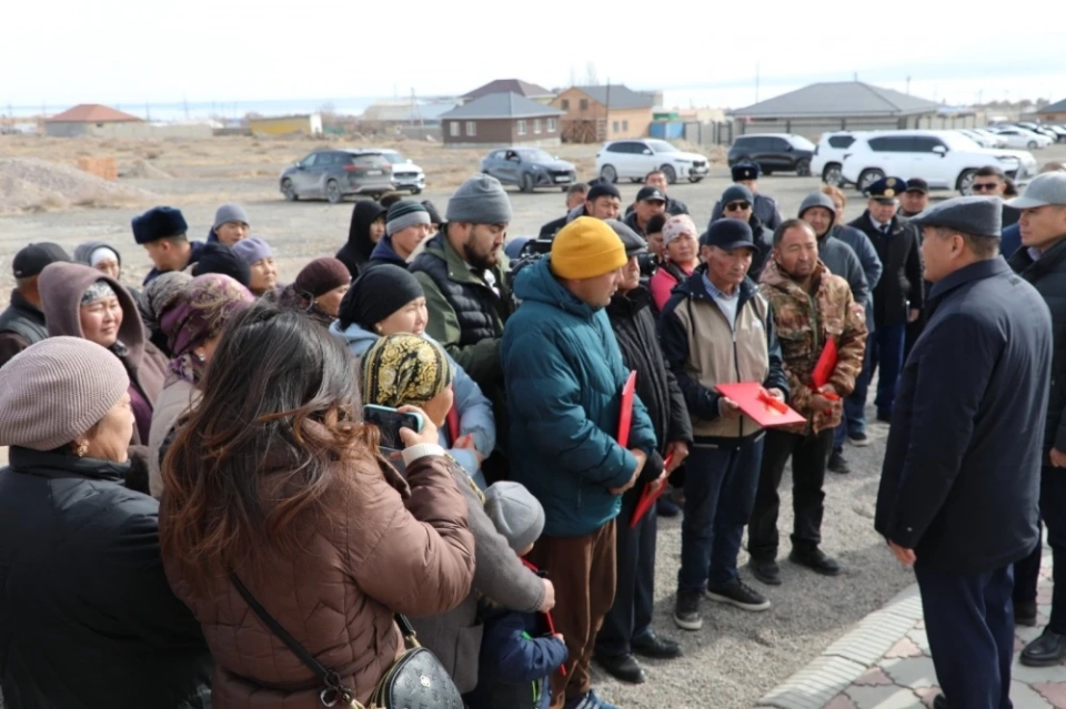
The resolution of the issue was made possible on the terms proposed by Kyrgyzstan from the very beginning and implemented according to the maps from 1991. We did not give away a single meter of land without justification. Mutual exchanges were conducted, as in some places villages were intermixed, making it impossible to draw the border strictly between houses. In some cases, it was necessary to relocate several houses or even entire villages. And although it is difficult for some people now, some may say: “I left my aiyl, my garden, my trees,” — instead of these plots, we received more advantageous and safer lands.
Some may be dissatisfied, but these decisions were made not for one generation, but for the future — for the safety of the country. The plots we gave away were close to the borders of Tajikistan, where incidents often occurred, and in return, we received safer and more controllable lands. And I want to emphasize once again that all this happened strictly in accordance with the conditions that were proposed from the very beginning.
Now about the Leilek district. In the process of determining the border from the Tajik side in the area of the Kayragach section, the Kyrgyz Republic received 155 hectares of land and 35 hectares of the Kayragach enclave, a total of 190 hectares in our favor. This section, where the Kayragach post is located, includes fertile, irrigated land. We received 155 hectares and 35 hectares of the former enclave. Thus, in total, we received 190 hectares.
As for the plots we transferred to them, we, esteemed ones, received 155 hectares of fertile, irrigated land, and in return, we transferred the following plots:
from the village of Saada — 21 hectares;
from the Razakov sections — 23.5 hectares;
from Selkan — 4 hectares;
from Mayty — 7 hectares;
from Proletarsky — 12.5 hectares.
Proletarsky is a village on the territory of Tajikistan. Previously, there was our “Selkhozkhim” base there until 1991. Then this plot was sold and resold, after which the land passed to the Tajik side. For this plot, we also received compensation: 12 hectares in Proletarsky were accounted for in the exchange.
In addition, from the Ulaq-Jai area, we transferred 15 hectares, and from Ak Aryk — 7 hectares. In total, this amounted to 90 hectares. Also, from Karabak in the Batken district, we transferred 65 hectares. In the end, we transferred 155 hectares.
Thus, for the 35 hectares of the Kayragach enclave, we transferred 35 hectares from the Mayty section. The total area of the exchange amounted to 190 hectares. That is, we received 190 hectares and also transferred 190 hectares.
This was not done arbitrarily, but on a mutual basis, so that the plots were equivalent. I emphasize that we gave away lands that were not strategically important to us.
For example, below the village of Kulundu, there is a large canal. On the other side of the canal are the villages of Mayty and Saada, which are close to the Tajik side. In the event of a conflict, it would be possible to reach there on foot and destroy houses. Therefore, we gave away these plots, and in return, we received safer and more convenient ones.
Now about the Leilek district. According to the 1991 line, the border ran through the middle of the Khujand–Arka–Kanibadam highway. The Tajik side proposed to leave this road entirely with them and also transferred the territory of the Dostuk market, covering an area of 3 hectares. Thus, they received 12 hectares of land. However, we, in turn, took twice as much — 25 hectares of irrigated land in the Lakkon area in favor of Kyrgyzstan.
Why did this happen? We insisted that our section of the Dostuk market has not only land value but also commercial value, as there is a market there. In addition, half of the road we were giving away also belonged to us, and if we had not agreed, the Tajiks would have had to build a new bypass road, which would have required significant costs. That is why they agreed to compensate us with twice as much land.
Furthermore, in the same Karabak-Lakkon section, the Tajik side received 200 hectares of land that were previously used by Kyrgyz citizens. In return, we also received 200 hectares from them — 130 hectares in the Karabak area and 70 hectares in the Kuruksay area. Thus, we transferred 200 hectares and received 200 hectares in response.
As a result, in order to align land use and the convenience of the border location, such mutual exchanges were conducted. In particular, in the Kayragach section, the border line now runs along the Selkan canal, which eliminates conflict situations and defines a clear border.
Now let’s move on to the next major section — the headwater facility “Golovnoi” on the Ak-Suu River, where there are three spillways. The border runs through the middle of the riverbed, and half of the dam structure remains on the Tajik side, while half remains on ours. However, the water distribution will occur jointly according to the intergovernmental agreement.
I want to elaborate on this section. Remember how many years the disputes over “Golovnoi” lasted. The Tajik side claimed that this was their territory and they should manage it. We insisted that this is our land and provided the relevant documents.
As a result, after long negotiations, we agreed to give away 2.5 meters of land, but in exchange for 1000 hectares of another territory. At first, the Tajiks were indignant, but ultimately an agreement was reached.
Now specifically — what lands did we receive in exchange for the section at “Golovnoi”:
— Unzhu Bulak section — 500 hectares;
— Karool Don section — 100 hectares;
— Katta-Tuz section — 150 hectares.
Thus, we received 750 hectares of land in exchange for the section near “Golovnoi.” This is a strategic and economically beneficial achievement for us.
Now let’s move on to the Batken district. Between the Batken district and the Isfara district of the Sughd region of Tajikistan, there were previously fragmented lands. We organized the plots so that each nation could use a continuous territory.
As a result, the Batken district transferred to the Tajik side:
– in the Dostuk area — 91 hectares;
– in Mazeiyte — 8.13 hectares;
– in the village of Kök-Terek — 17.5 hectares;
– in the village of Tash-Tumshuk — 20 hectares;
– in the dacha plots — 5 hectares.
The total area amounted to 141.9 hectares. These lands were recognized as belonging to the Tajik side. In fact, this is approximately 142 hectares, including adjacent plots.
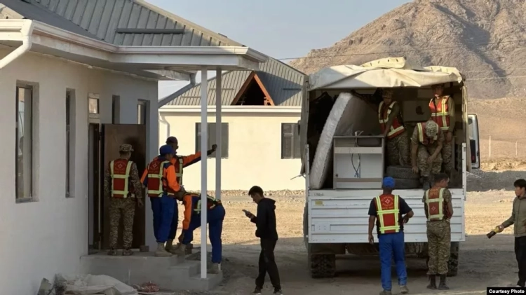
The village of Dostuk, which is located right on the border, was moved to a safer territory, and its former plot was assigned to the Tajik side. Now the border line runs straight, which reduces the risks of conflicts. Although this was a difficult decision, people received new homes and land.
In exchange for the 142 hectares transferred, we received from the Tajiks equivalent plots:
– in the village of Somonien in the Isfara district — 118.5 hectares;
– in the village of Dakhma — 3.11 hectares;
– in the village of Khojai-Aylo — 21.5 hectares;
– in the Gavsuvor section — 2.17 hectares;
– in the Min Bulak section — 42 hectares;
– and in part of the Lakkon section — 55 hectares.
In total — 142.7 hectares. We transferred 142 hectares and received 142.7 — a little even in our favor.
Additionally, for the new homes of the residents of the village of Dostuk, we received from the Tajiks another 30 hectares of fertile land as compensation.
As for the Vorukh enclave, its area increased from 12,000 hectares in 1991 to 19,000 hectares. We insisted on returning the borders to the level of 1991, but the Tajiks did not agree. After long negotiations, a compromise was reached — to establish the area of the Vorukh enclave at 14,500 hectares, which is officially recorded.
The Tajiks, in turn, stated the need for new pastures. We agreed to provide them with 1000 hectares, but in return demanded 1000 hectares in another area. In the end, agreements were reached.
In the Chon-Alai district, we also received plots in the areas of Unzhu-Bulak and Karagansay — totaling 1500 hectares. These lands became compensation for the two previously mentioned plots.
Next, preparations for demarcation began — the installation of fences and markers. Demarcation work has already started and continues.
Regarding neutral roads, both sides agreed on the construction and use of roads with neutral status.
We transferred to the Tajiks the Vorukh–Khojai-Aylo road, and in return, we received the Ming-Örük–Samarkandek road. This significantly improved the connection between our villages.
The Tört-Köche section was also a subject of disputes. The Tajiks proposed to lease the roads, which we did not recognize. As a result, this section received neutral status.
The bridge over the Ak-Suu River remained entirely on the Kyrgyz side — a strategic object that was not subject to division.
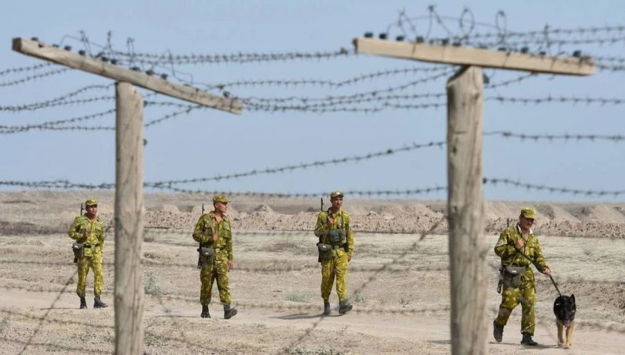
All these issues were resolved, and the work was officially ratified on March 19, 2025. After that, on March 31, an intergovernmental agreement was signed in Khujand, formalizing the border between Kyrgyzstan and Tajikistan. This means that we will no longer have territorial disputes and conflicts.
Now about the Chon-Alai district, which is of particular interest. The length of the border in its territory is 218 kilometers.
In the Altyn-Mazar section, the Tajik side insisted on transferring 250 hectares, but the Kyrgyz side refused, keeping this section for itself. This issue was resolved in favor of Kyrgyzstan.
Thus, we have completed important steps in defining the state border and can move forward towards a stable and secure future.