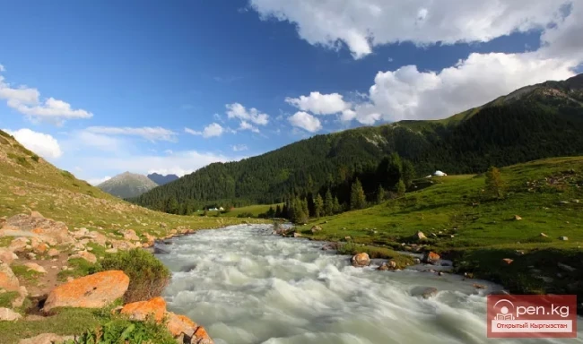
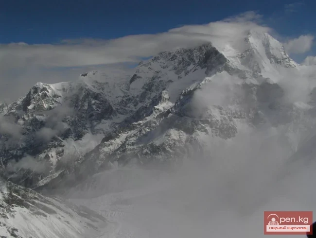
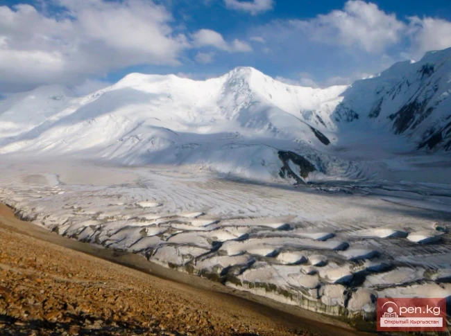
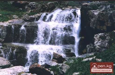
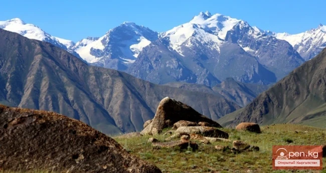
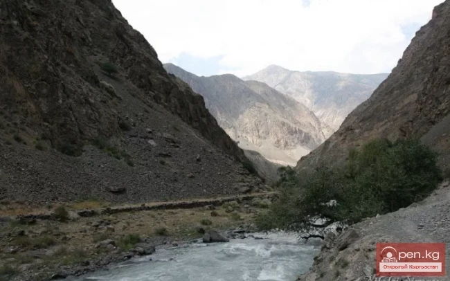
Nature

{title}
Climate
{title}
Natural ecological complexes
{title}
Water resources
{title}
Rivers
{title}
Lakes
{title}
Secrets of Issyk-Kul Lake
{title}
Reservoirs
{title}
Waterfalls
{title}
Mineral waters
{title}
Flora
{title}
Fauna of Kyrgyzstan
{title}
Mammals of Kyrgyzstan
{title}
Birds of Kyrgyzstan
{title}
Fish of Kyrgyzstan
{title}
Amphibians and reptiles of Kyrgyzstan
{title}
Insects of Kyrgyzstan
{title}
Mountains and glaciers
{title}
Mountain ranges
{title}
Mountain peaks
{title}
Mountain passes
{title}
Glaciers
{title}
Caves
{title}
Gorges
{title}
National parks and reserves
{title}
Pastures and valleys
{title}
Soil and minerals
{title}
Red Book
{title}
Fungi and higher plants
{title}
Animals
{title}
Arthropods
{title}
Fish
{title}
Amphibians and reptiles
{title}
Birds
{title}
Mammals
Glacier Archa-Bashi
Glaciers

Glacier Archa-Bashi

Archa-Bashi Glacier on the Alai Range The Archa-Bashi Glacier is large and dendritic, located at the western foothills of the Tandy-Kul peaks (5539 m) and Snowy Shelter (5529 m) — both geographically belong to the High Alai. The polluted morainic trunk of Archa-Bashi has carved a distance of almost 6 km between the sheer walls of the spurs. The end of the glacier is situated at an altitude of approximately 3000 m. The gentle firn fields of the glacier's branches lie at the ridges, like on

19.01.2019, 02:26
Aksai Glacier
Glaciers

Aksai Glacier

Ak-Sai Glacier The glacier is located 40 km from Bishkek in the picturesque Ala-Archa gorge at an altitude of 3500 meters above sea level, within the Ala-Archa National Park. This gorge is the largest of all the gorges of the Kyrgyz Ala-Too range (part of the Tien Shan mountain system), with a length of over 35 km. The 5 km long Ak-Sai Glacier is the most beautiful of the largest glaciers in the range: Golubina, Top-Karagay, Tuyuk, Adygene, and Ala-Archa. The glacier and the waterfall of the

16.01.2019, 21:12
The Tauşkandarya River
Rivers

The Tauşkandarya River

Tauskandarya - "Raging River" A river in Kyrgyzstan and the Xinjiang Uygur Autonomous Region of China, in its upper reaches known as Kokshaal. It originates in the mountains south of the Kyrgyz city of Naryn. It flows eastward and merges with the Aksu River, which in turn is a tributary of the Tarim River. It is formed by the confluence of the Aksay and Myuduryum rivers. The name "Tauskandarya" likely comes from the combination of the words dar'ya ("river")

14.01.2019, 20:45
General Characteristics of Glaciation in the Kyrgyz Republic
Glaciers

General Characteristics of Glaciation in the Kyrgyz Republic

General Characteristics of Glaciation According to satellite images from "Landsat-8" for the years 2013-2016, there are a total of 9,959 glaciers in the territory of the Kyrgyz Republic, covering an area of 6,683.9 km², including: 6,227 glaciers larger than 0.1 km², with a total area of 6,494.0 km², and 3,732 glaciers smaller than 0.1 km², covering an area of 189.9 km². According to the Catalog of Glaciers of the USSR (1940s-1970s), there were 8,164 glaciers in the territory of the

13.01.2019, 22:19
Komarov Glacier
Glaciers

Komarov Glacier

Komarov Glacier (Ak-Sai), Kokshaalsky Ridge The first survey of the glaciation in this area was conducted by N. N. Palgov in 1928, so we refer to his article. The glaciers of the upper reaches of the Ak-Sai River flow down from Kok-Shal-Tau onto a wide plateau known as the Kogaly-Chap area. The relief of this plateau-lake, with its huge boulders, reveals its glacial origin. Therefore, all the glaciers of the upper Ak-Sai can be considered remnants of an ancient glacier that, in its final

12.01.2019, 22:37
Shaar Waterfall
Waterfalls

Shaar Waterfall

Baš-Kaindy or Shaar Naryn Region, Baš-Kaindy Gorge. The height of the waterfall is 220 m, considering the cascades – 400 m. Height above sea level: 3200 m. It is also called Shaar. In Kyrgyz, waterfall is "sharkyratma." Possibly derived from the shortened word "shar."

12.01.2019, 19:35
River Kyzyl-Suu
Rivers

River Kyzyl-Suu

Kyzyl-Suu (Kyzyl-Suu River, Красная река) - a river in Kyrgyzstan and Tajikistan, the right source of Surkhob. It flows from east to west through the Alai Valley. At an altitude of 1834 m, merging with Muksu near the village of Dombrach, it forms the Surkhob River. The length is 242 km (from the source of Aylama to Muksu). Of these, 193 km flows through the territory of Kyrgyzstan and 49 km - through Tajikistan. The basin area is 8380 sq. km.

11.01.2019, 20:13
The River Kashgar
Rivers

The River Kashgar

Kashgar Kashgar (Kyzyl-Suu, Uluu-Chat (Ulugchat), Kabaatsu, Kyzylsu, Aavatusten Canal, Kashgar, Faizabad Darya, Chon-Kashgar Darya) is a river in the west of China, with its upper reaches in Kyrgyzstan and Tajikistan. Previously, Kashgar flowed into the Yarkand River, but now it is lost in the sands. Length — 765 km, including 685 km on the territory of China, with a catchment area of 90.8 thousand km². The average water flow near the village of Kafka is 80 m³/s.

11.01.2019, 20:02
River Ak-Suu
Rivers

River Ak-Suu

The main channel of the Ak-Suu River is at least 20-22 kilometers long. The lower part of the valley, crossing the first terrace of the Chatkal Valley, has a wall-like character. Passing through the second terrace of the main valley of the Chatkal River, the Ak-Suu has carved a deep canyon that is completely impassable for 1-1½ km. Then the valley widens somewhat, with mixed forests growing near the water, and many junipers and shrubs on the slopes. As it approaches the Main Ridge, the valley

10.01.2019, 21:35
Nura Glacier
Glaciers

Nura Glacier

The Nura Glacier is located in the basin of the Eastern Kyzylsu River A large complex valley glacier formed from small and medium glaciers flowing from different sides into the main trunk, glacier 85,86. The glacier is gentle, closed, and has crevasses. The overall short and passive tongue is covered by a thick layer of moraine, containing buried and dead ice. The end of the tongue transitions into dissected loose deposits of significant thickness with deep incisions from modern flows. The

10.01.2019, 21:16
The River Aflatun
Rivers

The River Aflatun

Aflatun River – the largest right tributary of the Kara-Suu River in the Jalal-Abad region. The valley of the Aflatun River leads to the most accessible pass connecting the Chatkal Valley with Fergana. The lower steppe part of the valley stretches for about 6-7 kilometers. Two river terraces are covered with dry grass, and only at the very bottom, by the riverbed, there is a narrow strip of green trees. Further, the river deepens into a rocky canyon, the walls of which rise as they approach

08.01.2019, 21:24
Glacier Kyzylsu
Glaciers

Glacier Kyzylsu

Kyzylsu - Red Water The Kyzylsu Glacier (often referred to as the Eastern Kyzylsu) is a complex valley glacier of the Eastern Zaalai. It is 15.1 km long and covers an area of 43.0 sq. km. The height of the glacier's tongue is 3780 m, and the firn line is at 4500 m. The main flow of the glacier extends from the southwest to the northeast and has a three-chamber accumulation area. These chambers are located on the northern slopes of the Kulumdy (6613) and Chorku (6283) peaks. The glacier

03.01.2019, 19:17
River Karakulja
Rivers

River Karakulja

Karakulja The Chatkal River in its upper reaches is called Karakulja (translated - Black Ram), which is formed by the confluence of Kara-su and Ak-su. It flows through the territory of the Osh region of Kyrgyzstan. The two main sources of Kara-su originate from small glacial lakes at the foot of the ridge connecting the Chatkal Range with the Uzun-Akhmat and Talas ranges. The more water-rich Ak-su River originates from a valley-type glacier flowing down from the Chatkal Range. This glacier,

03.01.2019, 18:51
Kursheb River
Rivers

Kursheb River

Kursheb, Kursheb River, in the upper reaches — Gulcha, A river in Kyrgyzstan, flowing through the Osh region, a left tributary of the Karadarja River (Syr Darya basin), it flows into the Andijan Reservoir. The river originates from the northern slope of the Alai Range and is classified as a snow and glacier-fed river. After receiving the Jusal River from the right, the river Gulcha is named Kursheb. Kursheb flows through a deep valley and has about 40 tributaries along its entire length. It is

02.01.2019, 20:40
Glacier Starlet
Glaciers

Glacier Starlet

Zvezdochka The Zvezdochka Glacier flows into the Inylchek Glacier, 40 km from the tongue of the latter, and is the most powerful of its southern (left) tributaries. The elevation at the confluence of the Zvezdochka Glacier is 4000 m above sea level, and its width reaches 3 km, which is almost the same as that of the Southern Inylchek Glacier. The total length of the Zvezdochka Glacier is 20 km. The glacier is sharply divided into two parts: the upper and lower sections. The upper part runs

01.01.2019, 17:03
Kugart River
Rivers

Kugart River

Kugart The Kugart River (Kek-Art), in the valley of the same name in southern Kyrgyzstan, is a right tributary of the Karadarja River, originating on the southwestern slopes of the Fergana Range. It flows through the city of Jalal-Abad. The river is fed by snow, has a wide gravel floodplain, and steep banks, and is characterized by significant variability in flow, increased sediment transport, and a debris flow nature. A feature of the Kugart River is that it practically does not carry its

26.12.2018, 19:20
Glacier Koy-Kap
Glaciers

Glacier Koy-Kap

Koy-Kap - Glacier in the Khan-Tengri Massif The Kaindy Ridge, which separates the valleys of the Kaindy and Koy-Kap glaciers, adjoins the Inylchek-Tau ridge in the area of the Red Army Peak in the eastern part. The northern slopes of the ridge have significant glaciation. In the wide lateral valleys of the ridge, there are relatively large (3-7 km long) valley glaciers. The southern slope of the ridge has less glaciation and a steep gradient; it is cut by narrow canyon-like gorges through

24.12.2018, 20:34
Isfara River
Rivers

Isfara River

Isfará — a river of the Syr Darya basin The river basin encompasses the Isfara and Kanibadam districts of the Sughd region of Tajikistan, the Batken district of the Batken region of Kyrgyzstan, and the Besharik district of the Fergana region of Uzbekistan. It originates from the glaciers of the Turkestan Range at an altitude of over 5000 m and flows north through the Fergana Valley to the Syr Darya River. From the Isfara district to the northern foothills of the Turkestan Range, where the

23.12.2018, 15:32
Chatkal River
Rivers

Chatkal River

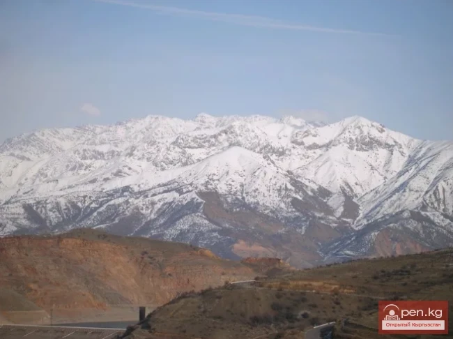
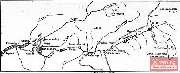
Chatkal - a mountain river in Kyrgyzstan and Uzbekistan, Before the formation of the Charvak Reservoir, it was the left tributary of the Chirchik River (Syr Darya basin). It originates on the southwestern slopes of the Talas Alatau. In its upper reaches, it flows through a wide ancient glacial valley. Below the confluence with the Ters River, the valley narrows, transitioning into a deep gorge. The banks of the Chatkal River form terraces 7-10 m high. The river often splits into channels. After

22.12.2018, 01:33
The title translates to "Isfayramsay River."
Rivers

The title translates to "Isfayramsay River."

Isfayramsay A river in Kyrgyzstan and Uzbekistan, a left tributary of the Syr Darya. Its total length is one hundred and twenty-two kilometers with a catchment area of two thousand two hundred twenty square kilometers. The river originates from the spurs of the Alay Range. In its upper reaches, Isfayramsay is known as Tengizbay. It flows in a northern direction. The river is part of the Great Fergana Canal system. From the city of Kuvasay, the canal named after the XVII Party Congress branches

18.12.2018, 18:51
The title "Река Аспара" translates to "Aspara River" in English.
Rivers

The title "Река Аспара" translates to "Aspara River" in English.

Aspara A river in the Panfilov District of Chuy Region, Kyrgyzstan, and the Merken District of Zhambyl Region, Kazakhstan. It is part of the Chu River basin (Shu). The Aspara River is a tributary of the Chu River and belongs to the group of rivers on the northern slope of the Kyrgyz Range. The river originates in the Western Tian Shan in the northwest of Kyrgyzstan and flows north, crossing into southern Kazakhstan to the Kuragaty River. On the left bank of the Aspara River is the Merke River

17.12.2018, 23:53
Glaciers of the Kyrgyz Range
Glaciers

Glaciers of the Kyrgyz Range

Glaciers of the Kyrgyz Ala-Too The highlands of the Kyrgyz Range feature a deeply dissected alpine relief, which results in a variety of glacier forms. The majority of glaciers belong to the cirque and valley types, with many hanging glaciers and various transitional forms. Many glaciers over different areas are covered with debris, and almost all have powerful modern moraines. Extensive zones of fractures, icefalls, and ice dumps are often encountered. The Karamoynok Range is characterized by

16.12.2018, 20:36
Nalivkin Glacier
Glaciers

Nalivkin Glacier

Nalivkin Glacier. One of the right tributaries of the largest glacier in Pamir, Fedchenko Glacier. It is located in the valley between the North Tanymas and Aral ridges. The main flow of the glacier is connected into one system with the North Tanymas Glacier through the ice divide. The varying width of the Nalivkin Glacier flow at the right bank of the main trunk of the Fedchenko Glacier below the confluence indicates uneven ice supply. Its right tributaries — glaciers 25, 26, 28, 29, and 30 —

10.12.2018, 02:26
Belogorka Waterfall
Waterfalls

Belogorka Waterfall

Sokuluk (Belogorka). Chuy Region, Sokuluk Gorge. The waterfall is located 80 km southwest of Bishkek. The hike from the parking area takes 1-1.5 hours. The height of the waterfall is about 60 m. The height above sea level is 2200 m. The water, when falling, hardly reaches the ground, dispersing and turning into a cloud of mist. The spray from the waterfall can be felt from about 200 meters away, and it is cold to stand near the waterfall even on the hottest day. The giant column of water

09.12.2018, 22:08
Abramov Glacier
Glaciers

Abramov Glacier

Slow Retreat of the Abramov Glacier The Abramov Glacier in the Pamir-Alai mountains is one of the most picturesque and well-studied glaciers in the world. From 1967 to the 1990s, various very interesting studies were conducted on it. We are conducting our research in collaboration with the Central Asian Institute of Applied Earth Research. According to our observations, the melting of this glacier is occurring more slowly than in the Tian Shan mountains. However, opinions on this matter are

09.12.2018, 19:47
Glacier Golubina
Glaciers

Glacier Golubina

Golubina Glacier The Golubina Glacier is of the valley type and is located on the northern slope of the Kyrgyz Ala-Too range, in the basin of the Ala-Archa River (a left tributary of the Chu River). With an area of 6.2 km², its length exceeds 5 km. The highest point of the glacier basin is at an altitude of 4220 m, and the firn line is at an altitude of 3860 m. The firn basin of the glacier is a vast hollow, approximately 3 km in diameter, surrounded by snow-covered rocks. At the exit from the

08.12.2018, 23:49
Lenin Glacier
Glaciers

Lenin Glacier

Lenin Glacier — a mountain valley glacier on the northern slope of the Zaalai Range (Pamirs), in Kyrgyzstan (Osh region). The length of the glacier is 13.5 km, and its area is 55.3 km². An extensive firn basin lies at the foot of Lenin Peak (7134 m), with the firn line at an altitude of 5300 m. The tongue of the glacier descends to 3760 m, from where the Achi-Tash River begins, a left tributary of the Kyzylsu. The right tributary of the glacier is pulsating: in 1945 and 1969, it cracked and

03.12.2018, 15:09
Petrov Glacier
Glaciers

Petrov Glacier

Petrov Glacier - a glacier in Central Tien Shan On a small area of the Ak-Shiyrak mountain range, glaciers and snow cover are spread over two major river basins of Kyrgyzstan — the Sary-Jaz and Naryn rivers. In an area measuring 30 x 40 km, glaciers cover 435 km², which accounts for 44% of the area. The total number of glaciers is 154. The largest is the Petrov Glacier. Petrov Glacier is a glacier in Central Tien Shan in Kyrgyzstan, located in the Akshiyrak mountains. It is the source of the

23.11.2018, 23:10
Glacier Korzhenevskogo
Glaciers

Glacier Korzhenevskogo

The Greatest Glacier of Pamir On August 22, 1953, eight climbers from the Pamir expedition of the All-Union Central Council of Trade Unions — A.S. Ugarov, A.S. Gozhev, L.M. Krasavin, P.K. Skorobogatov, B.D. Dmitriev, A.I. Kovyrkov, E.M. Ryspaev, and R.M. Selidjanov — reached the summit of Mount Evgeniya Korzhenevskaya — 7105 m. Soviet high-altitude climbers conquered the last, third highest seven-thousander of Pamir, following the peaks of Lenin and Stalin, the fourth highest peak in the USSR.

23.11.2018, 19:37
Chatkal Ridge
Mountain ranges

Chatkal Ridge

Chatkal Ridge of the Central Tien Shan The mountain range in the Western Tien Shan, which limits the Fergana Valley from the northwest, is about 225 km long, 30 km wide, and has an average height (above sea level) of 3800 m. The highest peak, Chatkal (Aflatun), reaches 4503 m. It is located in the Tashkent region of Uzbekistan and the Jalal-Abad region of Kyrgyzstan. The main peaks of this ridge are slightly above 3000 meters, among which stand out Big Chimgan, Kyzylnura, Babaytag, Karakush,

21.11.2018, 21:34
Semenov Glacier
Glaciers

Semenov Glacier

Semenov Glacier - the basin of the upper reaches of the Sarydjaz River. This basin includes the glaciers at the sources of the Sarydjaz River and the glaciers on the northern slope of the Aydyrtor ridge, excluding its western section — the basin of the Turegeldyn River. There are 44 glaciers in the basin with a total area of 118.5 km². Of these, 64.1 km² belongs to the Semenov Glacier system, which originates on the northwestern slopes of Semenov Peak, at the junction of the Terkey-Alatau and

21.11.2018, 19:35
Mushketov Glacier
Glaciers

Mushketov Glacier

Mushketov Glacier A valley tree-like glacier in the Central Tien Shan in Kyrgyzstan (Issyk-Kul region), located on the northern slope of the Sarydjaz ridge, at the sources of the Aditor River, a left tributary of the Sarydjaz River. The length of the glacier is 20.5 km, with a width ranging from 1 to 1.8 km. The area is 68.7 square kilometers. The feeding area lies in a huge cirque at an altitude of 4500 to 5500 meters above sea level, with the firn line at an altitude of 4100 meters above sea

20.11.2018, 20:41
Burgan-Suu Waterfall
Waterfalls

Burgan-Suu Waterfall

Burgan-Suu Gorge Waterfall A hike to the waterfall will take about two days, as the gorge leading to the waterfall is long. The starting point for the hike is the village of Zharkonbaev (a little east of the village of Ananyev). If there is transport available, you can reach the village of Karoool-Debe (at the beginning of the gorge). From there, you can either walk or ride a horse. Along the way, you will need to cross the main river several times (on the General Staff map, it is called, like

19.11.2018, 19:18
The title "Хребет Джангарт" translates to "Dzhangart Ridge" in English.
Mountain ranges

The title "Хребет Джангарт" translates to "Dzhangart Ridge" in English.

Dzhangart Ridge The Dzhangart mountain ridge is located south of the Kainy Ridge on the border with the People's Republic of China. Administratively, it belongs to the Aksuysky district of the Issyk-Kul region. The small Dzhangart ridge is separated from the Kokshaaltau Ridge by the Dzhangart River and glacier. Ascents are possible both on the Dzhangart ridge, where heights reach up to 4600 meters above sea level, and in the Kokshaaltau Ridge, where heights are 5340 meters above sea

19.11.2018, 17:52
Kainyndy Glacier
Glaciers

Kainyndy Glacier

Kainy Between Kokshaal-Tau and Kainy-Katta lies the powerful Kuyakap Glacier, and between Kainy-Katta and Inylchek-Tau lies the enormous Kainy Glacier, the younger sibling of Inylchek, the second largest glacier in the region. The glacier is located on the southwestern edge of the Kan-Tenir ridge. It is bordered to the north by the Enilchek-Tuu ridge and to the south by the Kainy ridge of the same name. The length of the glacier is 25.8 kilometers, and its area is 107.5 square kilometers, of

18.11.2018, 22:45
Glaciers South and North Inylchek
Glaciers

Glaciers South and North Inylchek

South Inylchek "Inylchek" in Old Turkic means "little prince." But the "prince" turned out to be quite large. The Inylchek glacier is divided into North and South. So, South Inylchek is the largest glacier in the Tien Shan and the second largest mountain glacier in the CIS countries after the Fedchenko glacier in the Pamirs. Its length is slightly less than that of the colossal glaciers of the Karakoram, such as Siachen, Biafo, Baltoro, and Batura. It is located

18.11.2018, 20:55
Meridional Ridge
Mountain ranges

Meridional Ridge

Meridional Ridge The main nodal uplift of the Central Tien Shan on the border of Kyrgyzstan and China is the Meridional Ridge, approximately 90 km long and with an average height of over 6000 m. The northern continuation of the ridge is the Kakshaal-Too. The highest peaks include Peak Friendship (up to 6800 m), in the Akatau range - Peak High (up to 6964 m), and Peak Military Topographers (up to 6873 m), as well as Bezimenniy (6814 m) and Marble Wall (6140 m), located at the intersection of

18.11.2018, 19:42
Fergana Range
Mountain ranges

Fergana Range

Fergana Ridge A mountain range in the Tien Shan that stretches from southeast to northwest, separating the cold high-altitude plateaus of central Tien Shan from the scorching plains of the Fergana Valley. The length of the ridge is 225 km. Its width is 62 km. The average height (above sea level) is 3620 m. The highest peak, Kara-Kuldja (Uch-Seyit), reaches 4940 m. In the southeastern part, there are about 400 glaciers with a total area of about 195 km². The area in the southern part of the

17.11.2018, 20:03
Turkestan Range
Mountain ranges

Turkestan Range

Turkestan Range A high mountain range oriented in a latitudinal direction, approximately 340 km long and up to 30 km wide, belonging to the Gissar-Alai mountain system. The average height (above sea level) is 4430 m. The highest peaks are Skalistyy (5621 m) and Pyramid Peak (5509 m). Through the Matcha mountain knot, the range connects with the Alai Range to the east and stretches to the Samarkand Plain to the west. The northern slope is long and gentle, with juniper forests and sparse

17.11.2018, 15:21
Terskey Alatoo Ridge
Mountain ranges

Terskey Alatoo Ridge

Terskey Alatau The Terskey Alatau Ridge is very beautiful in its variety of landscapes. In one day, you can see the beauty of red sandstone cliffs, wild forests, and snowy peaks, widely spread over the greatest lake, Issyk-Kul. Each gorge is unique and unparalleled in its execution. The Terskey Alatau Ridge ("colorful mountains turned away from the sun") is located latitudinally and frames the basin of Lake Issyk-Kul from the south. The length of the ridge is about 375 km, and in the

16.11.2018, 02:27
Talas Ridge
Mountain ranges

Talas Ridge

Talassky Ala-Too A mountain range located in the Western Tien Shan system. Most of it is situated in Kyrgyzstan, with a part in southern Kazakhstan. This range separates the Talas Valley from other ranges and valleys of the Western Tien Shan and the western part of the so-called Inner Tien Shan. The length of Talassky Ala-Too is about 270 km, with a width of 40 km. The average height (above sea level) is 3930 m, with the highest peak being 4488 m – Mount Manas. The Talas basin is bounded to

16.11.2018, 02:13
The Ridges of Sonkyoiltau and Susamyrtau
Mountain ranges

The Ridges of Sonkyoiltau and Susamyrtau

Son-Kul-Tau A mountain range in the Tian Shan, in the southeastern part of Kyrgyzstan. It arches around the northern edge of the Son-Kul lake basin. The length of the ridge is about 60 km, with a maximum height of 3856 m. It is primarily composed of limestone. Alpine meadows are located on the northern slope and in the summit area of the ridge, while subalpine meadow-steppes and steppes are found on the southern side. Susamyr-Tau A mountain range in Kyrgyzstan, part of the Inner Tian Shan

15.11.2018, 19:41
The Saridzhaz Ridge
Mountain ranges

The Saridzhaz Ridge

Sarydjaz The mighty snow-covered barrier of the Sarydjaz mountain range rises in the Central Tian Shan, on the territory of Kyrgyzstan and partially Kazakhstan. It is located between the Sarydjaz River to the north and its left tributary, the Inylchek River, to the south. The length of the ridge is 113 km, with a width of up to 16 km. Its peaks rise above 5000 m. The average height is 4370 m, with the highest point being Semenov Peak (5816 m). The ridge is composed of metamorphic schists,

15.11.2018, 19:34
Naryn-Too Ridge
Mountain ranges

Naryn-Too Ridge

Naryn-Tau The area is hard to access and rarely visited. Due to the low glaciation and modest heights, the Naryn-Tuu ridge has only been traversed by watermen, one hiking group (Svitanko-1963), and, strangely enough, cyclists. The mountain range in the Inner Tien Shan in Kyrgyzstan forms the left bank of the valley of the Great Naryn River. To the east, it is bounded by the Karakolka River - a left tributary of the Naryn. From there, the ridge stretches westward for about 120 km to the

15.11.2018, 19:27
Ak-Sai Waterfall
Waterfalls

Ak-Sai Waterfall

Bright and Colorful Ak-Sai. The height of the waterfall is 25-30 m (2700 m above sea level). Chui region, Ak-Sai gorge. Right tributary of Ala-Archa (2100 m above sea level). Translation from Kyrgyz: ak – white, sai - river. The Ak-Sai waterfall is the most visited attraction of the Ala-Archa National Park. The waterfall is located just 42 km from Bishkek in the extraordinarily beautiful Ala-Archa gorge within the namesake park. From here, a beautiful panorama opens up to the snowy peaks and

14.11.2018, 22:48
The Moldotau Ridge
Mountain ranges

The Moldotau Ridge

Moldotau A mountain range in the Inner Tian Shan, in the central part of Kyrgyzstan, south of Lake Son-Kul. The range stretches generally from west to east, between the valleys of the Kökömeren and Naryn rivers. The length of the ridge is about 150 km. The maximum height is 4185 m. It is mainly composed of limestone. The lower slopes are covered with mountain steppes and meadows, while higher up there are areas of spruce forests and juniper groves.

14.11.2018, 18:55
Kungey-Alatau Ridge
Mountain ranges

Kungey-Alatau Ridge

Kungey-Alatau To the south of the Zailiysky Alatau, beyond the deep longitudinal valleys of the Chilik and B. Kemin (Chon-Kemin) rivers, stretches a chain of snowy peaks of the Kungey-Alatau ridge, which borders Lake Issyk-Kul from the north (the Terkey Alatau ridge limits this basin from the south). Together with the Zailiysky Alatau, it forms the Northern Tien Shan. The ridge is elongated in a latitudinal direction (from west to east) and has a length of 275 km in a straight line.

14.11.2018, 18:28
Kuylytau Ridge
Mountain ranges

Kuylytau Ridge

Kuylytau A mountain range in the Central Tien Shan, in Kyrgyzstan. It is located between the rivers Kuyly and Uchkel (the Sarydjaz basin). The length of the ridge is about 50 km, and the maximum height is 5203 m. The ridge is composed of limestones, metamorphic schists, and granites. The Kuyly massif extends approximately 50 km in the latitudinal direction and 25 km in the meridional direction. The natural boundaries of the area are the rivers Sary-Djaz, Uch-Kel, Sarychat, Kuyly, and the Kuyly

14.11.2018, 17:35