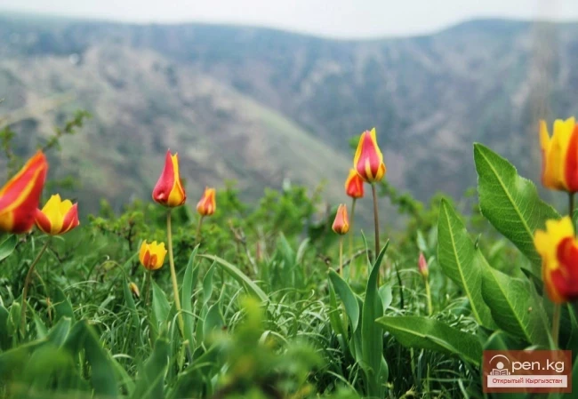
The territory of Kyrgyzstan occupies a unique position in geological terms on the Eurasian continent, as it is here that the collision of the largest folded belts in the world occurs as a result of opposing movements. The Tien Shan region of the country is composed of complexes from the Paleozoic Ural-Mongolian folded belt, the structural features of which are determined by the movement of the lithosphere, primarily from north to south, while the Pamir region consists of complexes from the Alpine-Himalayan folded belt, whose structure is formed by movements of the lithosphere mainly from south to north. The meeting of the structures of these belts occurs in the valley of the Chon-Alaï River. Immediately upon exiting to the west and east, the structures of the mentioned belts diverge sharply and are significantly distanced from each other. Geologically, the country occupies a nodal position in the structure of Eurasia, serving as a bridge connecting the west and east, and is of great importance in addressing many regional geological issues.
The following major latitudinal tectonic zones are distinguished within the country: Northern, Central, and Southern Tien Shan, and Northern Pamir. The eastern part of the Southern Tien Shan includes a small part of the Tarim massif, located to the east of the Kakshaalsky ridge. The boundaries of these structures are defined by major regional faults in the Earth's crust. The Northern and Central Tien Shan are bounded by the fault known as the "main structural line of Tien Shan," while the Central and Southern Tien Shan are limited on the west by the South Fergana-Babashatin fault and on the east by the Atbashi-Enilchek faults. The Southern Tien Shan is bordered to the south by the Gissar-Kakshaalsky fault, which separates it from the Northern Pamir to the west and from the Tarim massif to the east. The Central and Southern Tien Shan are divided into western and eastern sectors by the diagonal Talas-Fergana shift. The western sectors are displaced northwest by 180-250 km relative to the eastern sectors.
In the geological structure of the territory of the republic, four megacomplexes and their corresponding four mega-stages in the development of the lithosphere are distinguished, which differ sharply from each other in composition, structure, and conditions of formation. From bottom to top, these are the Archean-Lower Proterozoic, Proterozoic, Upper Proterozoic-Paleozoic, and Mesozoic-Cenozoic megacomplexes. The first and third of these are composed of geological formations formed in continental and oceanic geodynamic settings, while the second and fourth consist only of formations from continental settings.
Archean-Lower Proterozoic megacomplex is represented by intensely metamorphosed formations that make up separate blocks, cores of Paleozoic tectonic uplifts, and the foundations of rigid masses within the Northern and Central Tien Shan, as well as blocks of the Tarim massif. Its structure includes two groups of formations: a) ophiolite complexes — a specific combination of ultrabasic rocks, amphibolitized basalts, and silicites, representing oceanic crust rocks; b) gneisses, crystalline schists, and marbles — primary sedimentary sequences deposited on continental crust. The rocks of group "a" are thrust over the rocks of group "b," and they are subject to strong folding and flow deformation, resulting in significant mixing in many cases. The rocks also underwent metamorphism and migmatization. Radiometric studies have established dates of 2600±50 million years and 2000-1800 million years.
The character of the rocks indicates that in those distant times, continental and oceanic structures already existed, and later, as a result of the collision of surrounding continental masses, the ocean closed, and a single continent was formed. Apparently, these formations became part of the ancient supercontinent called Rodinia.
Proterozoic megacomplex encompasses the level limited by dates of 1800-600 million years and is mainly composed of metamorphosed quartz sandstones, terrigenous, and carbonate deposits. Volcanic rocks and granitoid intrusions are also present. They are widely distributed within the Northern and Central Tien Shan, where they form tectonic blocks and cores of uplifts. Overall, they formed in intracontinental conditions under a calm tectonic regime. However, the nature of volcanism and sediments indicates that at levels of 1300, 1100, and 720 million years, continental rift processes occurred against the background of intraplate settings, with the Earth's crust experiencing tangential stretching, and at the level of 830 million years, conditions of intracontinental tangential compression arose, expressed in the formation of intense folding, the intrusion of granitic magmatism, and the manifestation of regional metamorphism.
Upper Proterozoic-Paleozoic megacomplex encompasses the level above 600 million years and the entire Paleozoic. It is composed of diverse geological formations and is widespread in all tectonic zones of Tien Shan and Northern Pamir. The ages of the sequences are often determined by organic remains, while the ages of magmatic masses are established through radiogeochronological dating. A distinctive feature of the megacomplex is the presence of formations from several oceanic basins and continental masses in its structure. In the initial stage, the single continent fragmented, oceanic basins opened, and in the final stage, the oceans closed, leading to the reformation of a single continent as a result of the accretion of previously separated blocks. Based on the timing of the closure of the oceanic basins, the tectonic complexes are distinguished: Lower Paleozoic (Caledonian) and Upper Paleozoic (Hercynian).
The tectonic complex of early Paleozoic accretion encompasses formations from the Vendian system of the Proterozoic and the entire Lower Paleozoic. It is mainly developed within the Northern, Central, and some fragments are found in the Southern Tien Shan and Tarim massif. In the Northern Tien Shan, these formations play a major role. At the bottom, they are represented by ophiolites from back-arc seas, partially from oceanic settings, terrigenous, and magmatic formations from island arcs. Here, terrigenous and carbonate deposits characteristic of the continental shelf, slope, and foot are also found. In the upper part of the complex, coarse clastic terrigenous deposits and large granitoid masses prevail. In the Central Tien Shan, coarse clastic terrigenous and volcanogenic sequences typical of rift settings are distinguished at the bottom, while above are clayey and siliceous schists and carbonate deposits from the passive margin of the continent. They are replaced upwards by terrigenous deposits from intermountain basins. In the Southern Tien Shan, the complex occurs as separate blocks composed of carbonate, terrigenous, and volcanogenic rocks from rift settings. Starting from the Lower Ordovician, an ophiolite complex with typical features of mid-ocean ridges is developed here. In the Tarim massif, the geological bodies of the considered level are similar to the formations of the Central Tien Shan; however, the upper part, instead of the well-developed coarse clastic sequence found there, is represented here by carbonate deposits.
The reconstruction of the paleogeodynamic setting of the formation of the considered complex showed the following. At the end of the Proterozoic, the ancient continent Rodinia experienced fragmentation, resulting in the formation of rift structures. During the late Vendian to early Ordovician, an oceanic basin, named the Sakhsky basin, formed between the Northern and Central Tien Shan. Its width, according to some estimates, reached more than 1,500-2,000 km. At the same time, relatively small continental blocks existed. In the second half of the early to the beginning of the middle Ordovician, the ocean began to shrink, and island arc systems formed within the Northern Tien Shan, creating back-arc basins. This setting persisted until the second half of the late Ordovician when the ocean closed and was completely absorbed by subduction. A suture remained in its place — a seam that, after subsequent movements, transformed into a tectonic structure known as the "main structural line of Tien Shan." The accretion of continental blocks and island arcs occurred, and by the end of the Ordovician, a mountainous territory emerged in place of the Northern and Central Tien Shan, where coarse clastic sediments were deposited in the depressions, and large masses of granitoids intruded into the uplifts. Within the Southern Tien Shan, complexes of two oceanic basins that developed from the early Ordovician (possibly even earlier) and continental masses are established.
The tectonic complex of late Paleozoic accretion is the most widely distributed formation in Kyrgyzstan. The Northern and Central Tien Shan in the middle and late Paleozoic were united into one microcontinent known as the Kyrgyz-Kazakh microcontinent. In the Northern Tien Shan, the Silurian is represented by granitoid intrusions, while sedimentary formations begin with the Devonian. The entire Devonian to Lower Permian is represented by terrigenous, volcanogenic, and intrusive formations of varied composition. In the Central Tien Shan, much of the Silurian is also absent, and only in the Chatkal ridge do terrigenous and volcanogenic sequences from island arcs emerge. Lower to middle Devonian terrestrial volcanic rocks are encountered. The upper parts of the middle Devonian to lower Carboniferous in the Central Tien Shan are represented at the bottom by terrestrial terrigenous deposits and at the top by marine carbonate and siliceous deposits. The middle Carboniferous to Lower Permian is represented by terrigenous, volcanogenic, and intrusive formations of varied composition.
In the Southern Tien Shan, at the Silurian-Lower Carboniferous level, ophiolites are widely developed, representing complexes from the Turkestan and Yagnob oceanic basins, as well as terrigenous and volcanogenic formations from island arcs. Terrigenous and carbonate sediments from continental blocks, as well as from slopes and foots of continental margins, play a significant role.
The reconstruction of the paleogeodynamic setting showed that at this level in the north (here and further in modern coordinates, in ancient times they were different) was the Kyrgyz-Kazakh continent, to the south was the Turkestan ocean, and further was the Tarim continent and Yagnob ocean. In the Silurian to early Devonian period, active continental margin conditions (similar to those of the modern Andes in western America) were established on the northern and southern margins of the Kyrgyz-Kazakh continent, caused by subduction processes from the north of the oceanic lithosphere of the Balkhash ocean (beyond the borders of Kyrgyzstan), which continued uninterrupted until the early Permian, as well as from the south — the lithosphere of the Turkestan ocean. The latter was located in the space between the Central and Southern Tien Shan. Its width, according to paleomagnetic data, reached at least 2,200 km during the Devonian. Within the Turkestan oceanic basin, the Alai-Ulan continental block is distinguished. During the Silurian to early Devonian, the oceanic lithosphere subducted both to the north (in modern coordinates) under the Kyrgyz-Kazakh continent and to the south under the Alai-Ulan microcontinent. Starting from the live epoch of the middle Devonian, these subduction processes weakened, and until the end of the early Carboniferous inclusively, a passive margin setting with the deposition of uniform types of sediments occurred on the surrounding continents: terrigenous at the bottom and carbonate at the top. In the Alai-Ulan microcontinent, among the carbonates, volcanic rocks are found, mainly of intermediate, less frequently acidic and basic compositions with an alkaline inclination. Starting from the Serpukhovian epoch of the early Carboniferous, the subduction processes of the Turkestan oceanic lithosphere resumed, but only to the north, under the Kyrgyz-Kazakh continent. The Tarim continent in the territory of Kyrgyzstan is represented by a very narrow carbonate strip, called the Kulgedzhilin "bar." In its western continuation, in the territory of Tajikistan, the so-called Rabut block emerges, which bears Paleozoic sections similar to those of the Tarim massif. Judging by the facies features of these sections, the block was quite large. The Kulgedzhilin strip was part of a vast continent that united the Tarim massif in the east and the East European (Russian) platform in the west. Geological bodies associated with the Yagnob ocean are mainly found in the territory of Tajikistan. According to the island arc complexes emerging in the axial part of the Turkestan-Alai, its lithosphere experienced subduction under the Tarim continent.
In the Northern Pamir, ophiolites from back-arc basins and volcanic rocks from island arcs of the Lower Carboniferous are known. They testify to the dominance of oceanic settings to the south of it, whose lithosphere subducted to the north (under the continent located south of the Yagnob ocean). Apparently, they are associated with the Paleotethys ocean and were thrust here by subsequent movements.
The middle Carboniferous to Lower Permian is represented in Kyrgyzstan by terrigenous, often coarse clastic marine, and in the upper part by terrestrial deposits. Large intrusive magmatic masses and volcanic rocks are encountered. During this time, the closure of oceanic basins occurred in all regions. However, on the northern and southern margins of the Kyrgyz-Kazakh continent, an active continental margin setting prevailed, i.e., subduction processes resumed from the south. In the axial part of the Turkestan-Alai ridges, Lower Permian magmatic complexes from active continental margins also emerge, indicating the subduction of lithosphere to the north from the Yagnob ocean. The accretion of the late Paleozoic united all continental masses, and mountainous structures arose in the territory of Kyrgyzstan. Due to intense tangential compression of the Earth's crust, not only did oceans with widths of several thousand kilometers close, but large continental blocks also experienced significant reductions in width or even completely disappeared. For example, the once vast Tarim continent in the territory of Kyrgyzstan turned into a narrow strip 10-15 km wide. The Central Tien Shan, whose width at the meridian of Tashkent reaches more than 350 km, narrows significantly to the east, having a width of 7 km in the area of the Sary-Jaz River valley, and further, in the territory of China, completely pinches out. The Fergana block underwent counterclockwise rotation, resulting in the formation of sigmoids (horizontal folds) to its east and the Talas-Fergana diagonal shift, with a displacement amplitude reaching 180-250 km.
The Upper Permian to Lower Triassic is formed in Kyrgyzstan by separate isolated outcrops of clastic and volcanogenic sediments and contrasting acidic, alkaline, and carbonatitic magmatic intrusive masses. Despite their small volume, these formations are of great importance in the geology and economy of Kyrgyzstan. They testify to the overall uplift of the region and the dominance of a dispersed rifting setting. Numerous and diverse large-scale mineral deposits are associated with this level.
Mesozoic-Cenozoic megacomplex is widely distributed across the territory of Kyrgyzstan. Based on the nature of the tectonic regime during the accumulation of sequences, two complexes are distinguished in its structure. The lower, Mesozoic-Lower Cenozoic complex, formed in a platform setting, while the upper — the Upper Cenozoic complex — formed in an orogenic setting.
The Mesozoic-Early Cenozoic platform complex in Kyrgyzstan is unevenly distributed. The Middle-Upper Triassic is absent in much of Kyrgyzstan. This includes volcanic rocks and red terrigenous sequences from an actively continental margin setting in the Northern Pamir and small diatremes (types of magmatic rocks formed by explosions) in the Turkestan-Alai. The Jurassic system is widely distributed in Kyrgyzstan and is represented by terrestrial clayey and sandy formations containing large deposits of coal in the lower part, which were deposited in plain conditions under a humid climate. However, in its upper part, among the terrigenous rocks, deposits of gypsum appear, indicating the onset of aridization of the climate. The chalk — middle Paleogene is represented by platform deposits and is only found in marine facies in the Fergana part of Tien Shan and Northern Pamir. They are composed of clayey and carbonate sediments. To the east of the Fergana ridge, the presence of chalk is unknown. Its presence is assumed in the lower parts of the red-colored deposits, indexed as Paleogene. They are represented by terrestrial gypsum-bearing terrigenous sediments of the desert. Basalts of the late Paleogene age are found in many places in Kyrgyzstan.
The Upper Cenozoic orogenic complex is predominantly represented by coarse clastic sediments of the Oligocene-Holocene, formed in a mountainous setting and found in all depressions of Kyrgyzstan. The lower parts of these formations are red-colored, while the upper parts are predominantly gray. In the lower, red-colored part, deposits of various rock salts and gypsum are found, indicating a hot arid climate, but in the upper parts, layers associated with glaciers become more frequent.
Cenozoic mountain structures are accompanied by widespread development of linear folds, tectonic covers, thrusts, uplifts, and schistose structures, indicating tangential compression of the Earth's crust across the strike of the orogen. Structures of tangential extension play a clearly subordinate role. Observations using satellites have shown that the width of the Tien Shan orogen is experiencing an annual reduction of about 20 mm on average. Geophysical data indicate a greater thickness of the Earth's crust in the territory of Kyrgyzstan: 50 km in the north and 75 km in the south. It is assumed that compared to the Mesozoic-Early Cenozoic crust, there has been an increase in crustal thickness by 15-35 km. Seismic data indicate that at depths of 35-50 km, there is a layer of partially molten masses, and at depths of 25-35 km, there are lens-shaped bodies of such formations. Apparently, the presence of a layer of softened mass weakens the rigid connection with the underlying layers and facilitates the deformation of the upper part of the crust. Perhaps this is why mountains are rising and the structural compressions mentioned above are occurring. There is no such layer under the Fergana basin.